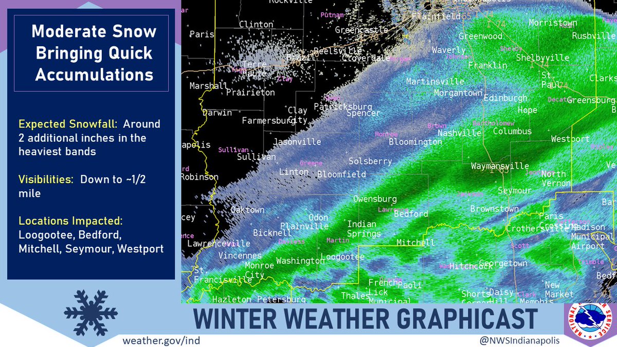
(Via @NWSIndianapolis.) Snow of moderate intensity, locally heavy, likely will bring an additional 2″ of snow to locations that are seeing or will soon see the main snow band stretching from about Monroe City to Greensburg at 8:54 PM EST. Visibilities down to ~1/2 mile are likely. #INwx #nwsind https://t.co/tgrXOGAhXM
My Huge Radar has real-time weather tracking, current temperatures, and severe weather watches and warnings. Get detailed Indiana conditions by clicking here. Follow these links to get my forecasts for Lafayette, Muncie, Hendricks County, and Hamilton County. Need a second opinion? Click here for central Indiana National Weather Service forecasts.
Never miss me! Subscribe for free. My Huge Radar has real-time weather tracking, current temperatures, and severe weather watches and warnings. Get detailed Indiana conditions by clicking here. Click here to see my central Indiana 7-Day Forecast. Follow these links to get my forecasts for Lafayette, Muncie, Hendricks County, and Hamilton County. Need a second opinion? Click here for central Indiana National Weather Service forecasts. (Some charts via WeatherBELL.)


