Survey says…sloppy Sunday!
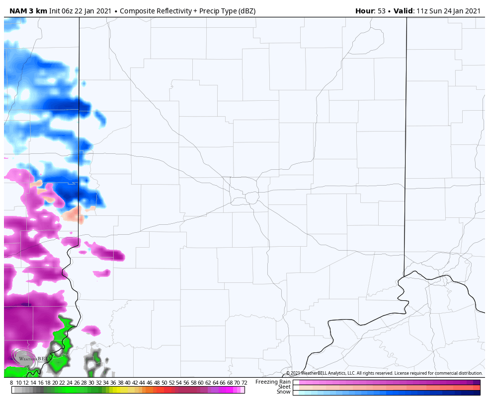
Snow, freezing rain, and rain are all possible. Good news? Amounts look light. Wind will be fairly tame also, so no widespread power problems are not anticipated. There is a chance of slippery roads, especially Sunday morning before temperatures warm. It could happen again Sunday evening and overnight.
The vast majority of precipitation will be plain rain Monday. Could be an inch of it south of Indy.

Never miss me! Subscribe for free. My Huge Radar has real-time weather tracking, current temperatures, and severe weather watches and warnings. Get detailed Indiana conditions by clicking here. Click here to see my central Indiana 7-Day Forecast. Follow these links to get my forecasts for Lafayette, Muncie, Hendricks County, and Hamilton County. Need a second opinion? Click here for central Indiana National Weather Service forecasts. (Some charts via WeatherBELL.)
INDY SEVEN DAY FORECAST
Today: Morning clouds, and afternoon sunshine. High 31.
Tonight: Mostly clear. Low 15.
Saturday: Mostly to partly sunny. High 33.
Saturday Night: Partly cloudy. Low 25.
Sunday: Mostly cloudy. Spotty snow showers, possibly mixed with freezing rain and rain. High 37.
Sunday Night: Rain and possibly a wintry mix of snow and freezing rain. Low 32.
Monday: Periods of rain. High 39.
Monday Night: Rain and snow showers diminish. Low 26.
Tuesday: Partly sunny. High 34.
Tuesday Night: Partly cloudy. Low 23.
Wednesday: Partly sunny. High 36.
Wednesday Night: Mostly cloudy. Low 25.
Thursday: Snow showers. High 34.

Never miss me! Subscribe for free. My Huge Radar has real-time weather tracking, current temperatures, and severe weather watches and warnings. Get detailed Indiana conditions by clicking here. Click here to see my central Indiana 7-Day Forecast. Follow these links to get my forecasts for Lafayette, Muncie, Hendricks County, and Hamilton County. Need a second opinion? Click here for central Indiana National Weather Service forecasts. (Some charts via WeatherBELL.)


