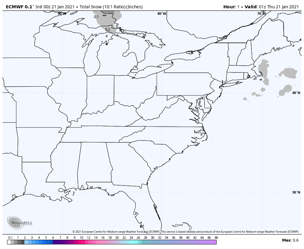
Enjoy the above average temps today, because they won’t last. We are still running 3.8 degrees above average for January. Snow is lacking still through the end of the month, as shown by this computer modeling.
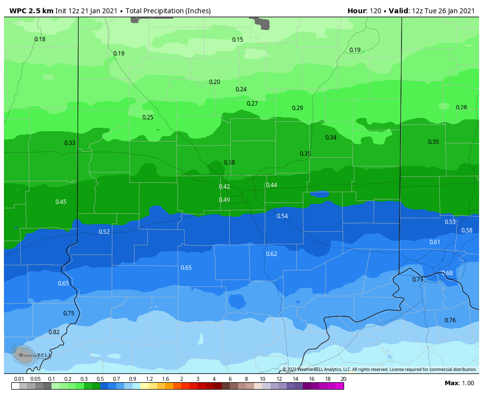
There may be some snow mixed with rain Sunday afternoon through Tuesday morning, mainly at night. Could be some decent rainfall, especially south of Indianapolis.
Never miss me! Subscribe for free. My Huge Radar has real-time weather tracking, current temperatures, and severe weather watches and warnings. Get detailed Indiana conditions by clicking here. Click here to see my central Indiana 7-Day Forecast. Follow these links to get my forecasts for Lafayette, Muncie, Hendricks County, and Hamilton County. Need a second opinion? Click here for central Indiana National Weather Service forecasts. (Some charts via WeatherBELL.)
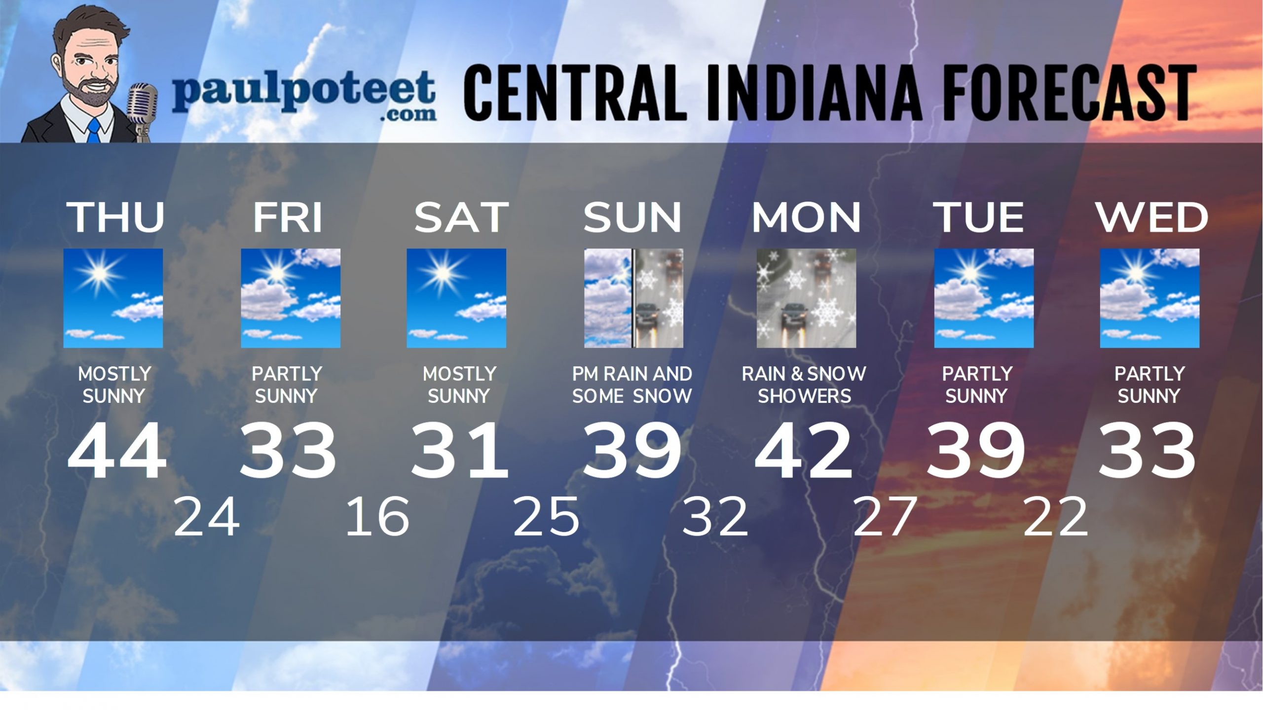
INDY SEVEN DAY FORECAST
Today: Mostly sunny and not as cold. Wind gusting to 25 mph. High 44.
Tonight: Mostly clear. Low 24.
Friday: Partly sunny. Wind gusting to 20 mph. High 33.
Friday Night: Clear and cold. Low 16.
Saturday: Mostly sunny. High 31.
Saturday Night: Partly cloudy. Low 25.
Sunday: Mostly cloudy. Spotty showers in the afternoon. High 39.
Sunday Night: Rain and snow showers. Low 32.
Monday: Rain showers. Some snow could mix in. High 42.
Monday Night: Rain and snow showers diminish. Low 27.
Tuesday: Partly sunny. High 39.
Tuesday Night: Partly cloudy. Low 22.
Wednesday: Partly sunny. High 33.
Never miss me! Subscribe for free. My Huge Radar has real-time weather tracking, current temperatures, and severe weather watches and warnings. Get detailed Indiana conditions by clicking here. Click here to see my central Indiana 7-Day Forecast. Follow these links to get my forecasts for Lafayette, Muncie, Hendricks County, and Hamilton County. Need a second opinion? Click here for central Indiana National Weather Service forecasts. (Some charts via WeatherBELL.)


