Some of it came and went, but there was 2.7 inches of snow at the Indy Airport from Friday through Sunday. More snow is possible to the south of Indy tonight.

Credit low pressure moving southeast out of the Plains today.
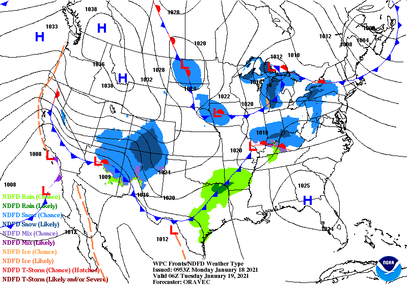
Most of that snow stuff happens late Monday evening and overnight. One more shot at snow this work week, but it’s mainly for the northern quarter of the state Tuesday night. I’ll keep an eye on it for my Lafayette and Muncie friends. Doesn’t look like a big threat.
Never miss me! Subscribe for free. My Huge Radar has real-time weather tracking, current temperatures, and severe weather watches and warnings. Get detailed Indiana conditions by clicking here. Click here to see my central Indiana 7-Day Forecast. Follow these links to get my forecasts for Lafayette, Muncie, Hendricks County, and Hamilton County. Need a second opinion? Click here for central Indiana National Weather Service forecasts. (Some charts via WeatherBELL.)
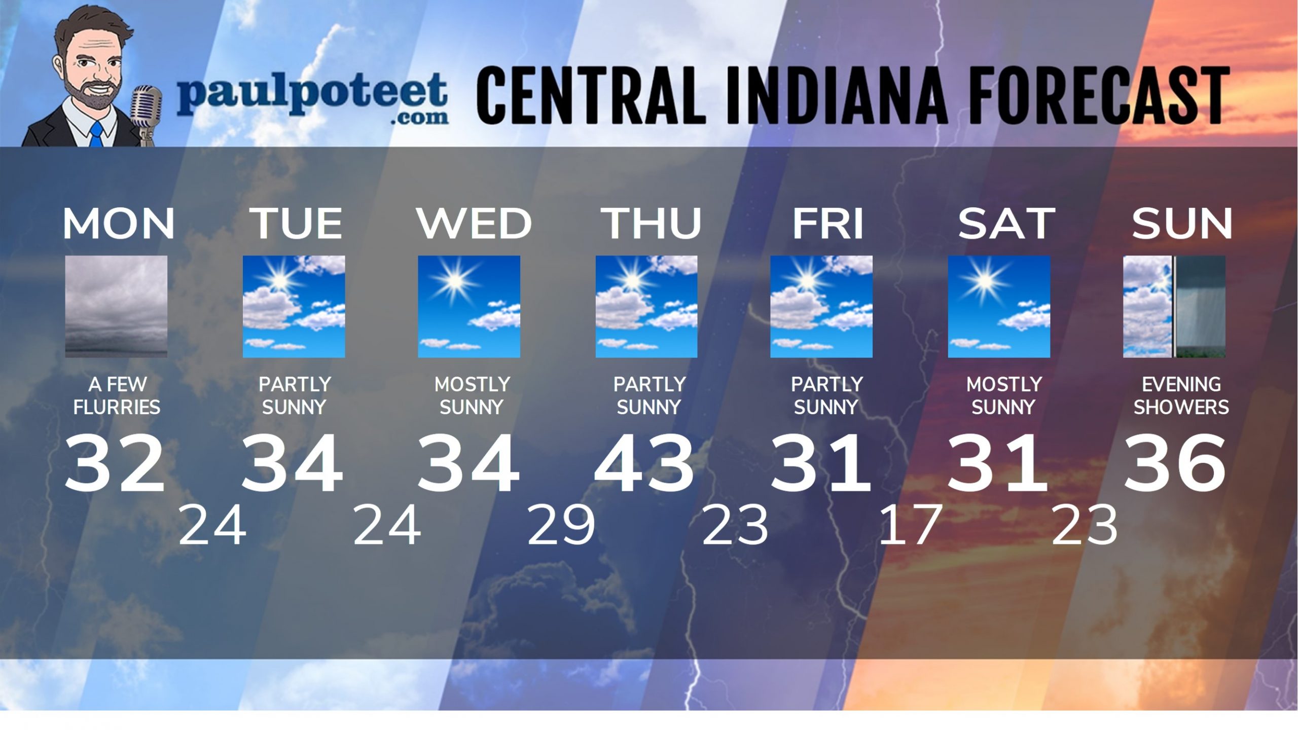
INDY SEVEN DAY FORECAST
Today: Cloudy with a few flurries. Chills in the upper teens and lower 20s with winds gusting to 20 mph. High 32.
Tonight: Cloudy with flurries and a few snow showers, especially south of Indy. Low 24.
Tuesday: Partly sunny. High 34.
Tuesday Night: Mostly cloudy. Low 24.
Wednesday: Mostly sunny. High 34.
Wednesday Night: Partly cloudy. Low 29.
Thursday: Partly sunny. High 43.
Thursday Night: Partly cloudy. Low 23.
Friday: Partly sunny. High 31.
Friday Night: Partly cloudy. Low 17.
Saturday: Mostly sunny. High 31.
Saturday Night: Partly cloudy. Low 23.
Sunday: Mostly cloudy. Showers by evening. High 36.
Never miss me! Subscribe for free. My Huge Radar has real-time weather tracking, current temperatures, and severe weather watches and warnings. Get detailed Indiana conditions by clicking here. Click here to see my central Indiana 7-Day Forecast. Follow these links to get my forecasts for Lafayette, Muncie, Hendricks County, and Hamilton County. Need a second opinion? Click here for central Indiana National Weather Service forecasts. (Some charts via WeatherBELL.)


