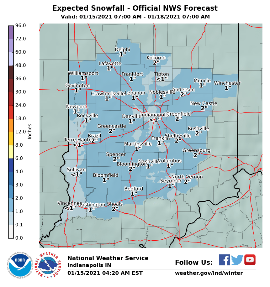
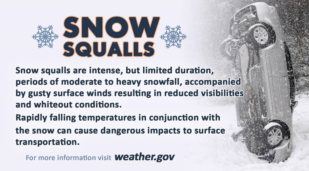
Look below for a chart of expected snow totals through a wintry weekend in Central Indiana. The biggest threat Friday afternoon and evening will be snow squalls. Those are localized, intense bursts of snow. Visibilities could quickly go to near-zero, and the wind could gust to 25 mph.
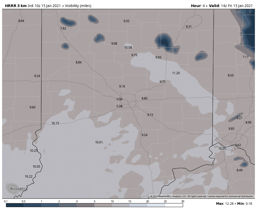
You can see computer modeling picking up on the squalls when displaying visibilities Friday afternoon and evening.
Never miss me! Subscribe for free. My Huge Radar has real-time weather tracking, current temperatures, and severe weather watches and warnings. Get detailed Indiana conditions by clicking here. Click here to see my central Indiana 7-Day Forecast. Follow these links to get my forecasts for Lafayette, Muncie, Hendricks County, and Hamilton County. Need a second opinion? Click here for central Indiana National Weather Service forecasts. (Some charts via WeatherBELL.)
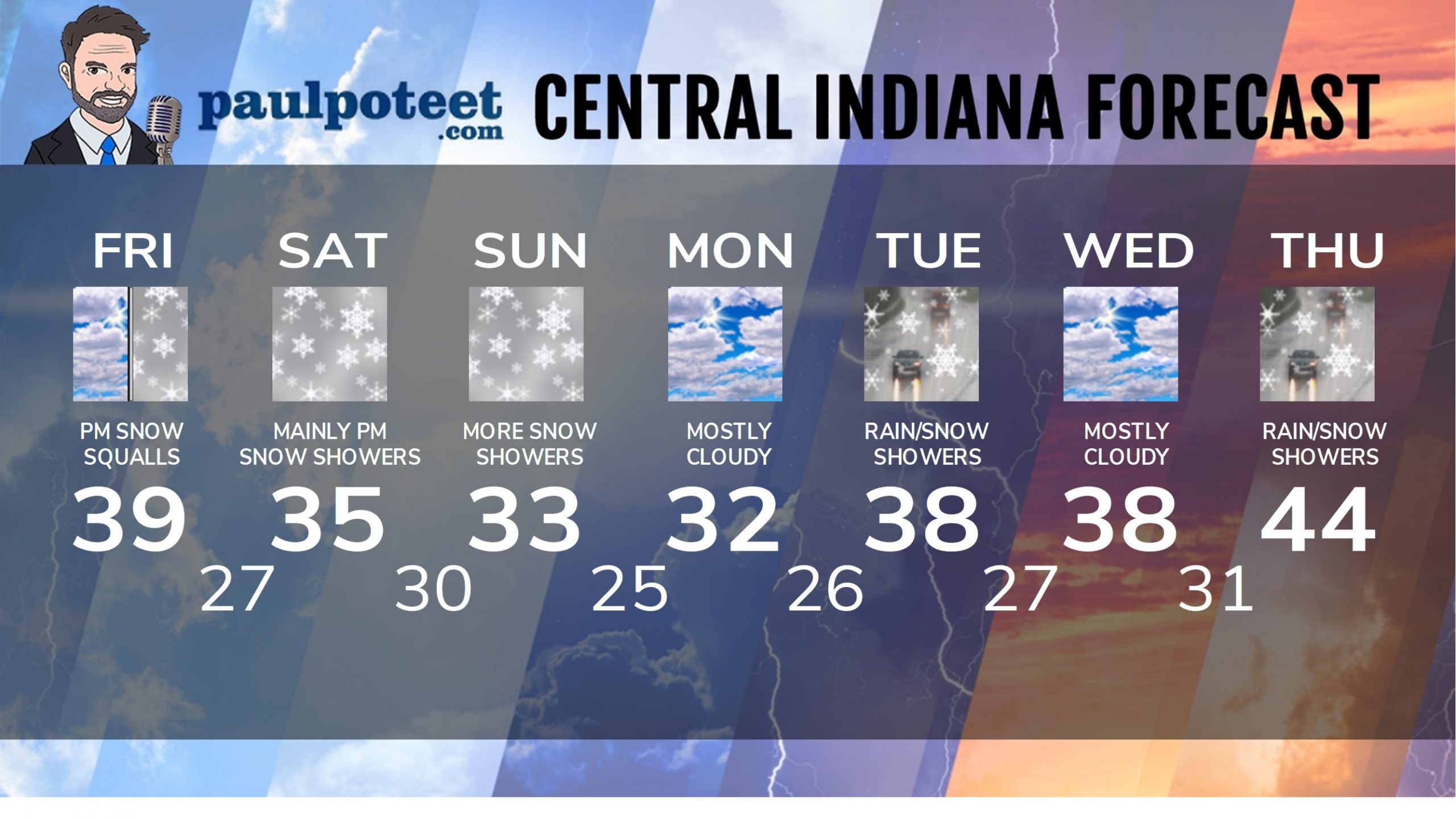
INDY SEVEN DAY FORECAST
Friday: Mostly cloudy and colder. Afternoon snow showers. Wind gusting to 25 mph. Snow squalls may briefly limit visibility. High 39.
Friday Night: Snow showers and snow squalls, briefly limiting visibilities. Low 27.
Saturday: Cloudy, with flurries at times. Afternoon snow showers. High 35.
Saturday Night: Snow showers, with minor accumulations. Low 30.
Sunday: Cloudy, with snow showers. Total accumulation through the weekend of 1-2 inches. High 33.
Sunday Night: Mostly cloudy. Low 25.
Monday: Mostly cloudy. High 32.
Monday Night: Mostly cloudy. Low 26.
Tuesday: Mostly cloudy. Rain and/or snow showers. High 38.
Tuesday Night: Mostly cloudy. Low 27.
Wednesday: Mostly cloudy. High 38.
Wednesday Night: Mostly cloudy. Low 31.
Thursday: Mostly cloudy. Rain and/or snow showers. High 44.
Never miss me! Subscribe for free. My Huge Radar has real-time weather tracking, current temperatures, and severe weather watches and warnings. Get detailed Indiana conditions by clicking here. Click here to see my central Indiana 7-Day Forecast. Follow these links to get my forecasts for Lafayette, Muncie, Hendricks County, and Hamilton County. Need a second opinion? Click here for central Indiana National Weather Service forecasts. (Some charts via WeatherBELL.)


