(Via @NWSIndianapolis.)
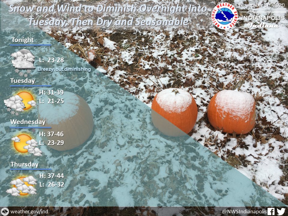
A chance of snow showers with wind gusts up to 35 mph, both diminishing overnight. Last of snow showers moving out Tue midday. Dry then thru Thu night. Highs 31-46°, warmest Wed, lows 21-32°, coldest Tue night. #INwx #nwsind https://t.co/VQnGAIIIwP
My Huge Radar has real-time weather tracking, current temperatures, and severe weather watches and warnings. Get detailed Indiana conditions by clicking here. Follow these links to get my forecasts for Lafayette, Muncie, Hendricks County, and Hamilton County. Need a second opinion? Click here for central Indiana National Weather Service forecasts.
Never miss me! Subscribe for free. My Huge Radar has real-time weather tracking, current temperatures, and severe weather watches and warnings. Get detailed Indiana conditions by clicking here. Click here to see my central Indiana 7-Day Forecast. Follow these links to get my forecasts for Lafayette, Muncie, Hendricks County, and Hamilton County. Need a second opinion? Click here for central Indiana National Weather Service forecasts. (Some charts via WeatherBELL.)


