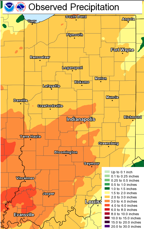
Here’s a map of where the rain was heaviest Friday and Saturday. The forecast of two to four inches was (unfortunately) accurate.
Hang on, Winter lovers! Big pattern changes kicks in this weekend.
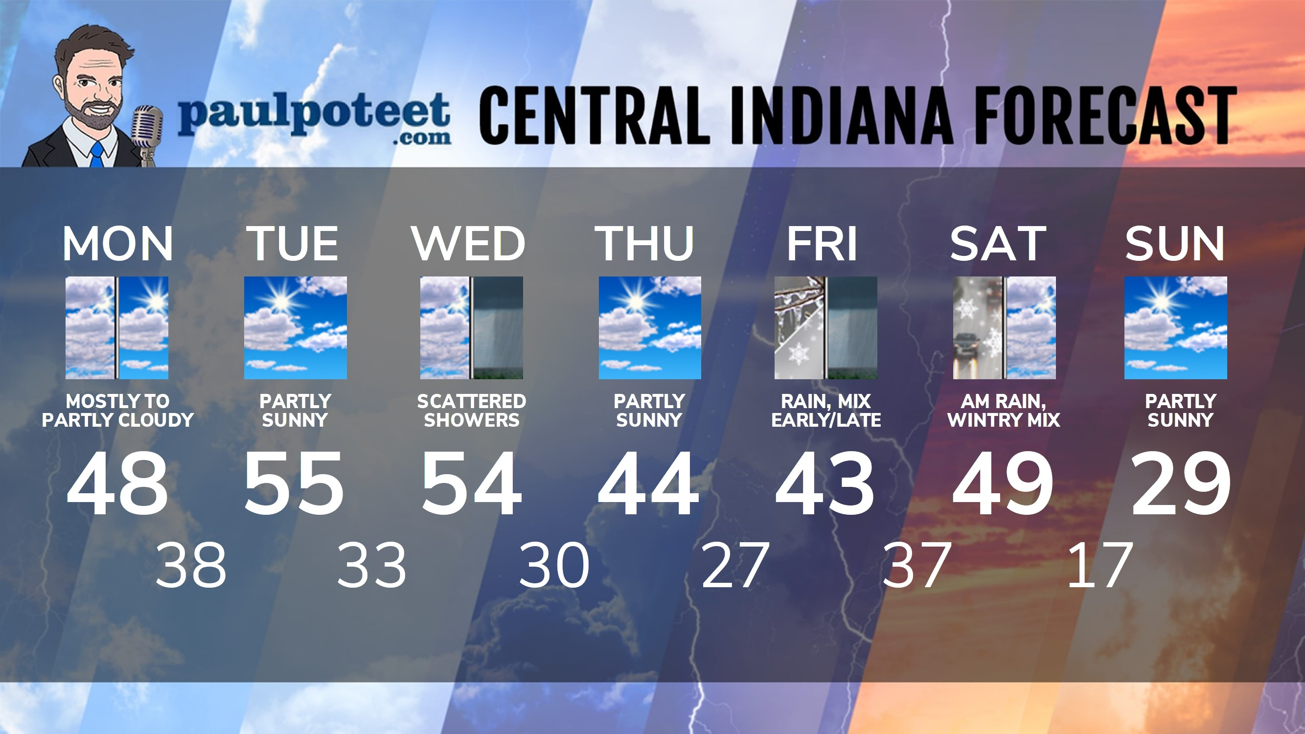
INDY SEVEN DAY FORECAST
Today: Mostly to partly cloudy. High 48.
Tonight: Partly cloudy. Low 38.
Tuesday: Partly sunny. High 55.
Tuesday Night: Partly cloudy. Low 33.
Wednesday: Clouding up. Scattered showers by afternoon. High 54.
Wednesday Night: Spotty showers early, then partly cloudy. Low 30.
Thursday: Partly sunny. High 44.
Thursday Night: Clouding up. Low 27.
Friday: Periods of rain, with a wintry mix possible in the morning. High 43.
Friday Night: More rain, possibly mixed with snow. Low 37.
Saturday: Morning showers, possibly mixed with snow. High 49.
Never miss me! Subscribe for free. My Huge Radar has real-time weather tracking, current temperatures, and severe weather watches and warnings. Get detailed Indiana conditions by clicking here. Click here to see my central Indiana 7-Day Forecast. Follow these links to get my forecasts for Lafayette, Muncie, Hendricks County, and Hamilton County. Need a second opinion? Click here for central Indiana National Weather Service forecasts. (Some charts via WeatherBELL.)


Indiana’ Weather For Monday
Here’s a map of where the rain was heaviest Friday and Saturday. The forecast of two… https://t.co/PKlyc8DJ8e
RT @PaulPoteet: Indiana’ Weather For Monday
Here’s a map of where the rain was heaviest Friday and Saturday. The forecast of two to four…