Most locations hit 90 again Thursday. For Indy it was the 21st time this year. Extra clouds and a few showers and storms from an approaching cold front should “limit” us to the upper 80s Friday, still comfortably (uncomfortably?) above average. There is a marginal risk of severe storms Friday afternoon, but things should settle down by sun down. Not a bad weekend—it won’t be as humid, especially Saturday.
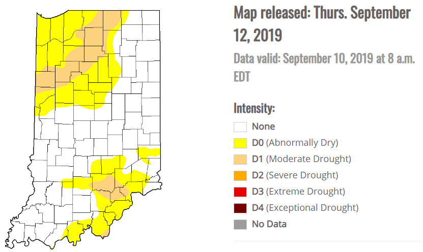
Drought conditions are developing in the northwest and southeast corners of the state.
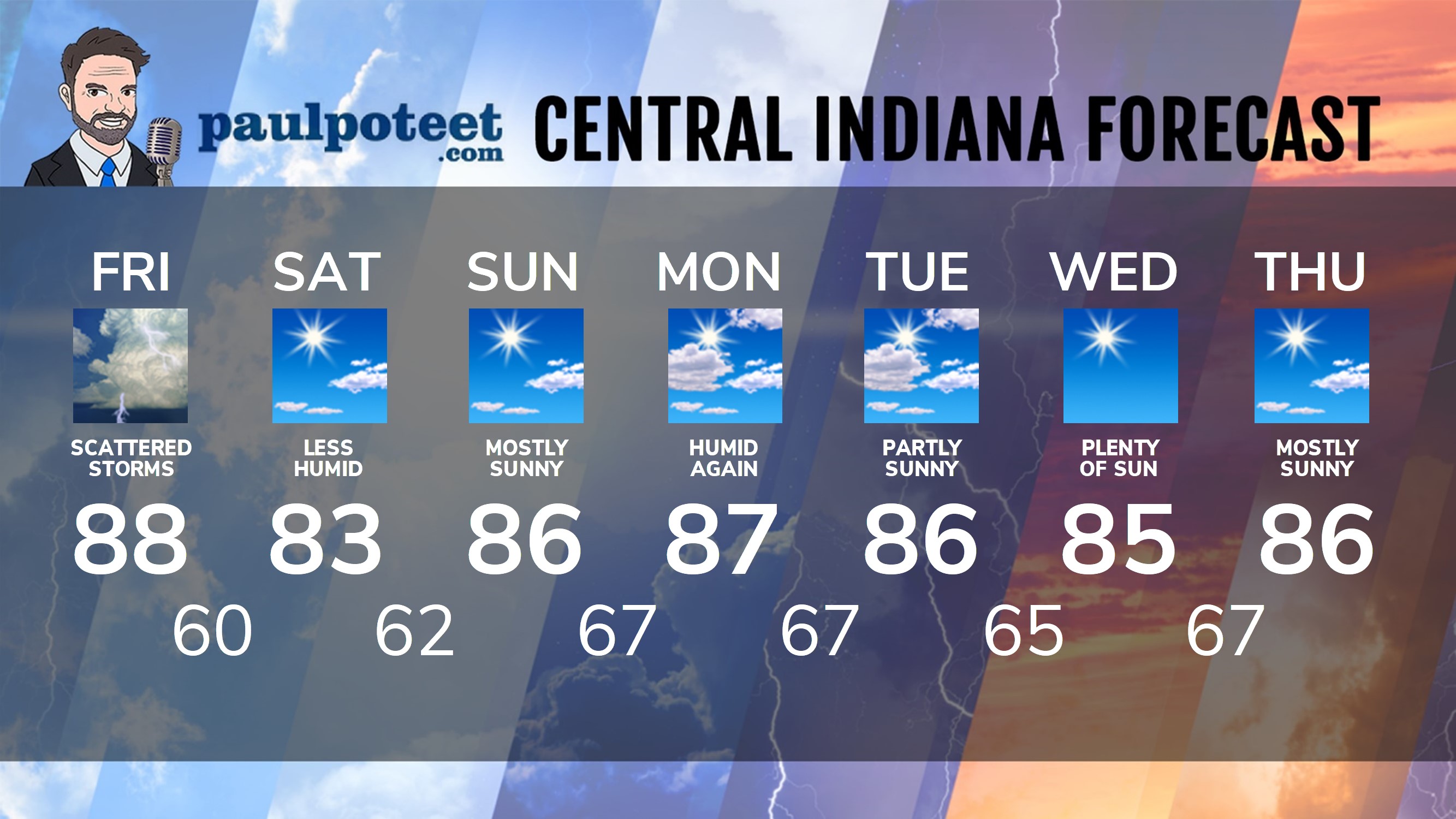
INDY SEVEN DAY FORECAST
Today: Partly sunny. Scattered showers and storms, mainly in the afternoon. High 88.
Tonight: Early evening lingering shower or storm possible. Clearing after sunset. Low 60.
Saturday: Mostly sunny and less humid. High 83.
Saturday Night: Mostly clear. Low 62.
Sunday: Mostly sunny. High 86.
Sunday Night: Mostly clear. Low 67.
Monday: Partly sunny. Muggy again! High 87.
Monday Night: Mostly clear. Low 67.
Tuesday: Partly sunny. High 86.
Tuesday Night: Partly cloudy. Low 65.
Wednesday: Sunny. High 85.
Wednesday Night: Mostly clear. Low 67.
Thursday: Mostly sunny. High 86.
Never miss me! Subscribe for free. My Huge Radar has real-time weather tracking, current temperatures, and severe weather watches and warnings. Get detailed Indiana conditions by clicking here. Click here to see my central Indiana 7-Day Forecast. Follow these links to get my forecasts for Lafayette, Muncie, Hendricks County, and Hamilton County. Need a second opinion? Click here for central Indiana National Weather Service forecasts. (Some charts via WeatherBELL.)


Indiana’s Weather For The Weekend
Most locations hit 90 again Thursday. For Indy it was the 21st time this year. E… https://t.co/DFEubLAxP0
RT @PaulPoteet: Indiana’s Weather For The Weekend
Most locations hit 90 again Thursday. For Indy it was the 21st time this year. Extra clo…