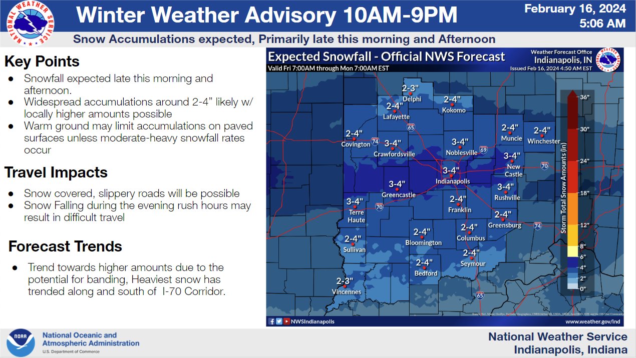
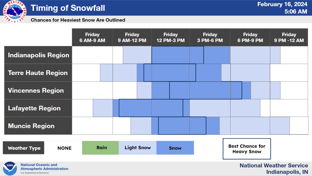
Snowfall rates will be heavy at times this afternoon. You might even get some THUNDER snow! Most of the snow will end by sunset. Accumulations of 2-3 inches will be most likely, with isolated 4 inch possible. Via @NWSIndianapolis… Snow is on the way! Snow arrives later this morning and continues into the afternoon. The snow may be heavy at times, limiting visibility and leading to hazardous travel. Additionally, very cold wind chills are possible by Saturday morning with values as low as 0 degrees.
Never miss me! Subscribe for free. My Huge Radar has real-time weather tracking, current temperatures, and severe weather watches and warnings. Get detailed Indiana conditions by clicking here. Click here to see my central Indiana 7-Day Forecast. Follow these links to get my forecasts for Lafayette, Muncie, Hendricks County, and Hamilton County. Need a second opinion? Click here for central Indiana National Weather Service forecasts. (Some charts via WeatherBELL.)


