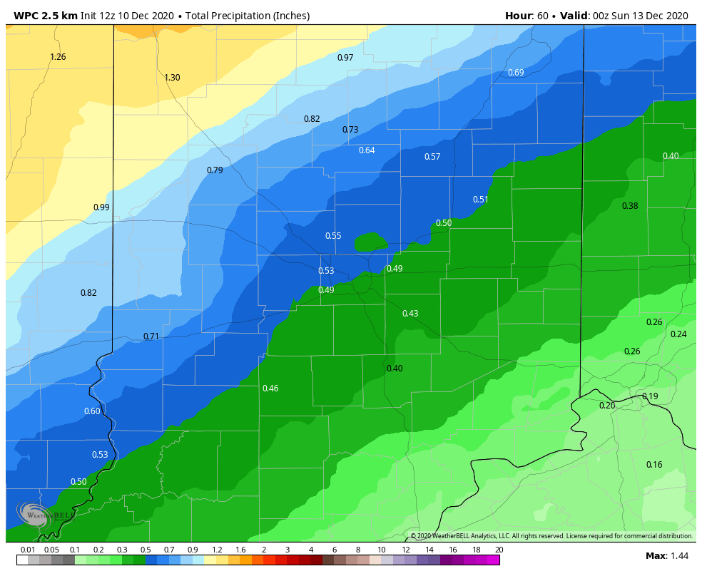
I’m expecting the warmest day since the 20th of November today! It will still be mild through Saturday, but rain’s coming Friday night into Saturday morning. About one-third to three-quarters of an inch is expected.
How about a White Christmas? This chart shows one particular model’s rendering of 12 hours of snow potential leading up to the afternoon of December 25th. DO YOU BELIEVE?

Never miss me! Subscribe for free. My Huge Radar has real-time weather tracking, current temperatures, and severe weather watches and warnings. Get detailed Indiana conditions by clicking here. Click here to see my central Indiana 7-Day Forecast. Follow these links to get my forecasts for Lafayette, Muncie, Hendricks County, and Hamilton County. Need a second opinion? Click here for central Indiana National Weather Service forecasts. (Some charts via WeatherBELL.)
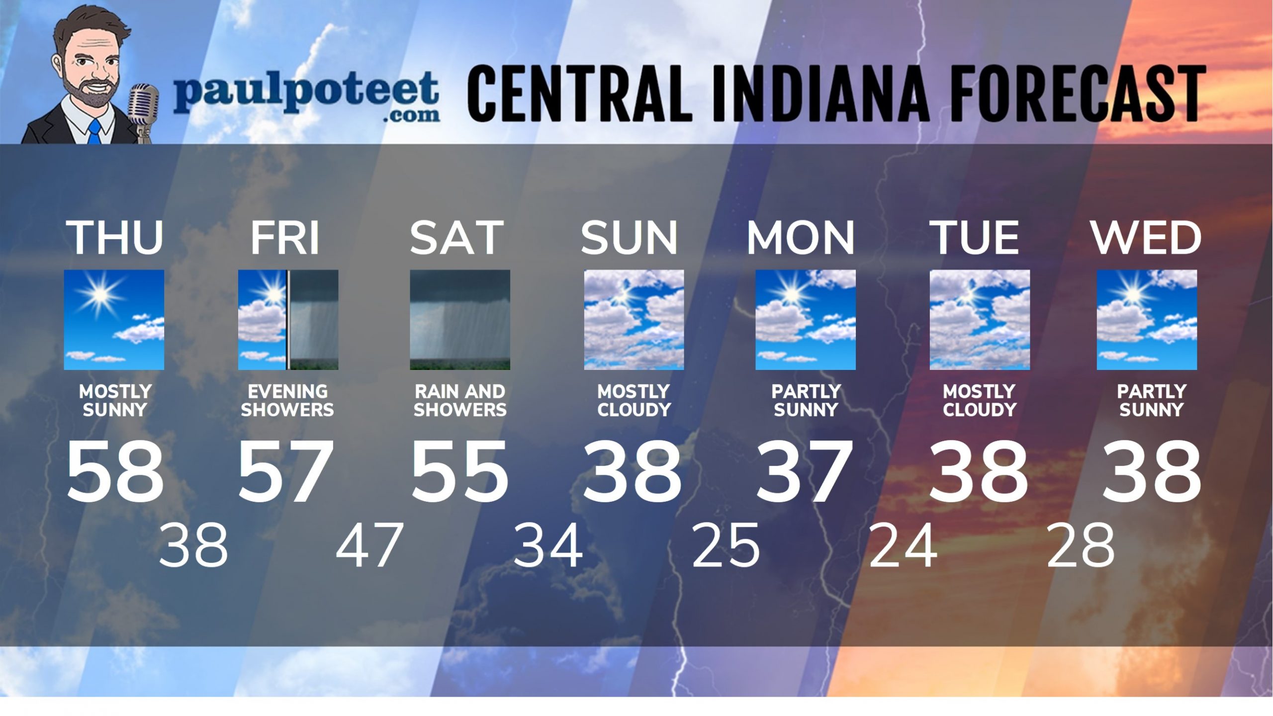
INDY SEVEN DAY FORECAST
Today: Mostly sunny. High 58.
Tonight: Partly cloudy. Low 38.
Friday: Partly to mostly cloudy. High 57.
Friday Night: Scattered showers. Low 47.
Saturday: Rainy in the morning. Scattered showers in the afternoon. High 55.
Saturday Night: Showers. Snow could mix in late. Low 34.
Sunday: Mostly cloudy, with a few flurries. High 38.
Sunday Night: Partly cloudy. Low 25.
Monday: Partly sunny. High 37.
Monday Night: Partly cloudy. Low 24.
Tuesday: Mostly cloudy. High 38.
Tuesday Night: Mostly cloudy. Low 28.
Wednesday: Partly sunny. High 38.
Never miss me! Subscribe for free. My Huge Radar has real-time weather tracking, current temperatures, and severe weather watches and warnings. Get detailed Indiana conditions by clicking here. Click here to see my central Indiana 7-Day Forecast. Follow these links to get my forecasts for Lafayette, Muncie, Hendricks County, and Hamilton County. Need a second opinion? Click here for central Indiana National Weather Service forecasts. (Some charts via WeatherBELL.)


