From 62 degrees yesterday to chills below freezing today. Don’t call it a Winter comeback! (Mama Nature said knock you out.)
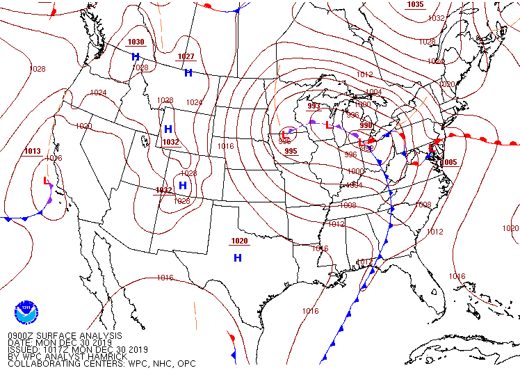
The cold front may have awoken you as it passed and the wind began kicking.(Peak gust of 45mph in Indy at 4:54am.) Here’s the front at 4am.
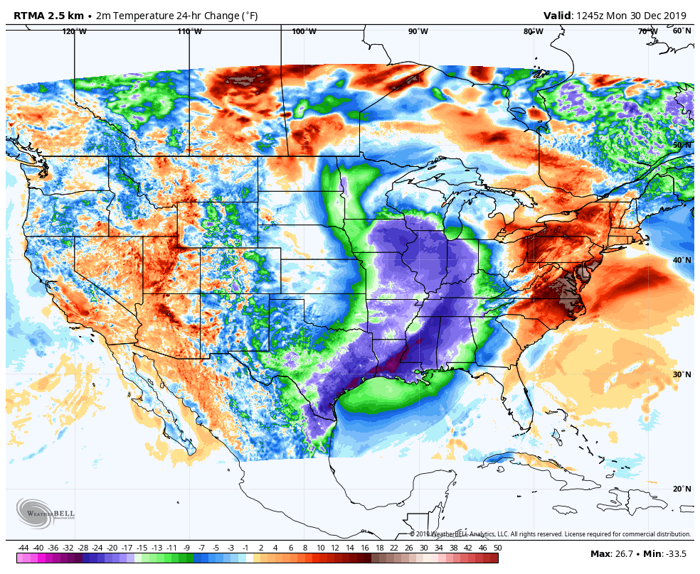
And here’s the effect on temperatures. (Chart via WeatherBELL.)
SUNDAY RAINFALL
1.48″ TERRE HAUTE (High 62)
1.21″ BLOOMINGTON (High 63)
1.08″ INDY (High 62)
0.93″ LAFAYETTE (High 61)
0.40″ MUNCIE (High 64)
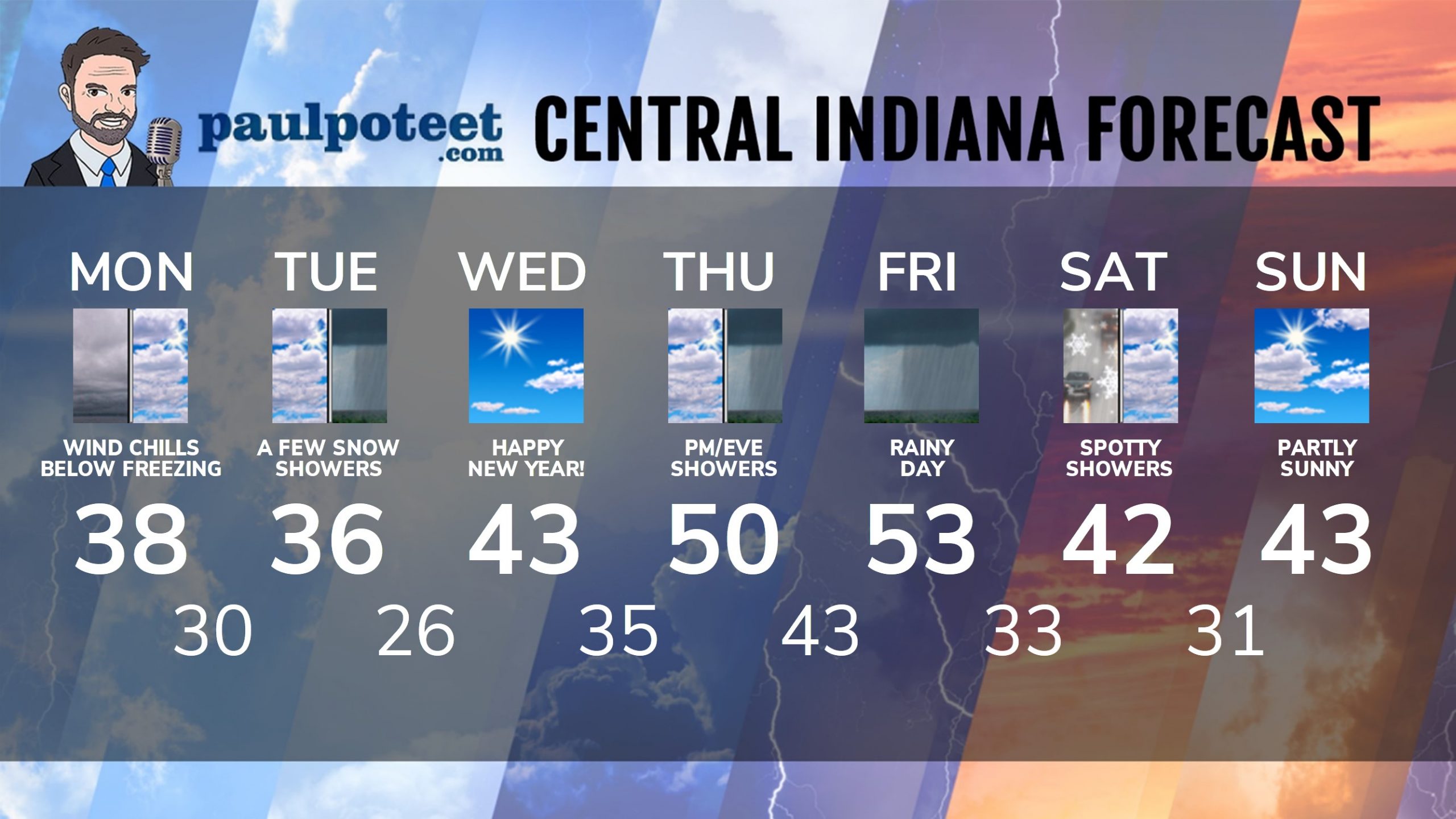
INDY SEVEN DAY FORECAST
Today: Mostly cloudy. Wind gusting to 35 mph. A few rain showers, possibly mixed with snow. High 38.
Tonight: Cloudy. Snow showers possible after midnight. Wind gusting to 35 mph. Low 30.
Tuesday: Cloudy with a few snow showers. Wind gusting to 35 mph again. High 36.
New Years Eve: Clouds decrease. Wind gusts to 25 mph. Low 26.
New Years Day: Mostly sunny. High 43.
Wednesday Night: Mostly clear. Low 35.
Thursday: Clouds return, with afternoon showers. High 50.
Thursday Night: Rainy. Low 43.
Friday: Rainy. High 53.
Friday Night: Rain, possibly mixed with snow. Low 33.
Saturday: Mostly cloudy, with morning rain and snow showers possible. High 42.
Saturday Night: Mostly to partly cloudy. Low 31.
Sunday: Partly sunny. High 43.
Never miss me! Subscribe for free. My Huge Radar has real-time weather tracking, current temperatures, and severe weather watches and warnings. Get detailed Indiana conditions by clicking here. Click here to see my central Indiana 7-Day Forecast. Follow these links to get my forecasts for Lafayette, Muncie, Hendricks County, and Hamilton County. Need a second opinion? Click here for central Indiana National Weather Service forecasts. (Some charts via WeatherBELL.)


