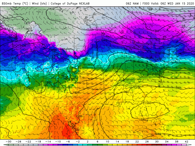
Middle of the week, middle of the month. So far this month: Indy is a blistering 11.8 degrees above average. A second half switch is less than 24 hours away! Watch the green and orange retreat southward on this computer-modeled temperature forecast.
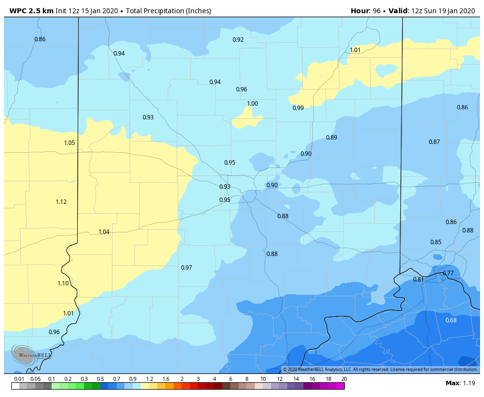
Wednesday morning’s drive was slowed by fog, and Wednesday afternoon’s drive could be slightly slowed by spotty showers. A bigger storm is waiting for the later Friday into Saturday time period. Most of it will be rain, which is a good thing, considering the total amount of possible precipitation. (Chart via WeatherBELL.)
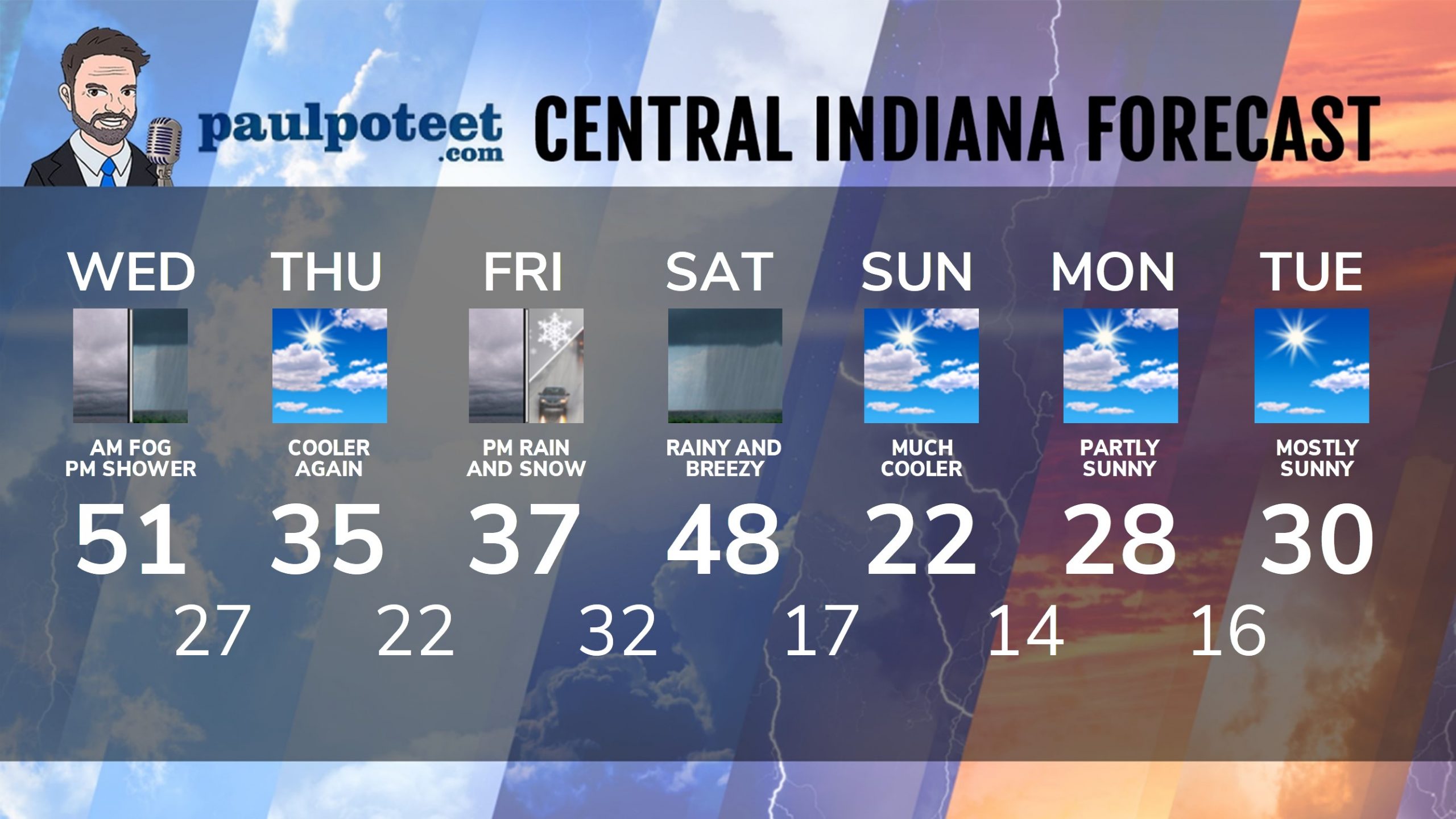
INDY SEVEN DAY FORECAST
Today: DENSE FOG ADVISORY until 10am. Spotty showers in the midday and early afternoon. High 51.
Tonight: Cloudy and colder. Low 27.
Thursday: Partly sunny. High 35.
Thursday Night: Partly cloudy. Low 22.
Friday: Cloudy, with rain and/or snow in the afternoon. High 37.
Friday Night: Snow and/or rain. Temps rise after midnight. Low 32.
Saturday: Rainy. High 48.
Saturday Night: Mostly cloudy. Low 17.
Sunday: Partly sunny. High 22.
Sunday Night: Partly cloudy. Low 14.
Monday: Partly sunny. High 28.
Monday Night: Partly cloudy. Low 16.
Tuesday: Mostly sunny. High 30.
Never miss me! Subscribe for free. My Huge Radar has real-time weather tracking, current temperatures, and severe weather watches and warnings. Get detailed Indiana conditions by clicking here. Click here to see my central Indiana 7-Day Forecast. Follow these links to get my forecasts for Lafayette, Muncie, Hendricks County, and Hamilton County. Need a second opinion? Click here for central Indiana National Weather Service forecasts. (Some charts via WeatherBELL.)


