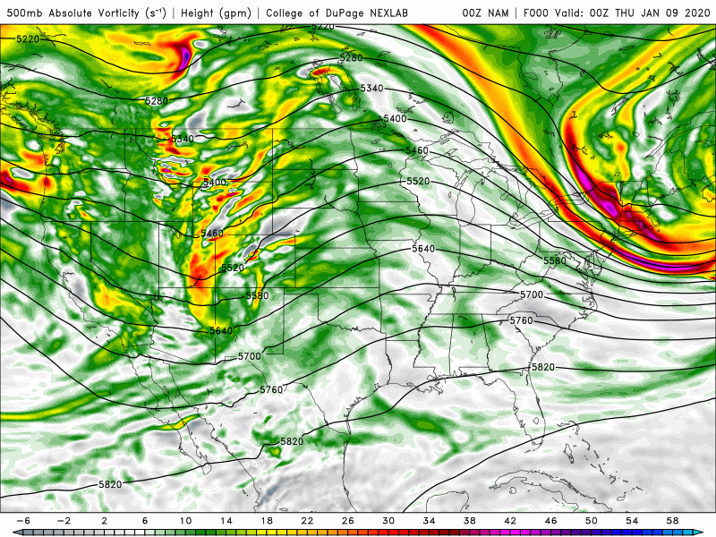
Things increasing today: clouds, temps, wind speeds! Temps will climb back to the 40s after 10am, and into the low 50s in the afternoon. A large trough in the upper atmosphere (look for the “u” shaped feature on the chart) lifts out of the West, then the Plains, and then into the upper Midwest by Saturday.
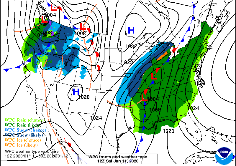
The trough and the associated surface low will stir up storms in the Deep South that could produce tornadoes Friday and Saturday, and 2-4 inches of rain here in Central Indiana. Heavy snow is likely northwest of the path of the surface low. Not a factor here.
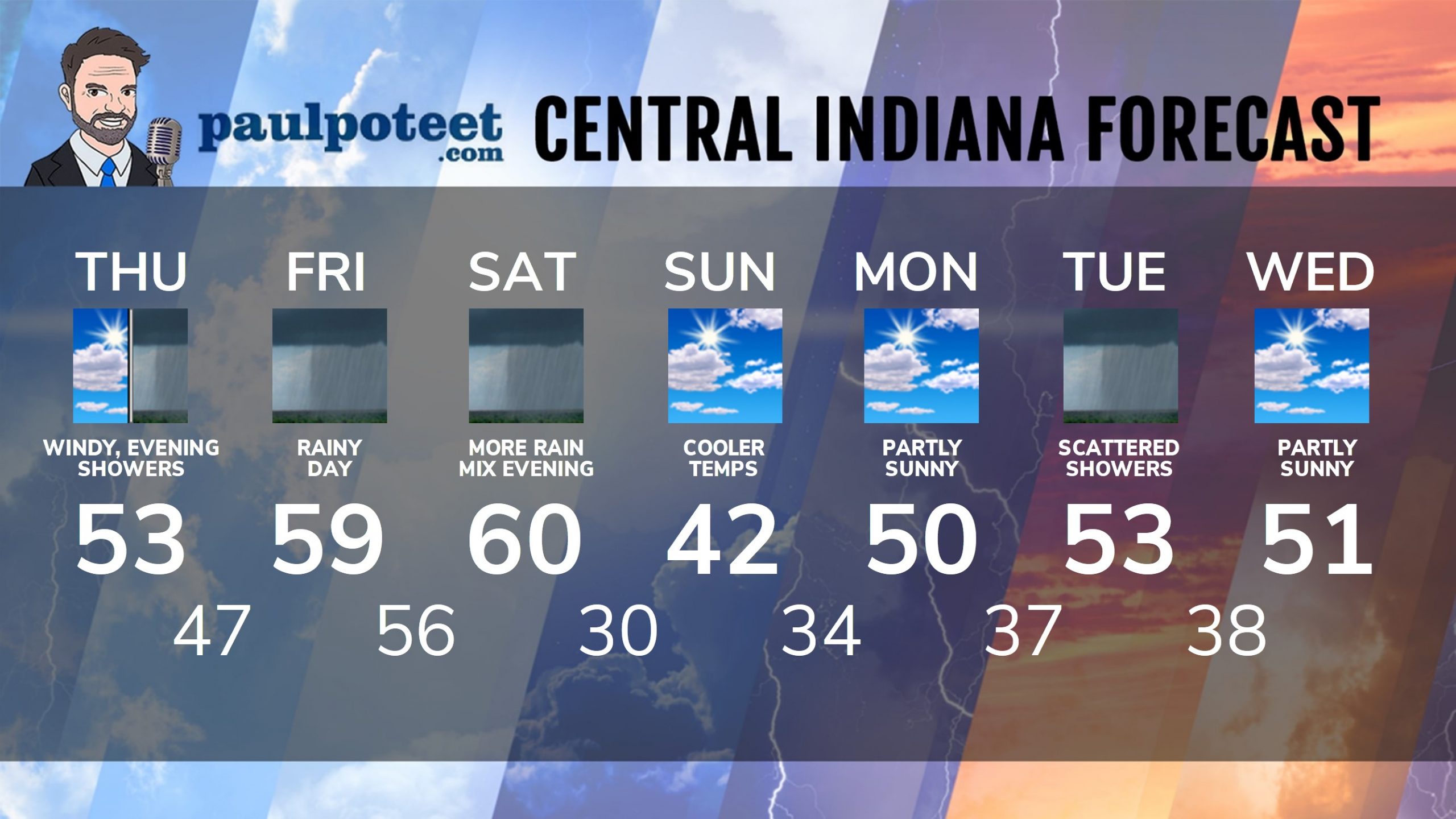
INDY SEVEN DAY FORECAST
Today: Partly cloudy morning. Mostly cloudy afternoon. Winds gust to 35 mph. High 53.
Tonight: Periods of rain. Low 47.
Friday: Rainy. Wind gusts to 35 mph. Storms possible in the afternoon. High 59.
Friday Night: Rainy. Storms and heavy rain possible. Low 56.
Saturday: More rain, again possibly heavy. High 60.
Saturday Night: Rain, mixed with a little snow. Low 30.
Sunday: Partly sunny. High 42.
Sunday Night: Partly cloudy. Low 34.
Monday: Partly sunny. High 50.
Monday Night: Partly cloudy. Low 37.
Tuesday: Partly sunny. Scattered showers. High 53.
Tuesday Night: Partly cloudy. Low 38.
Wednesday: Partly sunny. High 51.
Never miss me! Subscribe for free. My Huge Radar has real-time weather tracking, current temperatures, and severe weather watches and warnings. Get detailed Indiana conditions by clicking here. Click here to see my central Indiana 7-Day Forecast. Follow these links to get my forecasts for Lafayette, Muncie, Hendricks County, and Hamilton County. Need a second opinion? Click here for central Indiana National Weather Service forecasts. (Some charts via WeatherBELL.)


Indiana’s Weather For Thursday
Things increasing today: clouds, temps, wind speeds! Temps will climb back to the… https://t.co/l7zAN7gBYb
RT @PaulPoteet: Indiana’s Weather For Thursday
Things increasing today: clouds, temps, wind speeds! Temps will climb back to the 40s afte…