Gloomy again today, with showers, mainly in the morning and midday hours. Less than a quarter-inch is expected. This particular computer modeling covers 7 am to 2 pm.
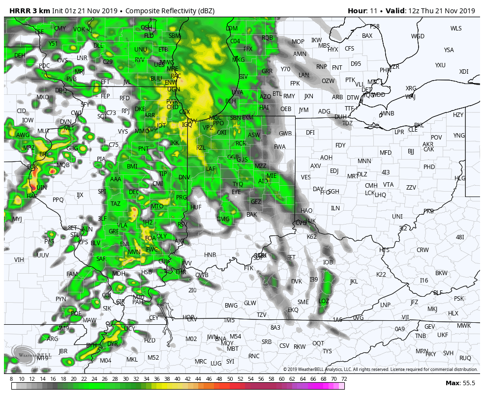
Low pressure moving through the Great Lakes will cause winds to gust to around 40 mph this afternoon and evening.
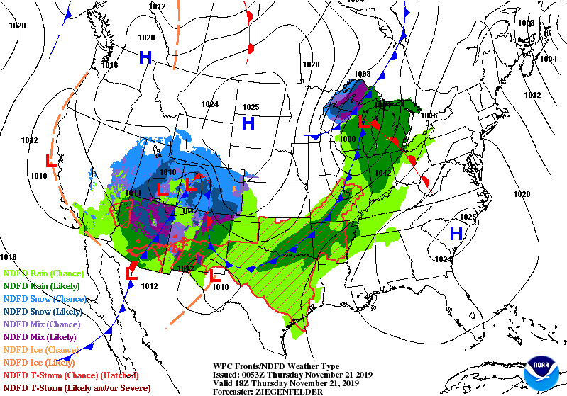
Active weather continue in the run-up to the holiday.
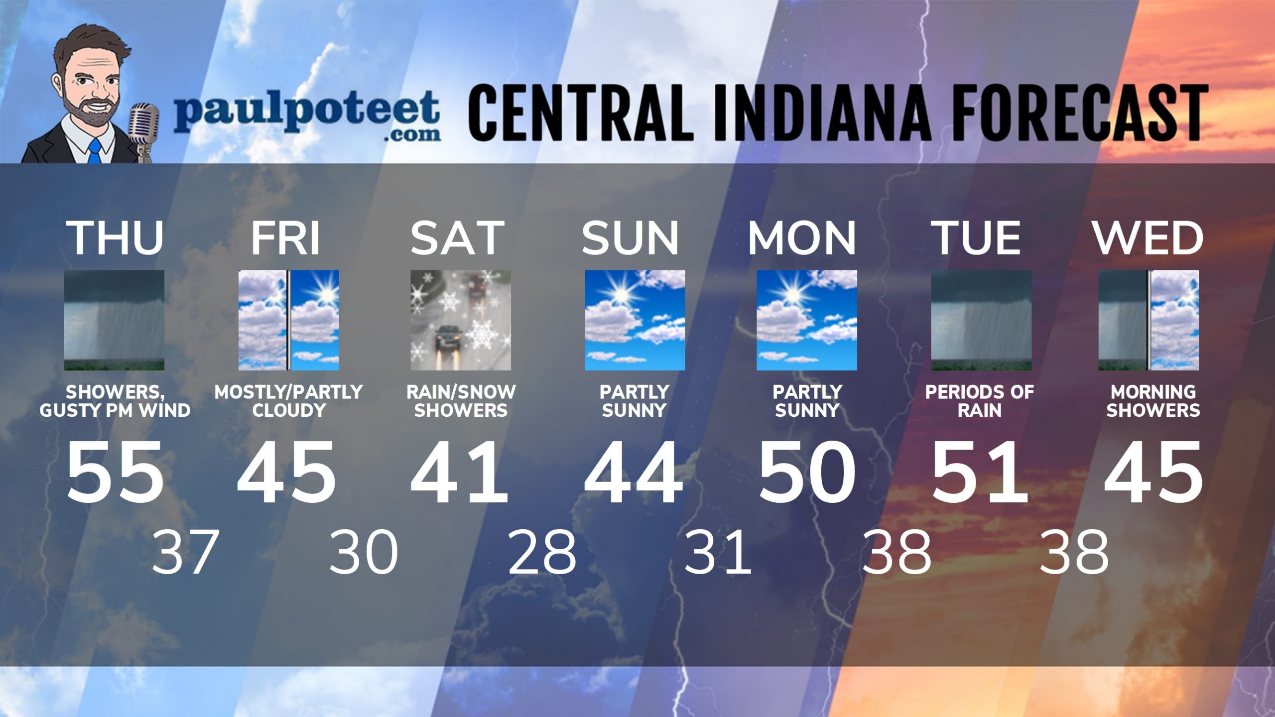
INDY SEVEN DAY FORECAST
Today: Morning and midday rain. Wind gusts to 40 mph in the afternoon, with scattered showers. High 55.
Tonight: Scattered showers. Wind gusting to 30 mph. Low 37.
Friday: Mostly cloudy morning. Partly sunny afternoon. High 45.
Friday Night: Partly cloudy evening. Mostly cloudy overnight. Low 30.
Saturday: Cloudy, with periods of showers, mixing with snow later in the afternoon. High 41.
Saturday Night: Mostly cloudy. Low 28.
Sunday: Partly sunny. High 44.
Sunday Night: Partly cloudy. Low 31.
Monday: Partly sunny. High 50.
Monday Night: Partly cloudy. Low 38.
Tuesday: Periods of showers. High 51.
Tuesday Night: More showers. Low 38.
Wednesday: Morning showers likely. High 45.
Never miss me! Subscribe for free. My Huge Radar has real-time weather tracking, current temperatures, and severe weather watches and warnings. Get detailed Indiana conditions by clicking here. Click here to see my central Indiana 7-Day Forecast. Follow these links to get my forecasts for Lafayette, Muncie, Hendricks County, and Hamilton County. Need a second opinion? Click here for central Indiana National Weather Service forecasts. (Some charts via WeatherBELL.)


Indiana’s Weather For Thursday
Gloomy again today, with showers, mainly in the morning and midday hours. Less tha… https://t.co/RDMGSkD5mr
RT @PaulPoteet Indiana’s Weather For Thursday
Gloomy again today, with showers, mainly in the morning and midday… https://t.co/sdMyGD238M