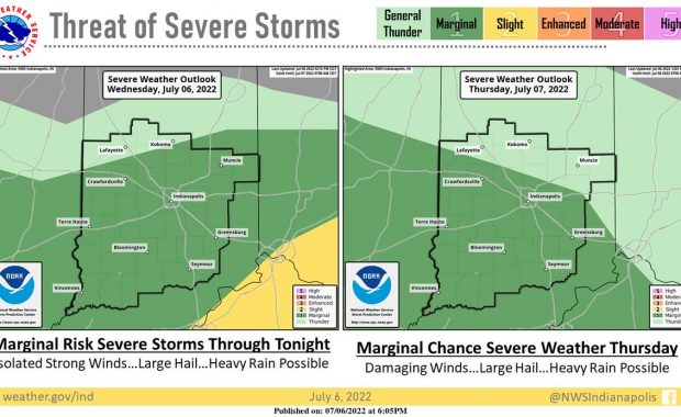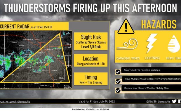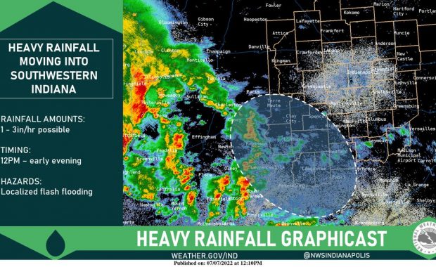
(Via @NWSIndianapolis.) Thunderstorms capable of producing heavy rainfall are moving into southwestern Indiana. The highlighted area has an increased potential for localized flash flooding. Areas northeast of this may see isolated showers throughout the afternoon. #INwx #NWSind https://t.co/HL7IXiQcU3 My Huge Radar has real-time weather tracking, current temperatures, and severe weather watches and warnings. Get detailed […]
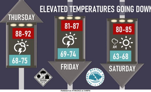
Never miss me! Subscribe for free. My Huge Radar has real-time weather tracking, current temperatures, and severe weather watches and warnings. Get detailed Indiana conditions by clicking here. Click here to see my central Indiana 7-Day Forecast. Follow these links to get my forecasts for Lafayette, Muncie, Hendricks County, and Hamilton County. Need a second opinion? Click here for central Indiana National Weather Service forecasts. (Some charts via WeatherBELL.)