Blue skies for your eyes today, with a few more clouds and a little more heat and humidity tomorrow. Rain chances return Friday as a warm front approaches.

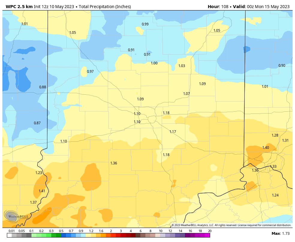
The front will stall out over the state Friday and Saturday, then drop southward Sunday, which should lessen the rain chance. Totals through the period could approach one inch.
INDY SEVEN DAY FORECAST
Today: Sunny. High 79.
Tonight: Clear evening. Partly cloudy overnight. Low 54.
Thursday: Partly sunny, a little more muggy. High 85.
Thursday Night: Partly cloudy. Shower chance after midnight. Low 64.
Friday: Showers likely, with some afternoon thunderstorms. High 76.
Friday Night: Partly to mostly cloudy. Scattered showers and storms. Low 64.
Saturday: Partly to mostly cloudy. Scattered showers and storms. High 80.
Saturday Night: Partly to mostly cloudy. Scattered showers and storms. Low 57.
Sunday: Partly to mostly cloudy. Scattered showers possible. High 75.
Sunday Night: Partly to mostly cloudy. Scattered showers and storms in the evening. Low 50.
Monday: Partly sunny. High 72.
Monday Night: Partly cloudy. Low 50.
Tuesday: Mostly sunny. High 79.

Never miss me! Subscribe for free. My Huge Radar has real-time weather tracking, current temperatures, and severe weather watches and warnings. Get detailed Indiana conditions by clicking here. Click here to see my central Indiana 7-Day Forecast. Follow these links to get my forecasts for Lafayette, Muncie, Hendricks County, and Hamilton County. Need a second opinion? Click here for central Indiana National Weather Service forecasts. (Some charts via WeatherBELL.)


