(Via @NWSIndianapolis.) 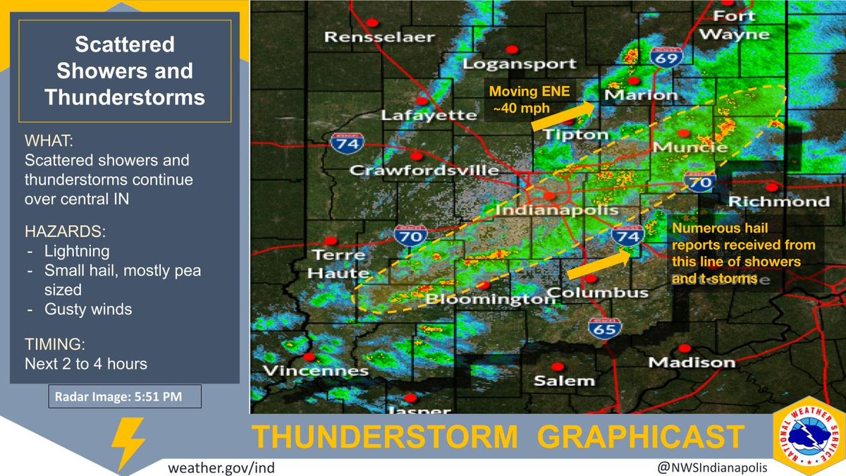 Showers/t-storms over central IN continue, though weakening and non-severe. Lightning, small hail (mostly pea sized), and wind gusts to 45 mph expected. Activity is expected to continue through approximately sunset. Movement is east-northeast at ~40 mph. #INwx #nwsind https://t.co/QDxX27ASsW
My Huge Radar has real-time weather tracking, current temperatures, and severe weather watches and warnings. Get detailed Indiana conditions by clicking here. Follow these links to get my forecasts for Lafayette, Muncie, Hendricks County, and Hamilton County. Need a second opinion? Click here for central Indiana National Weather Service forecasts.
Never miss me! Subscribe for free. My Huge Radar has real-time weather tracking, current temperatures, and severe weather watches and warnings. Get detailed Indiana conditions by clicking here. Click here to see my central Indiana 7-Day Forecast. Follow these links to get my forecasts for Lafayette, Muncie, Hendricks County, and Hamilton County. Need a second opinion? Click here for central Indiana National Weather Service forecasts. (Some charts via WeatherBELL.)


