Morning Lows around the state included 27 in Lafayette, 29 in the Haute, 30 at Indy, 32 in Anderson, and 34 in Muncie. The afternoon brings sunshine and temperatures warming quickly.
Never miss me! Subscribe for free. My Huge Radar has real-time weather tracking, current temperatures, and severe weather watches and warnings. Get detailed Indiana conditions by clicking here. Click here to see my central Indiana 7-Day Forecast. Follow these links to get my forecasts for Lafayette, Muncie, Hendricks County, and Hamilton County. Need a second opinion? Click here for central Indiana National Weather Service forecasts. (Some charts via WeatherBELL.)
Cold front crashes the party Thursday evening. Here’s what lightning might be like, around 10pm.

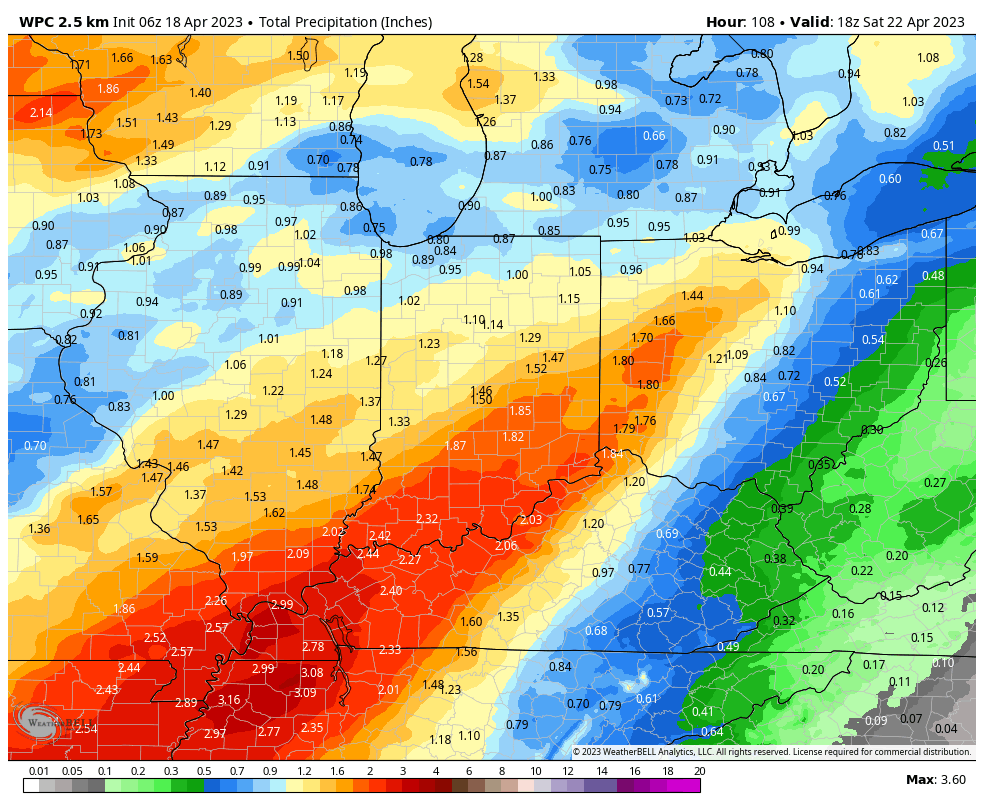
That first round of rain will fade later Friday morning, with more coming Friday night into Saturday. Could be an inch of precipitation between the two events.
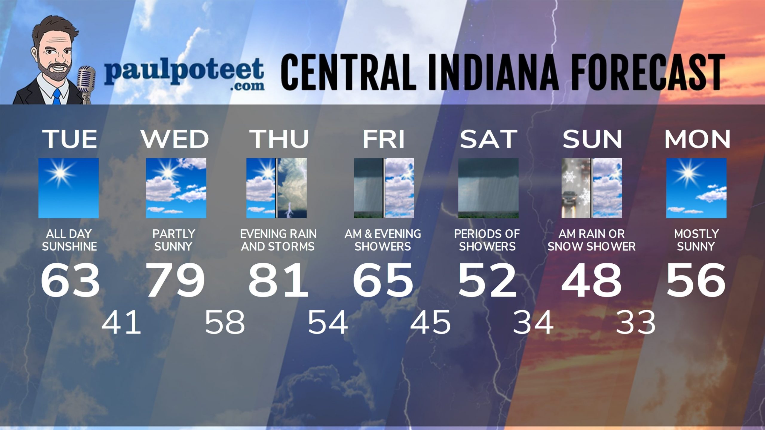
INDY SEVEN DAY FORECAST
Today: Sunny. High 63.
Tonight: Mostly clear. Low 41.
Wednesday: Partly sunny. High 79.
Wednesday Night: Partly cloudy. Low 58.
Thursday: Partly sunny. High 81.
Thursday Night: Scattered showers and storms. Low 54.
Friday: Mainly morning showers. Mostly cloudy. High 65.
Friday Night: Periods of showers. Low 45.
Saturday: Periods of showers. High 52.
Saturday Night: Mostly cloudy. Stray rain or snow shower. Low 34.
Sunday: Mostly cloudy morning. Stray rain or snow shower. Partly sunny afternoon. High 48.
Sunday Night: Partly cloudy. Low 33.
Monday: Mostly sunny. High 56.
Never miss me! Subscribe for free. My Huge Radar has real-time weather tracking, current temperatures, and severe weather watches and warnings. Get detailed Indiana conditions by clicking here. Click here to see my central Indiana 7-Day Forecast. Follow these links to get my forecasts for Lafayette, Muncie, Hendricks County, and Hamilton County. Need a second opinion? Click here for central Indiana National Weather Service forecasts. (Some charts via WeatherBELL.)


