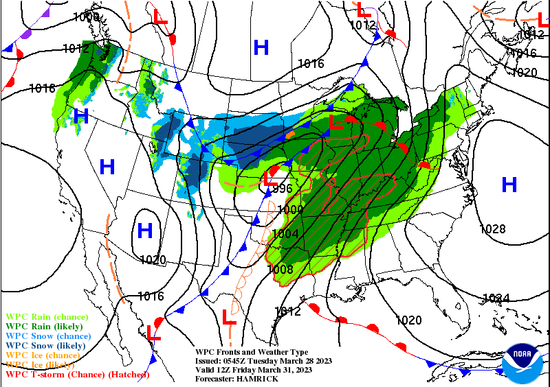
The next big weather day is Friday, with showers and storms as low pressure pulls a cold front through the state.
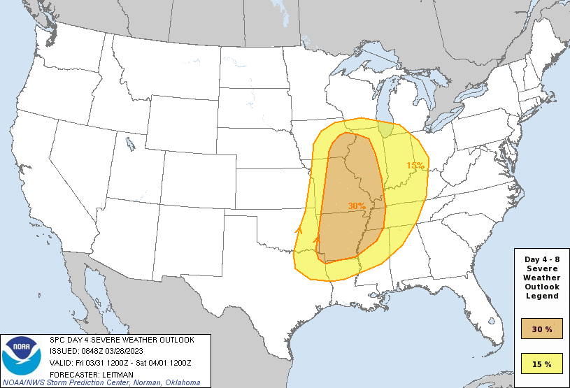
The Storm Prediction Center is already monitoring for the risk of severe weather Friday.
Total rainfall should remain below three-quarters of an inch for most in central Indiana.

Never miss me! Subscribe for free. My Huge Radar has real-time weather tracking, current temperatures, and severe weather watches and warnings. Get detailed Indiana conditions by clicking here. Click here to see my central Indiana 7-Day Forecast. Follow these links to get my forecasts for Lafayette, Muncie, Hendricks County, and Hamilton County. Need a second opinion? Click here for central Indiana National Weather Service forecasts. (Some charts via WeatherBELL.)
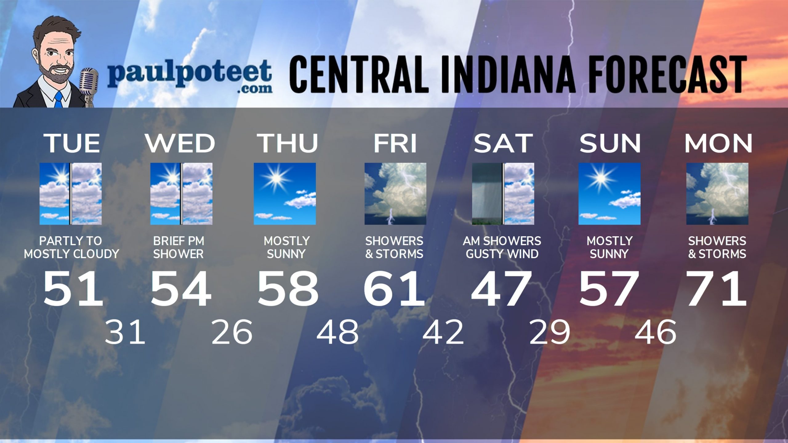
INDY SEVEN DAY FORECAST
Today: Partly sunny. More clouds in the afternoon. High 51.
Tonight: Mostly clear. Low 31.
Wednesday: Partly sunny. More clouds in the afternoon. A passing shower is possible in the afternoon. High 54.
Wednesday Night: Mostly clear. Low 26.
Thursday: Mostly sunny. High 58.
Thursday Night: Partly cloudy. Showers and storms after midnight. Low 48.
Friday: Windy, with periods of showers and storms. High 61.
Friday Night: Showers and storms. Low 42.
Saturday: Partly sunny. High 47.
Saturday Night: Partly cloudy. Low 29.
Sunday: Mostly sunny. High 57.
Sunday: Partly cloudy. Scattered shower or storm after midnight. Low 46.
Monday: Mostly cloudy, with scattered showers and storms. High 71.
Never miss me! Subscribe for free. My Huge Radar has real-time weather tracking, current temperatures, and severe weather watches and warnings. Get detailed Indiana conditions by clicking here. Click here to see my central Indiana 7-Day Forecast. Follow these links to get my forecasts for Lafayette, Muncie, Hendricks County, and Hamilton County. Need a second opinion? Click here for central Indiana National Weather Service forecasts. (Some charts via WeatherBELL.)


