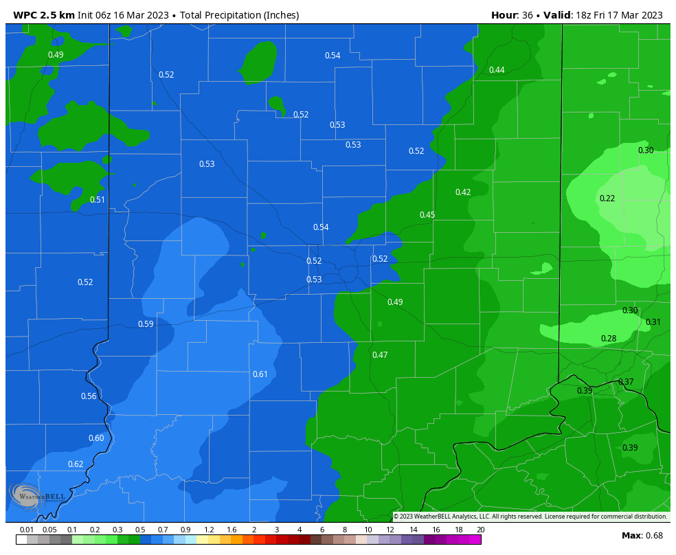
A half-inch of rain is expected tonight into very early tomorrow morning.
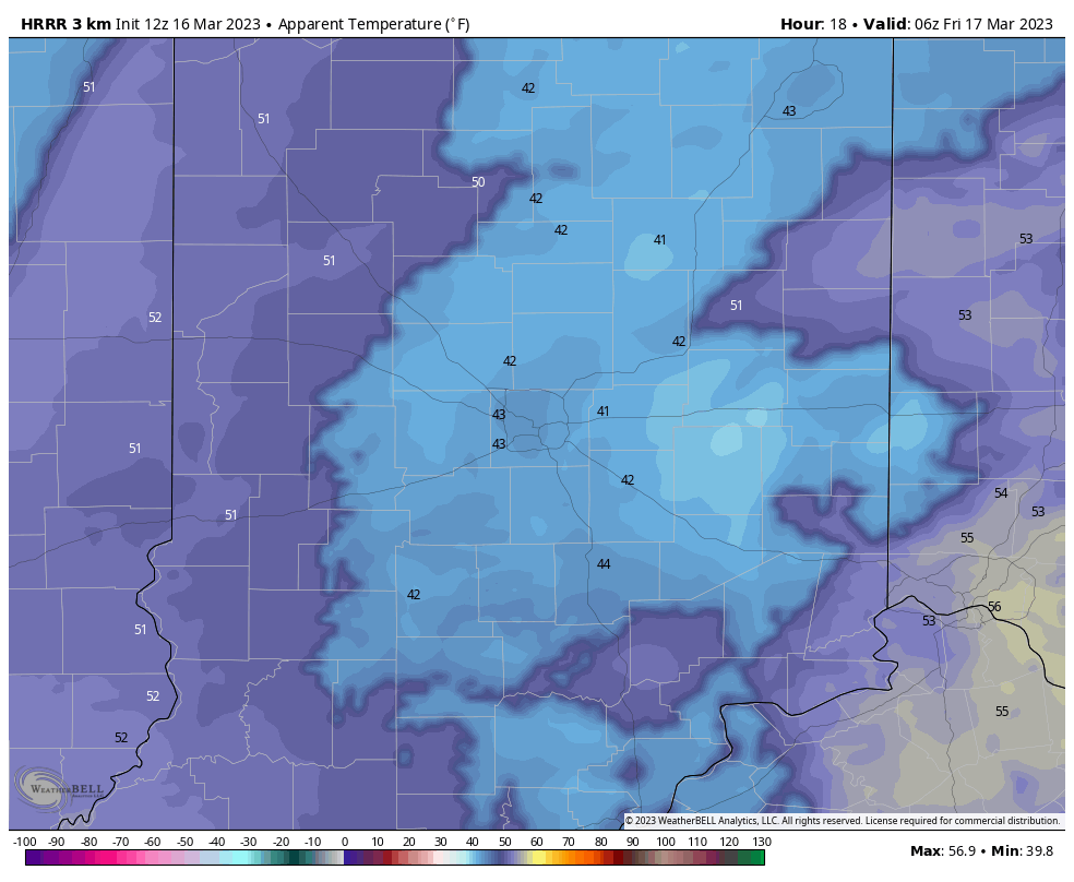
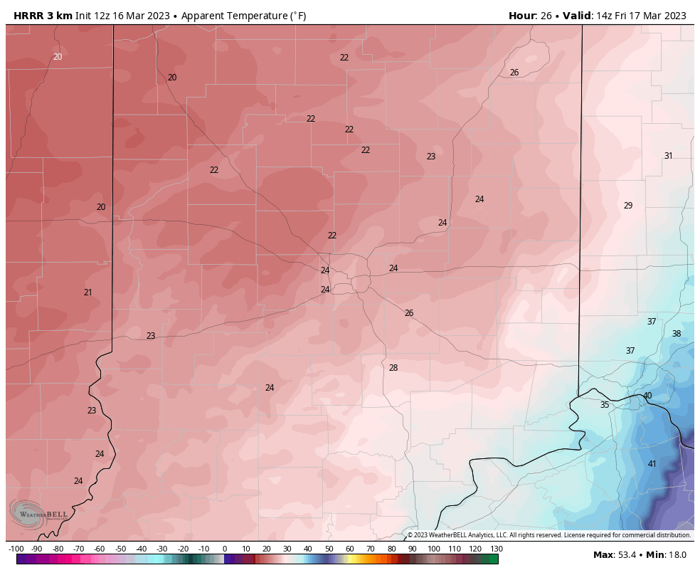
A sharp cold front will make for a frigid Friday. Compare the modeled wind chill temperatures for 1am, 5am and 9am Friday. Wind will gust to 40 mph tonight and Friday morning.

Never miss me! Subscribe for free. My Huge Radar has real-time weather tracking, current temperatures, and severe weather watches and warnings. Get detailed Indiana conditions by clicking here. Click here to see my central Indiana 7-Day Forecast. Follow these links to get my forecasts for Lafayette, Muncie, Hendricks County, and Hamilton County. Need a second opinion? Click here for central Indiana National Weather Service forecasts. (Some charts via WeatherBELL.)
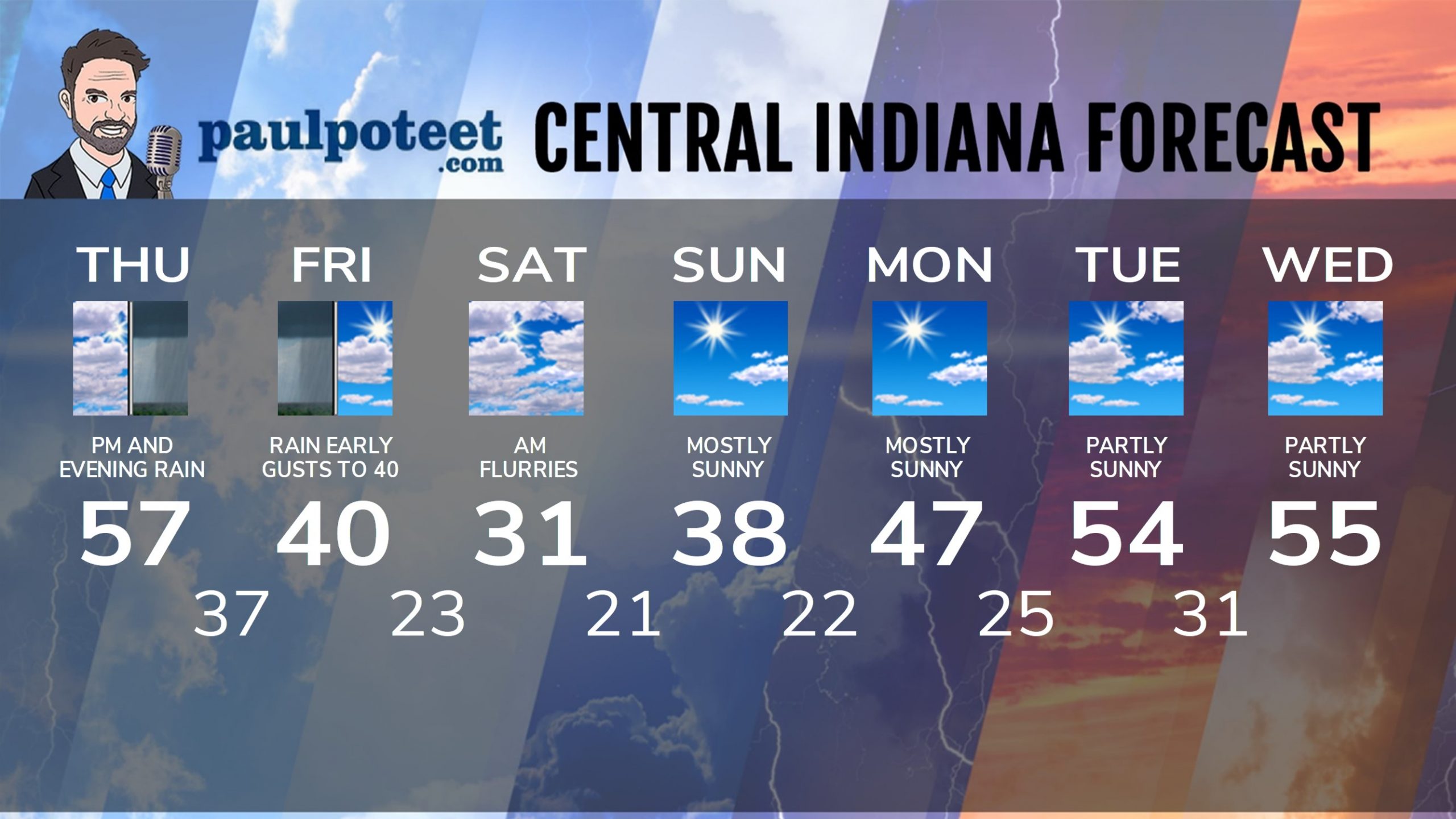
INDY SEVEN DAY FORECAST
Today: Mostly cloudy. Scattered afternoon showers. Wind gusts to 35 mph. High 57.
Tonight: Rainy. Wind gusts to 40 mph. Low 37.
Friday: Early morning rain, perhaps mixing with, and ending with a few snow showers. Some clearing in the afternoon. Wind gusts to 35 mph. Chills in the 20s. High 40.
Friday Night: Partly cloudy. Chills in the teens and single digits. Low 23.
Saturday: Mostly cloudy, with a few flurries in the morning. Wind gusts to 35 mph. Chills in the teens. High 31.
Saturday Night: Partly cloudy. Chills in the teens. Low 21.
Sunday: Mostly sunny. Not as windy. High 38.
Sunday Night: Mostly clear. Low 22.
Monday: Mostly sunny. High 47.
Monday Night: Partly cloudy. Low 25.
Tuesday: Partly sunny. High 54.
Tuesday Night: Partly cloudy. Low 31.
Wednesday: Partly sunny. High 55.
Never miss me! Subscribe for free. My Huge Radar has real-time weather tracking, current temperatures, and severe weather watches and warnings. Get detailed Indiana conditions by clicking here. Click here to see my central Indiana 7-Day Forecast. Follow these links to get my forecasts for Lafayette, Muncie, Hendricks County, and Hamilton County. Need a second opinion? Click here for central Indiana National Weather Service forecasts. (Some charts via WeatherBELL.)


