Sunday’s snow in Indy was the first measurable stuff since January 30. There was 0.6′ officially at Indianapolis. Many areas near and north of I-74 saw up to 1 to 1.5′ with a few reports of 2′ to 2.5′ in Henry and Madison Counties. This brings the Indy seasonal snow total to 9.1 inches, less than half of normal 23.7 inches. Last year’s total by this point was pretty close to this year’s: exactly ten inches.
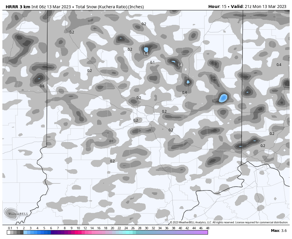
We are likely to add a little more today. Scattered to numerous snow showers are in the forecast. A few of these snow showers may be briefly intense, and a few snow squalls will be possible. Minor spotty accumulations of an inch or less will be possible in some locations, although accumulations will be variable and will likely begin to melt quickly. Accumulations will generally be limited to grassy surfaces, except in locations where briefly intense snowfall rates are able to overwhelm the warmth of paved surfaces.
Wind chills through Tuesday will hold in the teens and 20s!
Never miss me! Subscribe for free. My Huge Radar has real-time weather tracking, current temperatures, and severe weather watches and warnings. Get detailed Indiana conditions by clicking here. Click here to see my central Indiana 7-Day Forecast. Follow these links to get my forecasts for Lafayette, Muncie, Hendricks County, and Hamilton County. Need a second opinion? Click here for central Indiana National Weather Service forecasts. (Some charts via WeatherBELL.)
INDY SEVEN DAY FORECAST
Today: Mostly cloudy, with scattered snow showers. Wind gusts to 25 mph. High 37.
Tonight: Scattered snow showers in the evening. Flurries overnight. Low 25.
Tuesday: Partly sunny. High 39.
Tuesday Night: Mostly clear. Low 21.
Wednesday: Sunny. High 48.
Wednesday Night: Partly cloudy. Low 33.
Thursday: Mostly cloudy. Spotty afternoon showers. High 59.
Thursday Night: Rainy. Low 43.
Friday: Mainly morning rain. High 52.
Friday Night: Mostly cloudy. Low 26.
Saturday: Partly sunny. High 37.
Saturday Night: Partly cloudy. Low 25.
Sunday: Partly sunny. High 43.

Never miss me! Subscribe for free. My Huge Radar has real-time weather tracking, current temperatures, and severe weather watches and warnings. Get detailed Indiana conditions by clicking here. Click here to see my central Indiana 7-Day Forecast. Follow these links to get my forecasts for Lafayette, Muncie, Hendricks County, and Hamilton County. Need a second opinion? Click here for central Indiana National Weather Service forecasts. (Some charts via WeatherBELL.)


