Two chances for showers over the next few days, Thursday night into Friday morning, and again on Sunday.
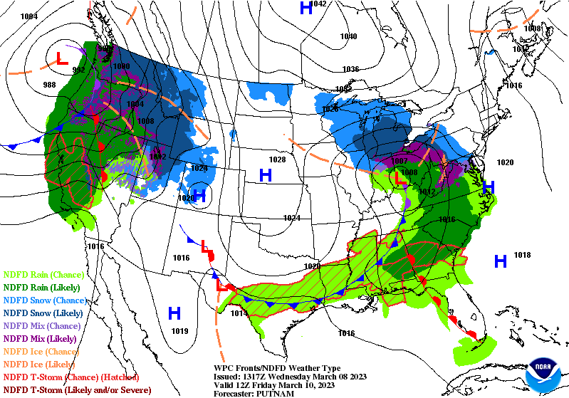

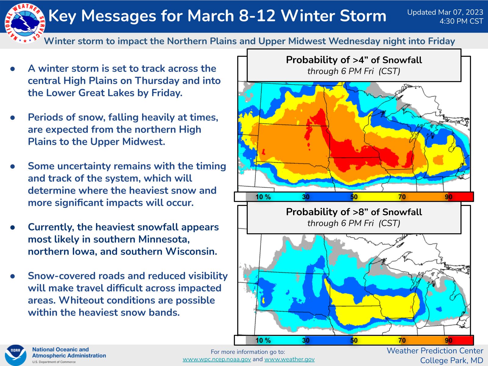
Both bring a chance of snow mixed with rain, mainly north of Indy Thursday night and Friday morning and across the state Sunday. Neither bring much of an accumulation threat. There is a winter storm expected in the northern Plains and Upper Midwest.
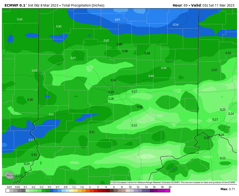
Not much total precipitation around here. Less than a half inch is expected.
Never miss me! Subscribe for free. My Huge Radar has real-time weather tracking, current temperatures, and severe weather watches and warnings. Get detailed Indiana conditions by clicking here. Click here to see my central Indiana 7-Day Forecast. Follow these links to get my forecasts for Lafayette, Muncie, Hendricks County, and Hamilton County. Need a second opinion? Click here for central Indiana National Weather Service forecasts. (Some charts via WeatherBELL.)
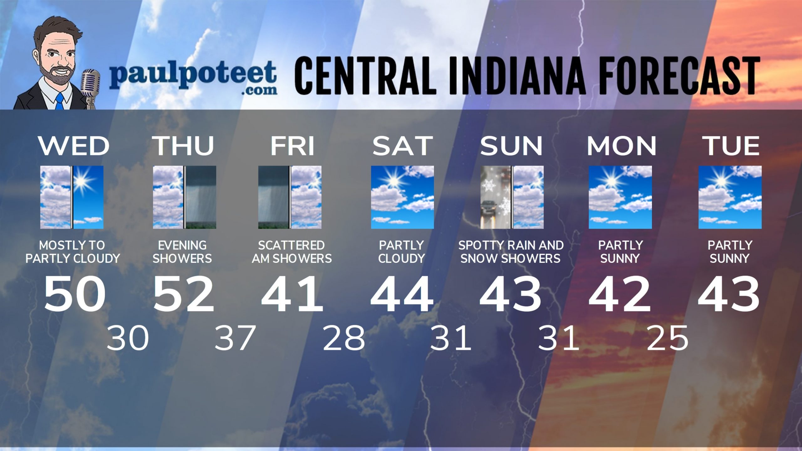
INDY SEVEN DAY FORECAST
Today: Mostly, then partly sunny. High 50.
Tonight: Partly cloudy. Low 30.
Thursday: Partly cloudy morning. Mostly cloudy afternoon. High 52.
Thursday Night: Scattered showers, possibly mixed with some snow. Low 37.
Friday: Scattered morning showers, possibly mixed with snow. Mostly cloudy afternoon. High 41.
Friday Night: Mostly cloudy evening. Partly cloudy overnight. Low 28.
Saturday: Partly cloudy. High 44.
Saturday Night: Partly cloudy evening. Mostly cloudy overnight, with spotty rain and/or snow showers. Low 31.
Sunday: Mostly cloudy, with spotty rain and snow showers. High 43.
Sunday Night: Mostly cloudy. Low 31.
Monday: Partly sunny. High 42.
Monday Night: Partly cloudy. Low 25.
Tuesday: Partly sunny. High 43.
Never miss me! Subscribe for free. My Huge Radar has real-time weather tracking, current temperatures, and severe weather watches and warnings. Get detailed Indiana conditions by clicking here. Click here to see my central Indiana 7-Day Forecast. Follow these links to get my forecasts for Lafayette, Muncie, Hendricks County, and Hamilton County. Need a second opinion? Click here for central Indiana National Weather Service forecasts. (Some charts via WeatherBELL.)


