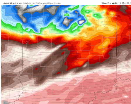
The biggest threat for severe weather today will be in the northern half of Indiana, fading by about 5 or 6pm. There were two reports of tornadoes on the ground near Champaign/Urbana Illinois between 8 and 9am. That energy is moving eastward.
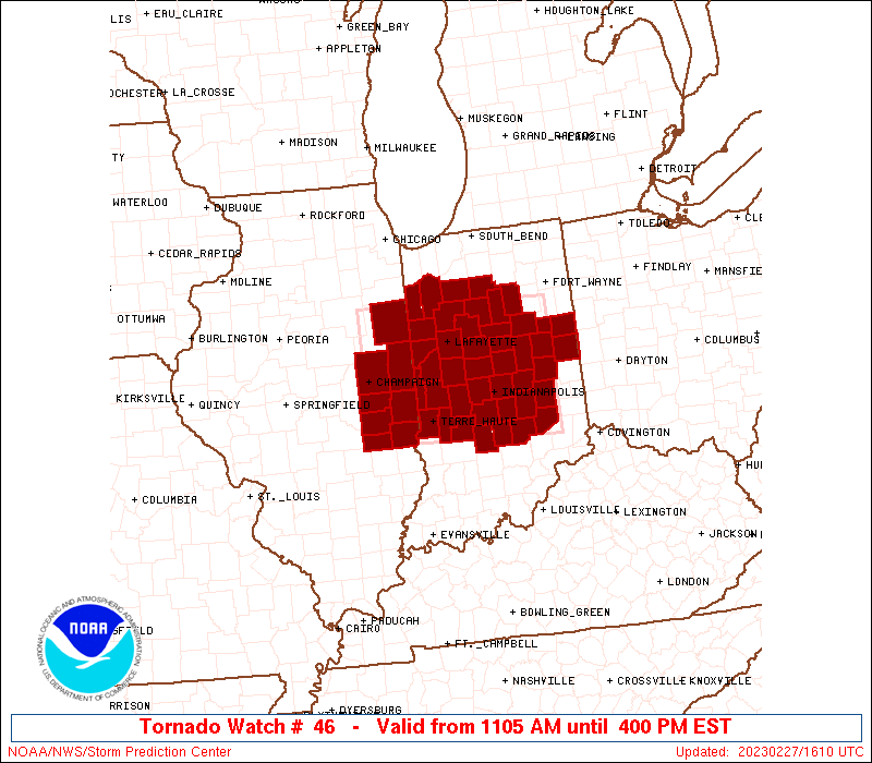
There is a TORNADO WATCH for much of Indiana until 4pm today.
Never miss me! Subscribe for free. My Huge Radar has real-time weather tracking, current temperatures, and severe weather watches and warnings. Get detailed Indiana conditions by clicking here. Click here to see my central Indiana 7-Day Forecast. Follow these links to get my forecasts for Lafayette, Muncie, Hendricks County, and Hamilton County. Need a second opinion? Click here for central Indiana National Weather Service forecasts. (Some charts via WeatherBELL.)
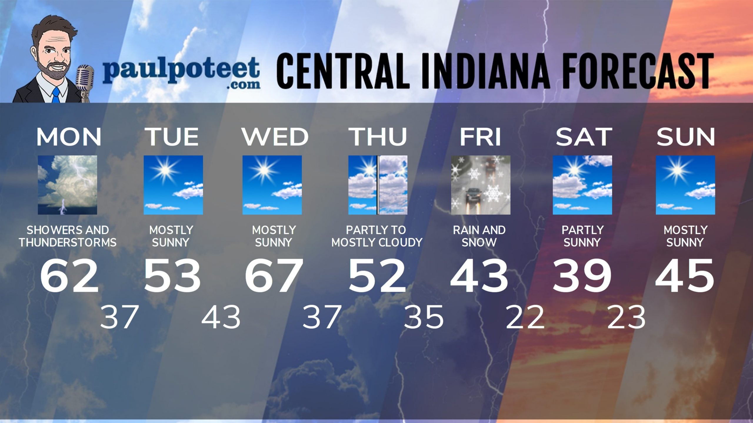
INDY SEVEN DAY FORECAST
Today: Showers and storms. Some storms could be severe. Wind gusting to 45 mph. Wind Advisory from 9am-7pm. High 62.
Tonight: Cloudy and breezy. Spotty evening showers possible. Low 37.
Tuesday: Becoming mostly sunny. High 53.
Tuesday Night: Mostly clear. Low 43.
Wednesday: Mostly sunny. High 67.
Wednesday Night: Partly cloudy. Low 37.
Thursday: Partly cloudy morning. Mostly cloudy afternoon. High 52.
Thursday Night: Cloudy, with showers after midnight. Low 35.
Friday: Rain and snow. Accumulating snow possible. High 43.
Friday Night: Partly cloudy. Low 22.
Saturday: Partly sunny. High 39.
Saturday Night: Partly cloudy. Low 23.
Sunday: Mostly sunny. High 45.
Never miss me! Subscribe for free. My Huge Radar has real-time weather tracking, current temperatures, and severe weather watches and warnings. Get detailed Indiana conditions by clicking here. Click here to see my central Indiana 7-Day Forecast. Follow these links to get my forecasts for Lafayette, Muncie, Hendricks County, and Hamilton County. Need a second opinion? Click here for central Indiana National Weather Service forecasts. (Some charts via WeatherBELL.)


