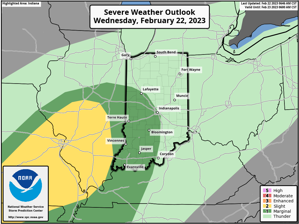
There’s now a marginal (level one of five) risk for severe weather in the western half of Indiana today. The biggest risk comes in the morning and again in the evening.
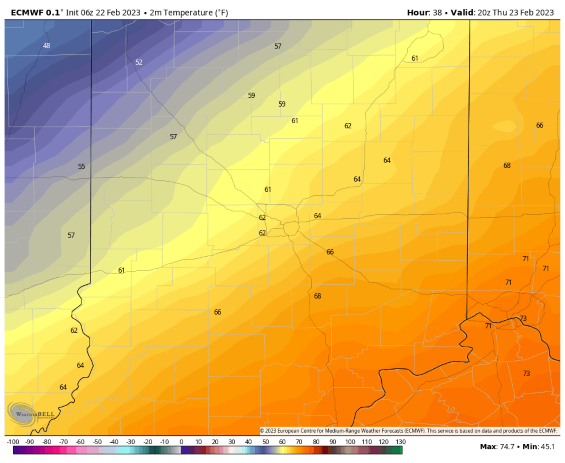
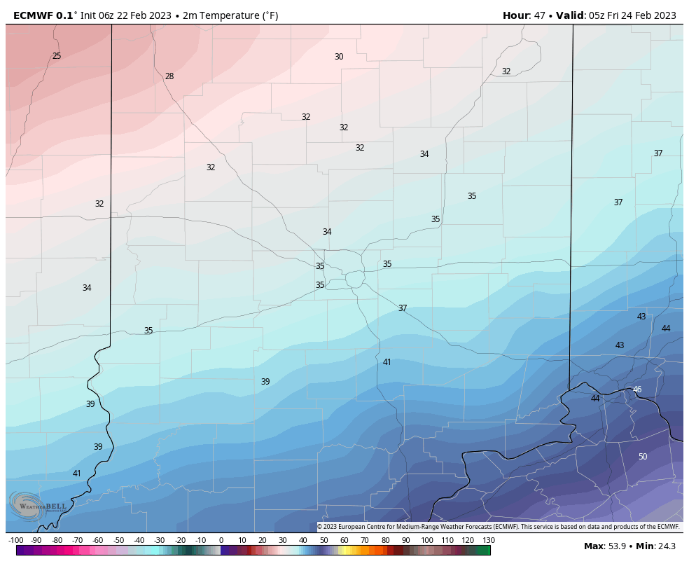
Tomorrow will be a nice day, if you don’t mind a stiff, warm wind in the afternoon. Temps will nosedive at night. First chart reflects 4pm Thursday, and the second represents 1am Friday.
Never miss me! Subscribe for free. My Huge Radar has real-time weather tracking, current temperatures, and severe weather watches and warnings. Get detailed Indiana conditions by clicking here. Click here to see my central Indiana 7-Day Forecast. Follow these links to get my forecasts for Lafayette, Muncie, Hendricks County, and Hamilton County. Need a second opinion? Click here for central Indiana National Weather Service forecasts. (Some charts via WeatherBELL.)
INDY SEVEN DAY FORECAST
Today: Showers and storms at times, especially in the morning. Wind gusting to 45 mph in the afternoon. WIND ADVISORY from Noon until 10pm. High 69.
Tonight: Scattered showers and storms end by late evening. Wind gusting to 45 mph in the evening, decreasing after midnight. Low 54.
Thursday: Mostly sunny. Wind gusts to 40 mph in the afternoon. High 65.
Thursday Night: Mostly clear. Low 26.
Friday: Mostly sunny morning. Partly sunny afternoon. High 40.
Friday Night: Mostly cloudy. Low 29.
Saturday: Becoming partly sunny. High 48.
Saturday Night: Partly cloudy. Low 34.
Sunday: Mostly sunny. High 55.
Sunday Night: Partly cloudy. Spotty showers after midnight. Low 43.
Monday: Rainy and breezy. High 62.
Monday Night: Evening showers. Breezy. Low 36.
Tuesday: Mostly sunny. High 49.

Never miss me! Subscribe for free. My Huge Radar has real-time weather tracking, current temperatures, and severe weather watches and warnings. Get detailed Indiana conditions by clicking here. Click here to see my central Indiana 7-Day Forecast. Follow these links to get my forecasts for Lafayette, Muncie, Hendricks County, and Hamilton County. Need a second opinion? Click here for central Indiana National Weather Service forecasts. (Some charts via WeatherBELL.)


