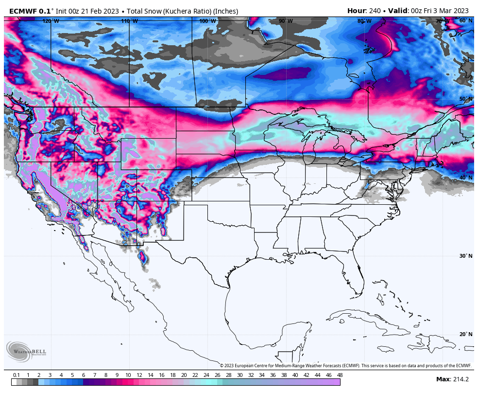
Indianapolis is running a blistering 6.9 degrees above average for February. It was 8.6 degrees above average in January! It’s a trend that continues overall, despite a small dip today, and bigger dip Friday. Not surprisingly the snow tote board is way behind. The official total for the season is only 8.5 inches, where it would normally be 20.6 inches. Doesn’t look like that’s changing in the next ten days, which would take us into the first few days of March!
Never miss me! Subscribe for free. My Huge Radar has real-time weather tracking, current temperatures, and severe weather watches and warnings. Get detailed Indiana conditions by clicking here. Click here to see my central Indiana 7-Day Forecast. Follow these links to get my forecasts for Lafayette, Muncie, Hendricks County, and Hamilton County. Need a second opinion? Click here for central Indiana National Weather Service forecasts. (Some charts via WeatherBELL.)
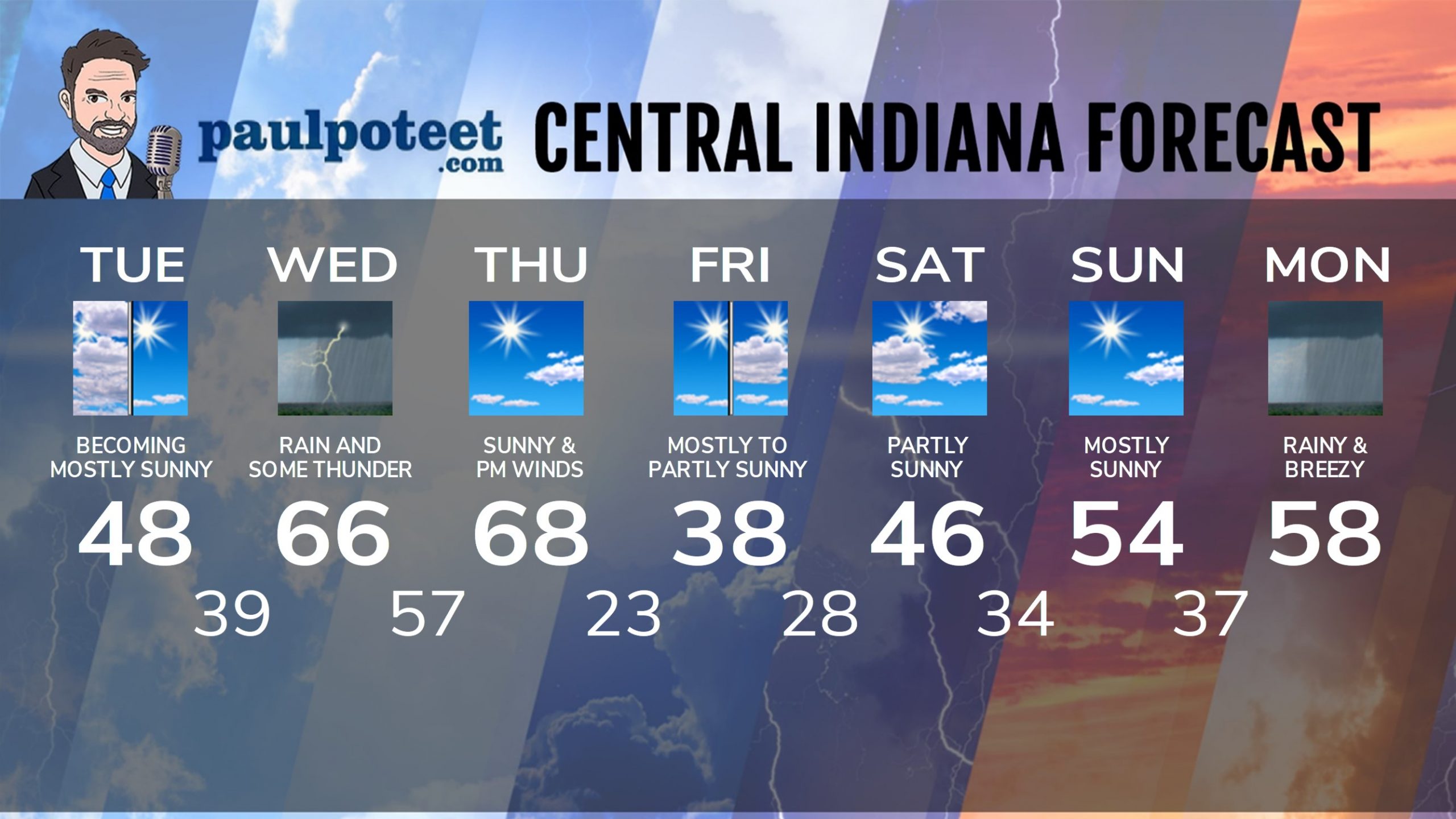
INDY SEVEN DAY FORECAST
Today: Clouds, and lingering sprinkles from overnight. Becoming mostly sunny by mid-morning. High 48.
Tonight: Clouds increase. Spotty showers after midnight. Low 39.
Wednesday: Rainy day, with some thunder possible. High 66.
Wednesday Night: Scattered showers. Wind gusting to 40 mph in the evening. Low 57.
Thursday: Mostly sunny. Wind gusts to 45 mph in the afternoon. High 68.
Thursday Night: Mostly clear. Low 23.
Friday: Mostly sunny morning. Partly sunny afternoon. High 38.
Friday Night: Mostly cloudy. Spotty snow showers overnight, with a dusting possible. Low 28.
Saturday: Becoming partly sunny. High 46.
Saturday Night: Partly cloudy. Low 34.
Sunday: Mostly sunny. High 54.
Sunday Night: Partly cloudy. Spotty showers after midnight. Low 37.
Monday: Rainy and breezy. High 58.
Never miss me! Subscribe for free. My Huge Radar has real-time weather tracking, current temperatures, and severe weather watches and warnings. Get detailed Indiana conditions by clicking here. Click here to see my central Indiana 7-Day Forecast. Follow these links to get my forecasts for Lafayette, Muncie, Hendricks County, and Hamilton County. Need a second opinion? Click here for central Indiana National Weather Service forecasts. (Some charts via WeatherBELL.)


