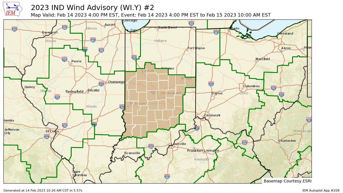
A Wind Advisory for most of central Indiana runs 4pm this afternoon through 10am Wednesday. Expect gusts to 45 mph tonight and early tomorrow.
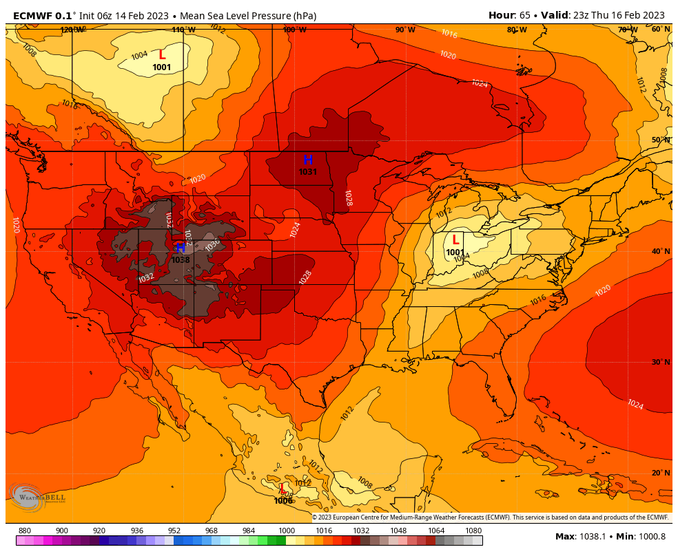
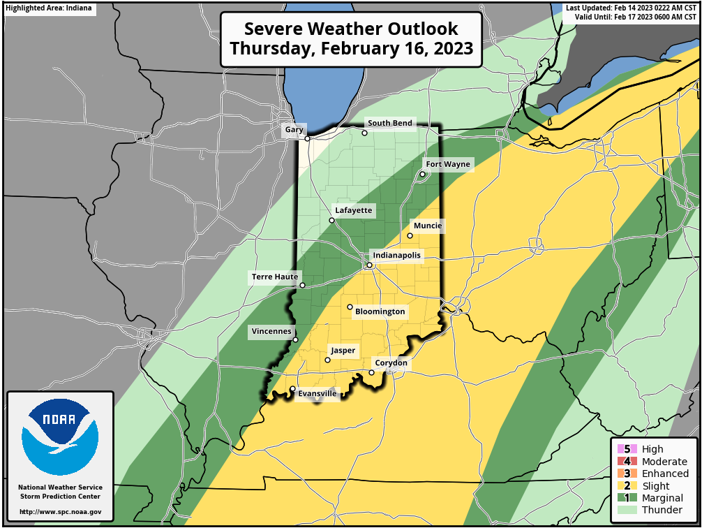
Strong low moves in from the Southwest Thursday, and is right over the state by late afternoon.
That will help trigger thunderstorms, which could be severe.
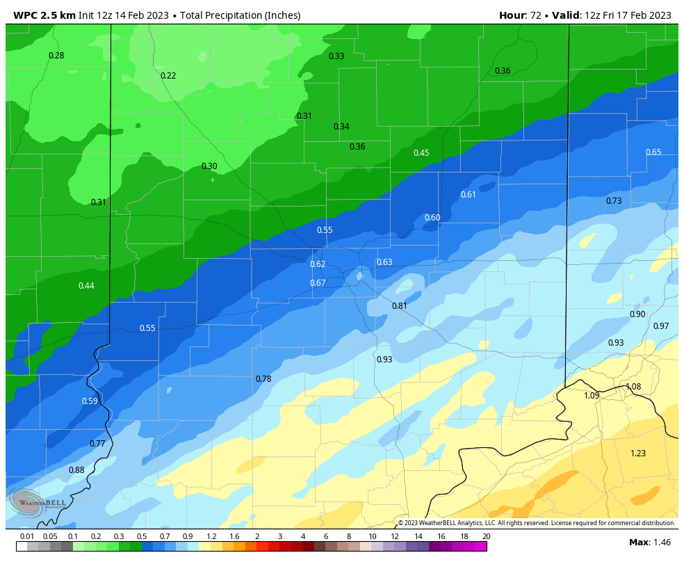
Rainfall amounts tonight will generally be less than a tenth of an inch, but they will be higher Thursday.
Never miss me! Subscribe for free. My Huge Radar has real-time weather tracking, current temperatures, and severe weather watches and warnings. Get detailed Indiana conditions by clicking here. Click here to see my central Indiana 7-Day Forecast. Follow these links to get my forecasts for Lafayette, Muncie, Hendricks County, and Hamilton County. Need a second opinion? Click here for central Indiana National Weather Service forecasts. (Some charts via WeatherBELL.)
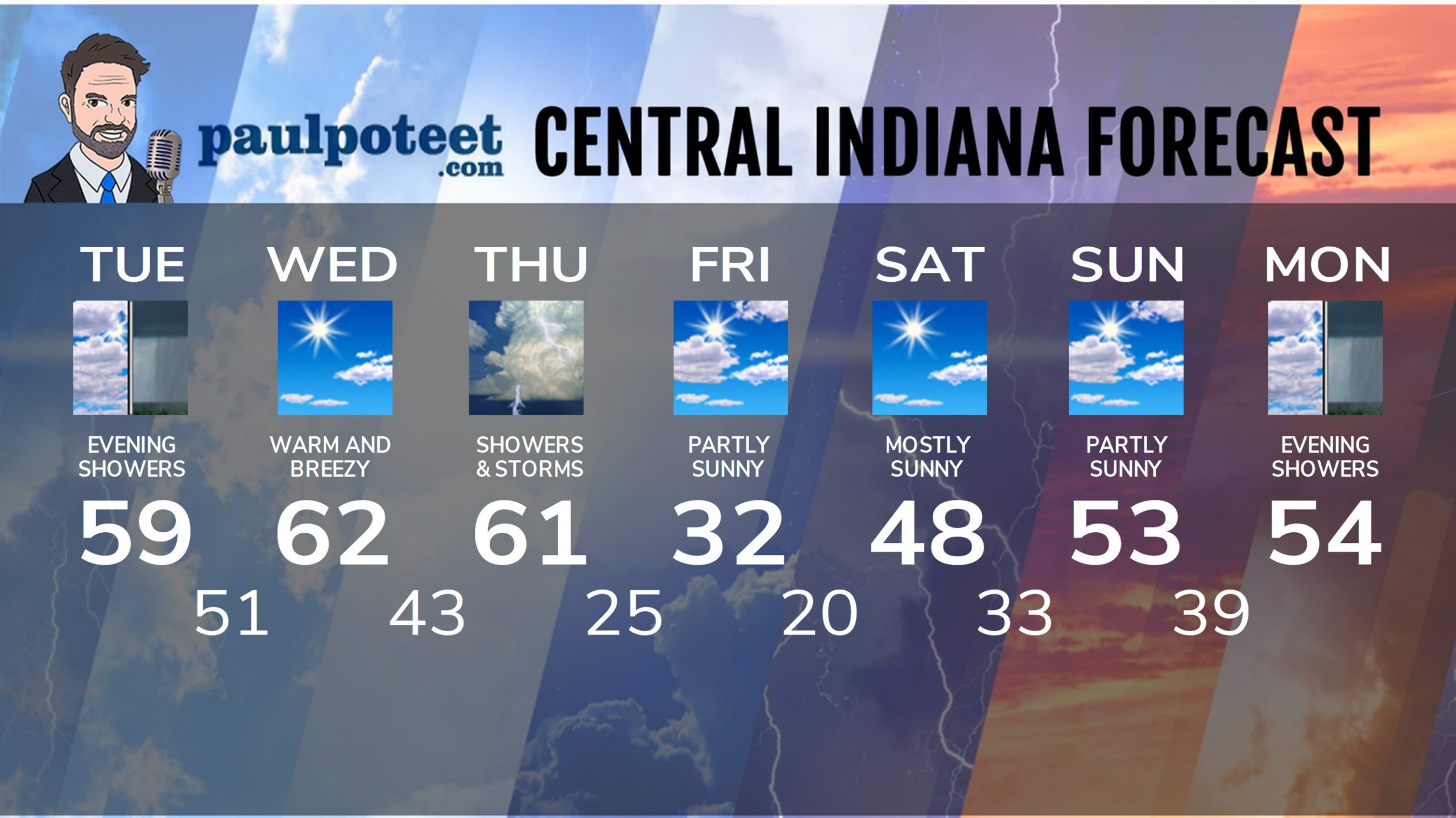
INDY SEVEN DAY FORECAST
Today: Partly to mostly cloudy. WIND ADVISORY after 4pm, with gusts to 40 mph. High 59.
Tonight: Scattered showers, diminishing overnight. WIND ADVISORY, with gusts to 45 mph. Low 51.
Wednesday: Mostly sunny! WIND ADVISORY in the morning until 10am, with gusts to 45 mph. High 62.
Wednesday Night: Scattered showers and storms after midnight. Low 43.
Thursday: Periods of showers and storms. High 61.
Thursday: Scattered early evening showers. Low 25.
Friday: Partly sunny. Colder again. High 32.
Friday Night: Mostly clear. Low 20.
Saturday: Mostly sunny. High 48.
Saturday Night: Partly cloudy. Low 33.
Sunday: Partly sunny. High 53.
Sunday Night: Partly cloudy. Low 39.
Monday: Mostly cloudy. High 54.
Never miss me! Subscribe for free. My Huge Radar has real-time weather tracking, current temperatures, and severe weather watches and warnings. Get detailed Indiana conditions by clicking here. Click here to see my central Indiana 7-Day Forecast. Follow these links to get my forecasts for Lafayette, Muncie, Hendricks County, and Hamilton County. Need a second opinion? Click here for central Indiana National Weather Service forecasts. (Some charts via WeatherBELL.)


