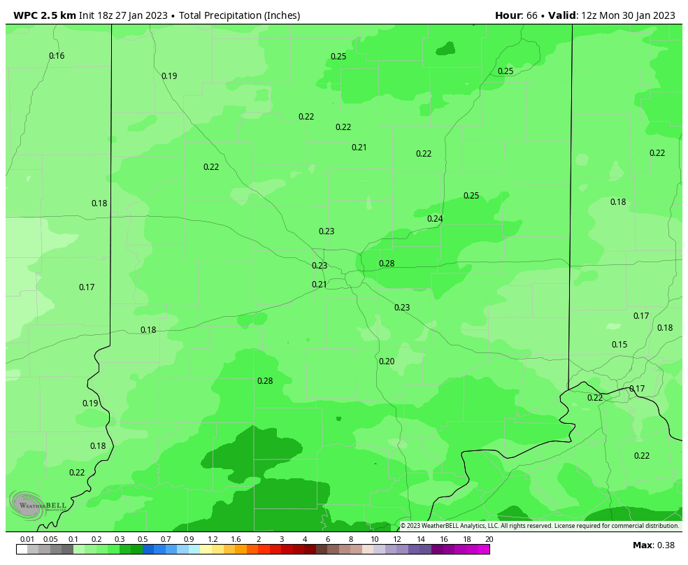
The spotty rain and snow showers have faded now across Indiana. The next weather maker brings rain late Saturday evening into Sunday morning. A quarter-inch or less precipitation is expected.
Never miss me! Subscribe for free. My Huge Radar has real-time weather tracking, current temperatures, and severe weather watches and warnings. Get detailed Indiana conditions by clicking here. Click here to see my central Indiana 7-Day Forecast. Follow these links to get my forecasts for Lafayette, Muncie, Hendricks County, and Hamilton County. Need a second opinion? Click here for central Indiana National Weather Service forecasts. (Some charts via WeatherBELL.)
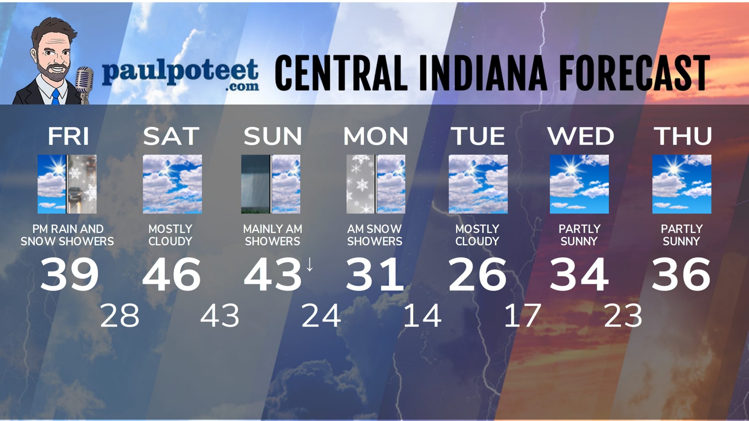
INDY SEVEN DAY FORECAST
Friday Night: Mostly cloudy. Wind gusting to 30 mph. Low 28.
Saturday: Mostly cloudy. High 46.
Saturday Night: Scattered showers by late evening. Steady temps in the low to mid 40s. Low 40.
Sunday: Cloudy. Morning showers. A few late morning and afternoon flurries possible, as temps fall from the low 40s in the morning into the mid 30s by afternoon. High 43.
Sunday Night: Cloudy. Snow showers after midnight. Low 24.
Monday: Morning snow showers, then mostly cloudy. High 31.
Monday Night: Mostly cloudy. Low 14.
Tuesday: Mostly cloudy. High 26.
Tuesday Night: Partly cloudy. Low 17.
Wednesday: Partly sunny. High 34.
Wednesday Night: Partly cloudy. Low 23.
Thursday: Partly sunny. High 36.
Never miss me! Subscribe for free. My Huge Radar has real-time weather tracking, current temperatures, and severe weather watches and warnings. Get detailed Indiana conditions by clicking here. Click here to see my central Indiana 7-Day Forecast. Follow these links to get my forecasts for Lafayette, Muncie, Hendricks County, and Hamilton County. Need a second opinion? Click here for central Indiana National Weather Service forecasts. (Some charts via WeatherBELL.)


