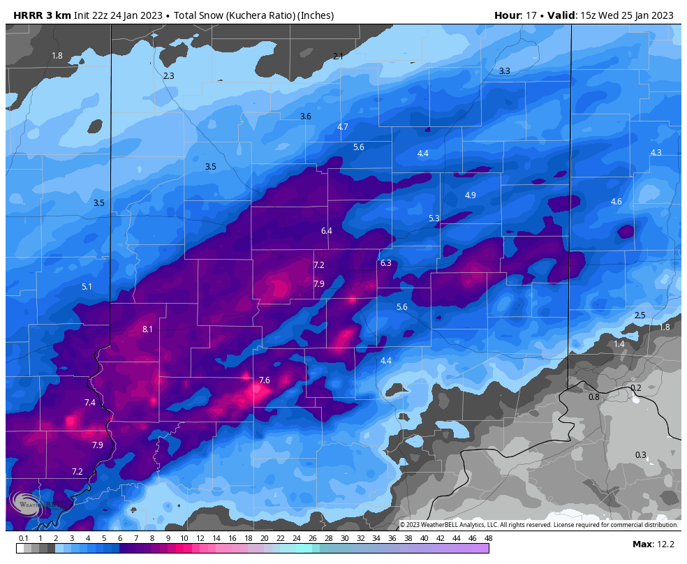
Plan on a longer trip Wednesday morning. Snow begins tonight after midnight. It may initially mix with some rain. It may mix at times with sleet Wednesday. The most intense part of the storm will be while the low pressure center tracks near I-70 (it’s not always I-70, it just seems that way) between 8am and 1pm. Final totals for much of central Indiana will be between 4 and 8 inches. Totals will be under that in the southeastern one-third of the state. This will be followed by COLDER temps TFN. January temps have been running a solid TEN degrees above average, so it’s payback time. And you know what payback is:)
Never miss me! Subscribe for free. My Huge Radar has real-time weather tracking, current temperatures, and severe weather watches and warnings. Get detailed Indiana conditions by clicking here. Click here to see my central Indiana 7-Day Forecast. Follow these links to get my forecasts for Lafayette, Muncie, Hendricks County, and Hamilton County. Need a second opinion? Click here for central Indiana National Weather Service forecasts. (Some charts via WeatherBELL.)


