Hail has already been reported this afternoon in Pendleton and around Southport and Whitestown. Expect a few hours of potentially severe storms as a cold front works through. A Severe Thunderstorm Watch is in place until 7pm for a part of east central Indiana.

Never miss me! Subscribe for free. My Huge Radar has real-time weather tracking, current temperatures, and severe weather watches and warnings. Get detailed Indiana conditions by clicking here. Click here to see my central Indiana 7-Day Forecast. Follow these links to get my forecasts for Lafayette, Muncie, Hendricks County, and Hamilton County. Need a second opinion? Click here for central Indiana National Weather Service forecasts. (Some charts via WeatherBELL.)
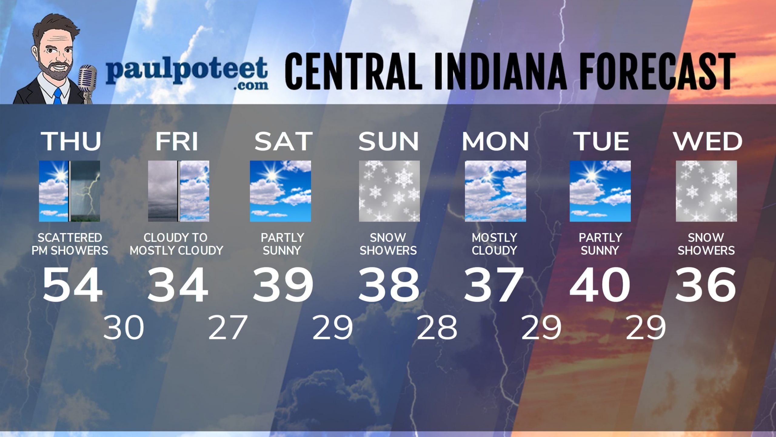
INDY SEVEN DAY FORECAST
Today: Partly sunny morning. Mostly cloudy afternoon, with scattered showers and storms. Wind gusting to 40 mph. High 54.
Tonight: Cloudy. Wind gusting to 35 mph. Low 30.
Friday: Cloudy to mostly cloudy. Wind gusting to 30 mph. High 34.
Friday Night: Becoming partly cloudy. Low 27.
Saturday: Partly sunny. High 39.
Saturday Night: Clouds increase. Snow showers toward daybreak. Low 29.
Sunday: Mostly cloudy. Snow showers. Light accumulation in the morning. High 38.
Sunday Night: Mostly cloudy. Low 28.
Monday: Mostly cloudy. High 37.
Monday Night: Mostly cloudy. Low 29.
Tuesday: Partly sunny. High 40.
Tuesday Night: Mostly cloudy. Low 29.
Wednesday: Snow showers, with light accumulation. High 36.
Never miss me! Subscribe for free. My Huge Radar has real-time weather tracking, current temperatures, and severe weather watches and warnings. Get detailed Indiana conditions by clicking here. Click here to see my central Indiana 7-Day Forecast. Follow these links to get my forecasts for Lafayette, Muncie, Hendricks County, and Hamilton County. Need a second opinion? Click here for central Indiana National Weather Service forecasts. (Some charts via WeatherBELL.)


