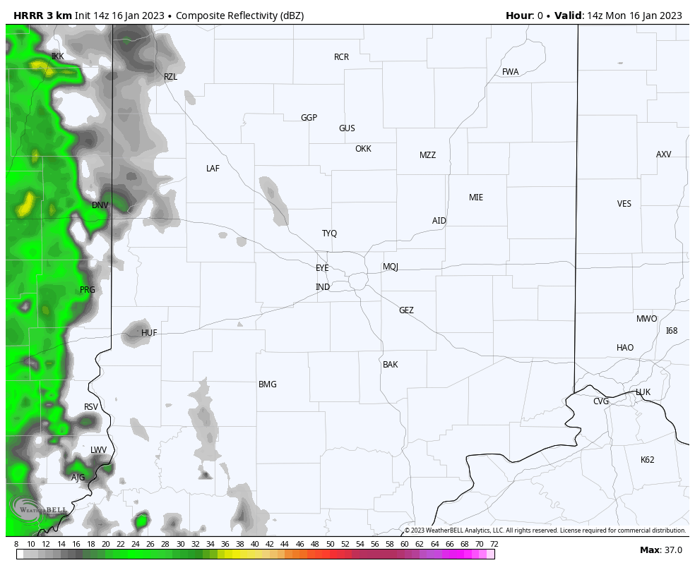
Another generally warmer and wetter stretch is upon us, and (just like last week) it will dry out and cool down starting Thursday. Rain will be heaviest this afternoon and evening.
Rain totals will generally be around a third of an inch.
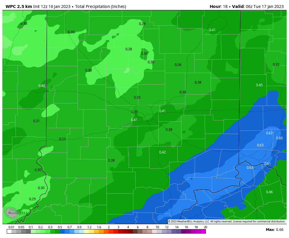
That will push Indy to around two inches for the month, which is a bit above average. Snowfall for the season is way below average.
A deeper area of low pressure arrives Wednesday evening through Thursday, with as much as inch of rainfall possible. (Here’s the national map for Wednesday morning.)

Never miss me! Subscribe for free. My Huge Radar has real-time weather tracking, current temperatures, and severe weather watches and warnings. Get detailed Indiana conditions by clicking here. Click here to see my central Indiana 7-Day Forecast. Follow these links to get my forecasts for Lafayette, Muncie, Hendricks County, and Hamilton County. Need a second opinion? Click here for central Indiana National Weather Service forecasts. (Some charts via WeatherBELL.)
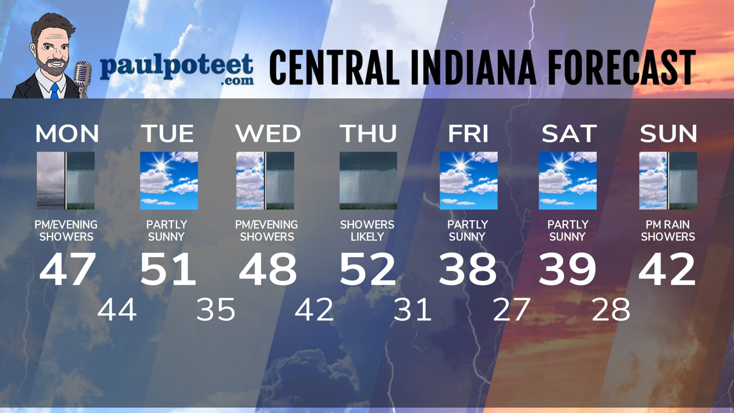
INDY SEVEN DAY FORECAST
Today: Afternoon showers. High 47.
Tonight: Evening showers. Clouds decrease after midnight. Low 44.
Tuesday: Partly sunny. Breezy. High 51.
Tuesday Night: Partly cloudy evening. Mostly cloudy overnight. Breezy. Low 35.
Wednesday: Mostly cloudy. Scattered afternoon showers. High 48.
Wednesday Night: Rainy. Thunder possible. Low 42.
Thursday: Rainy morning, with thunder possible. Scattered showers in the afternoon. High 52.
Thursday Night: Mostly cloudy. Low 31.
Friday: Partly sunny. High 38.
Friday Night: Partly cloudy. Low 27.
Saturday: Partly sunny. High 39.
Saturday Night: Partly cloudy. Low 28.
Sunday: Mostly cloudy. Scattered afternoon showers. High 42.
Never miss me! Subscribe for free. My Huge Radar has real-time weather tracking, current temperatures, and severe weather watches and warnings. Get detailed Indiana conditions by clicking here. Click here to see my central Indiana 7-Day Forecast. Follow these links to get my forecasts for Lafayette, Muncie, Hendricks County, and Hamilton County. Need a second opinion? Click here for central Indiana National Weather Service forecasts. (Some charts via WeatherBELL.)


