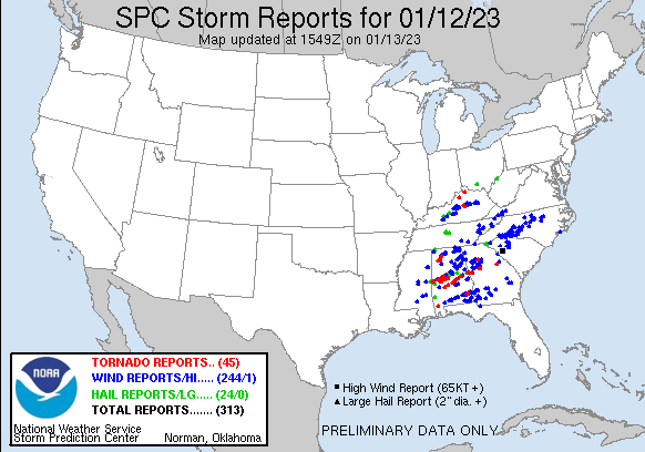
The weather across much of the country turns cooler and quieter this weekend, after a bang-up Thursday. There were 45(!) reports of tornadoes across the country, with the most destructive cells centered in Alabama.
Indianapolis is off to the 5th warmest start to the year on record and warmest since 1998. Looks like we’re right back to the above average stuff starting Sunday, and lasting through next week. And most of the week after that!

Never miss me! Subscribe for free. My Huge Radar has real-time weather tracking, current temperatures, and severe weather watches and warnings. Get detailed Indiana conditions by clicking here. Click here to see my central Indiana 7-Day Forecast. Follow these links to get my forecasts for Lafayette, Muncie, Hendricks County, and Hamilton County. Need a second opinion? Click here for central Indiana National Weather Service forecasts. (Some charts via WeatherBELL.)
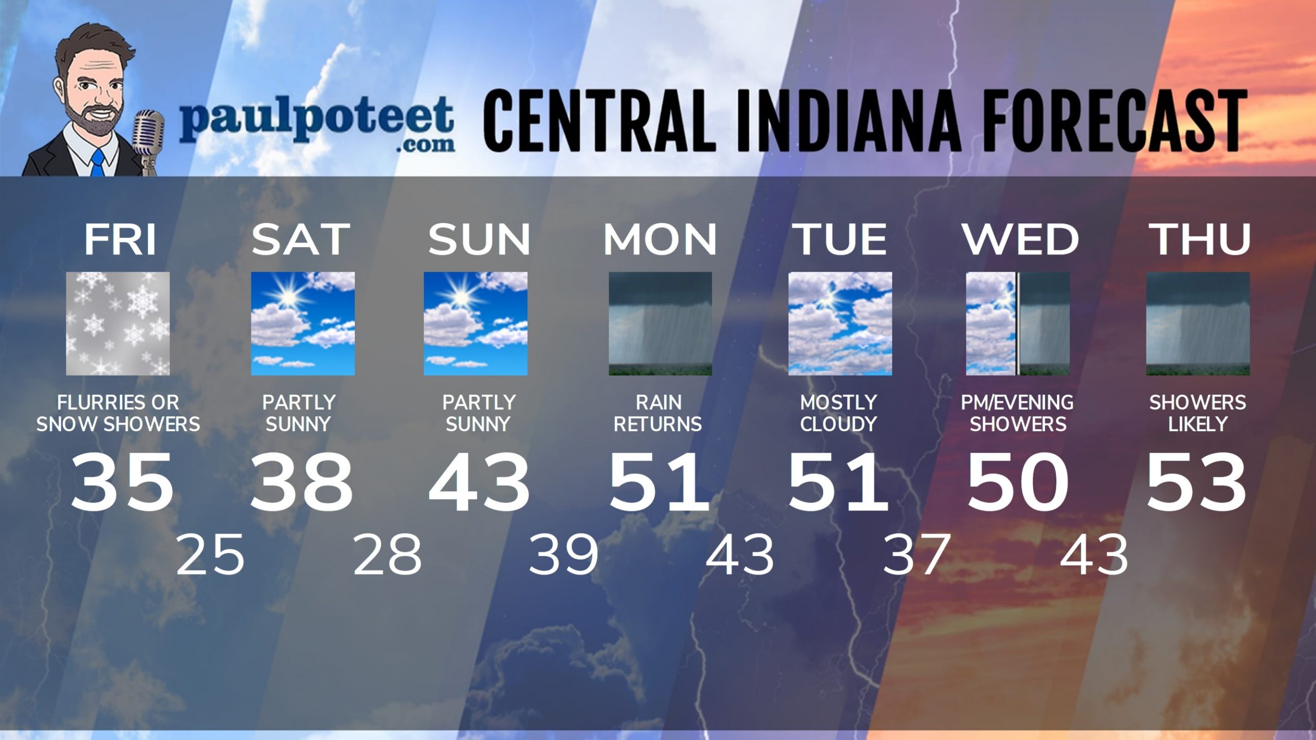
INDY SEVEN DAY FORECAST
Friday: Mostly cloudy. Colder wind gusting to 25 mph. Chills in the 20s. Flurries and/or snow showers. A dusting possible in some places. High 36.
Friday Night: Mostly cloudy and breezy. Partly cloudy and less windy overnight. Low 25.
Saturday: Mostly sunny. High 38.
Saturday Night: Partly cloudy. Low 28.
Sunday: Partly sunny. High 43.
Sunday Night: Mostly cloudy. Low 39.
Monday: Periods of rain, especially in the afternoon. High 51.
Monday Night: More rain. Low 43.
Tuesday: Mostly cloudy. High 51.
Tuesday Night: Mostly cloudy. Low 37.
Wednesday: Mostly cloudy. Scattered afternoon showers. High 50.
Wednesday Night: Showers. Low 43.
Thursday: Periods of showers. High 53.
Never miss me! Subscribe for free. My Huge Radar has real-time weather tracking, current temperatures, and severe weather watches and warnings. Get detailed Indiana conditions by clicking here. Click here to see my central Indiana 7-Day Forecast. Follow these links to get my forecasts for Lafayette, Muncie, Hendricks County, and Hamilton County. Need a second opinion? Click here for central Indiana National Weather Service forecasts. (Some charts via WeatherBELL.)


