We’re just halfway through December, but Indianapolis precipitation is already approaching the amount we had in all of November. We’ve had 1.26 inches, just about a tenth of an inch below average month-to-date. Most of that total came this past Wednesday and Thursday.

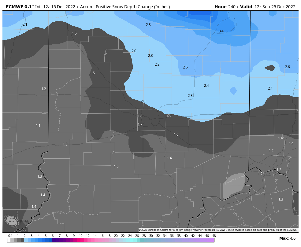
Our next big weathermaker is a system pulling in some light snow Thursday. Very cold air will follow through Christmas Day, so a “White Christmas” is looking likely this year. Here are the two main medium-range computer models’ versions of Christmas Day snow cover.

Never miss me! Subscribe for free. My Huge Radar has real-time weather tracking, current temperatures, and severe weather watches and warnings. Get detailed Indiana conditions by clicking here. Click here to see my central Indiana 7-Day Forecast. Follow these links to get my forecasts for Lafayette, Muncie, Hendricks County, and Hamilton County. Need a second opinion? Click here for central Indiana National Weather Service forecasts. (Some charts via WeatherBELL.)
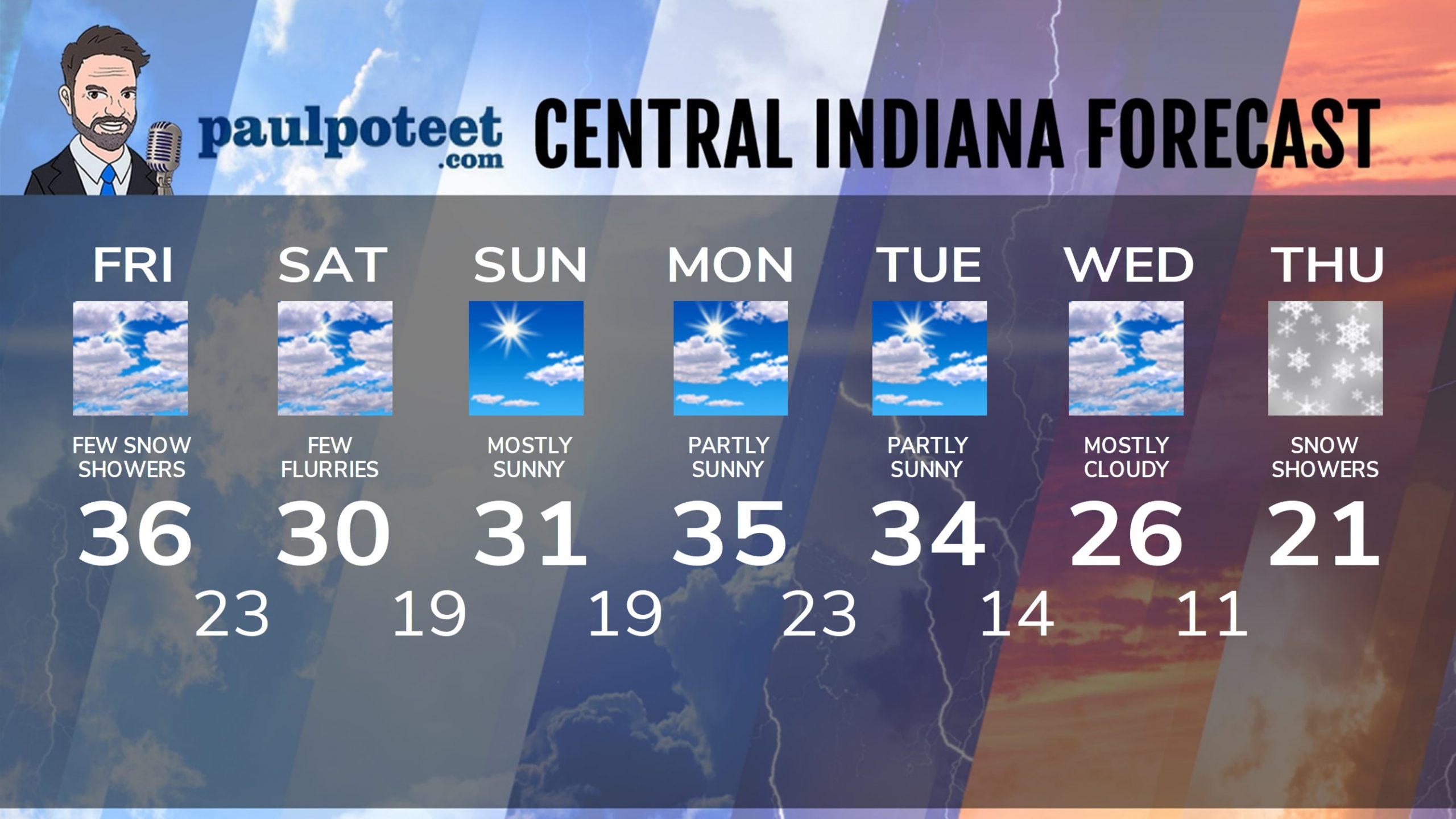
INDY SEVEN DAY FORECAST
Friday: Mostly cloudy. A few snow showers in the afternoon. Wind gusting to 25 mph. High 36.
Friday Night: Mostly cloudy. A few flurries. Low 23.
Saturday: Mostly cloudy, with a few flurries. Wind gusts to 25 mph. Chills in the teens! High 30.
Saturday Night: Partly cloudy. Low 19.
Sunday: Partly sunny early morning, then mostly sunny. High 31.
Sunday Night: Partly cloudy. Low 19.
Monday: Partly sunny. High 35.
Monday Night: Mostly cloudy. Low 23.
Tuesday: Partly sunny. High 34.
Tuesday Night: Partly cloudy. Low 14.
Wednesday: Mostly cloudy. High 26.
Wednesday Night: Mostly cloudy. Snow showers late. Low 11.
Thursday: Snow showers, with some light accumulations. High 21.
Never miss me! Subscribe for free. My Huge Radar has real-time weather tracking, current temperatures, and severe weather watches and warnings. Get detailed Indiana conditions by clicking here. Click here to see my central Indiana 7-Day Forecast. Follow these links to get my forecasts for Lafayette, Muncie, Hendricks County, and Hamilton County. Need a second opinion? Click here for central Indiana National Weather Service forecasts. (Some charts via WeatherBELL.)


