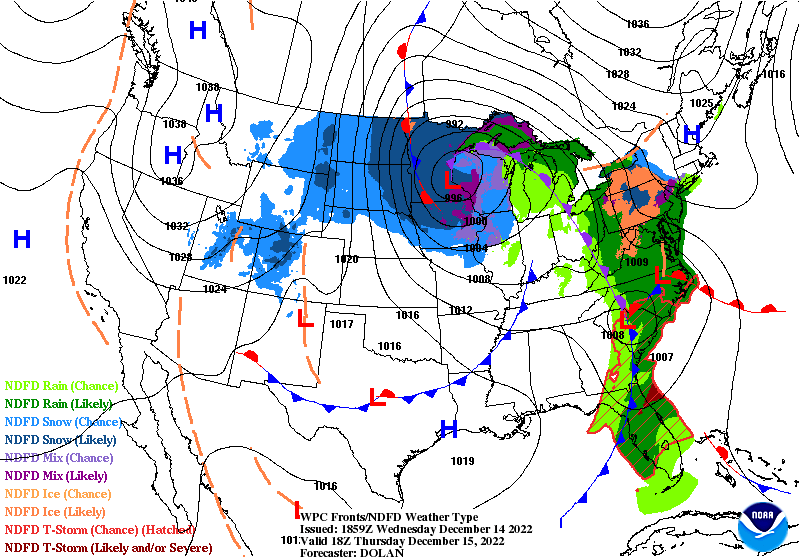
The deep low pressure system in the Northern Plains moves away slowly northeastward today, and rain moves out of the area.
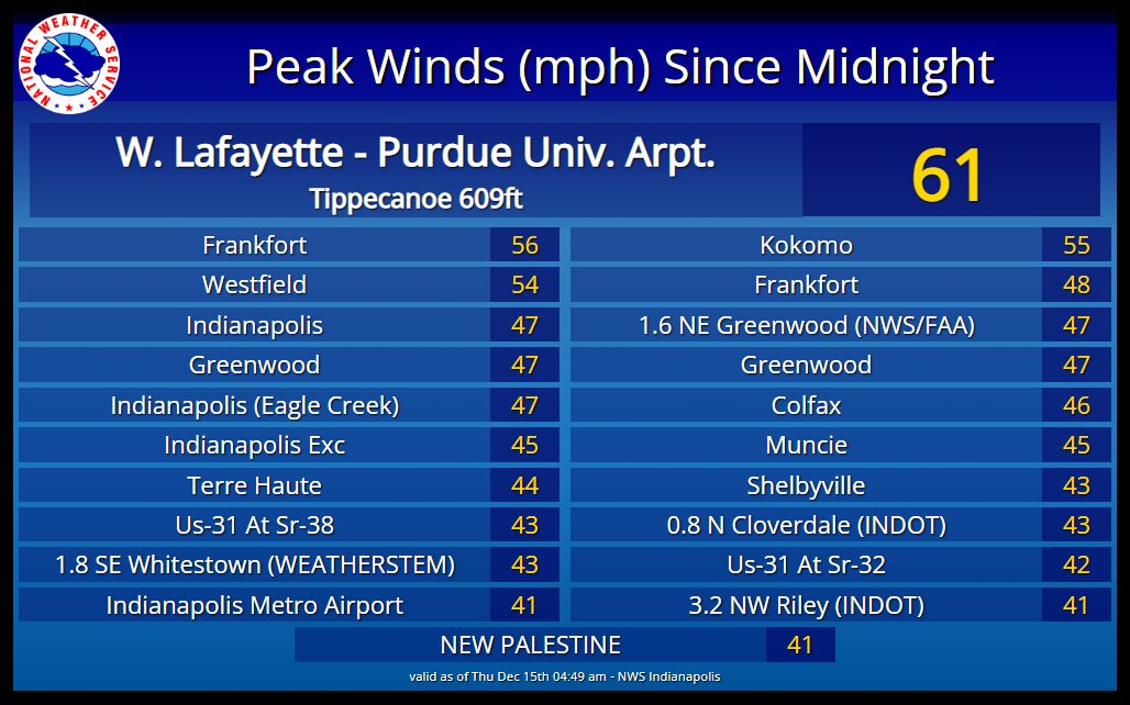
As a cold front crossed overnight: the temps and wind gusts both increased.
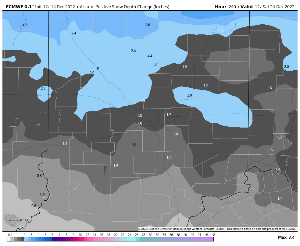
The next big system is well-timed for Santa! At the moment at least some accumulating snow looks likely *next* Thursday. Temperatures will likely remain well below freezing afterward through Christmas Day. Both major medium range weather models indicate late-week snow, and snow cover on Christmas. Here’s one version:
Never miss me! Subscribe for free. My Huge Radar has real-time weather tracking, current temperatures, and severe weather watches and warnings. Get detailed Indiana conditions by clicking here. Click here to see my central Indiana 7-Day Forecast. Follow these links to get my forecasts for Lafayette, Muncie, Hendricks County, and Hamilton County. Need a second opinion? Click here for central Indiana National Weather Service forecasts. (Some charts via WeatherBELL.)
INDY SEVEN DAY FORECAST
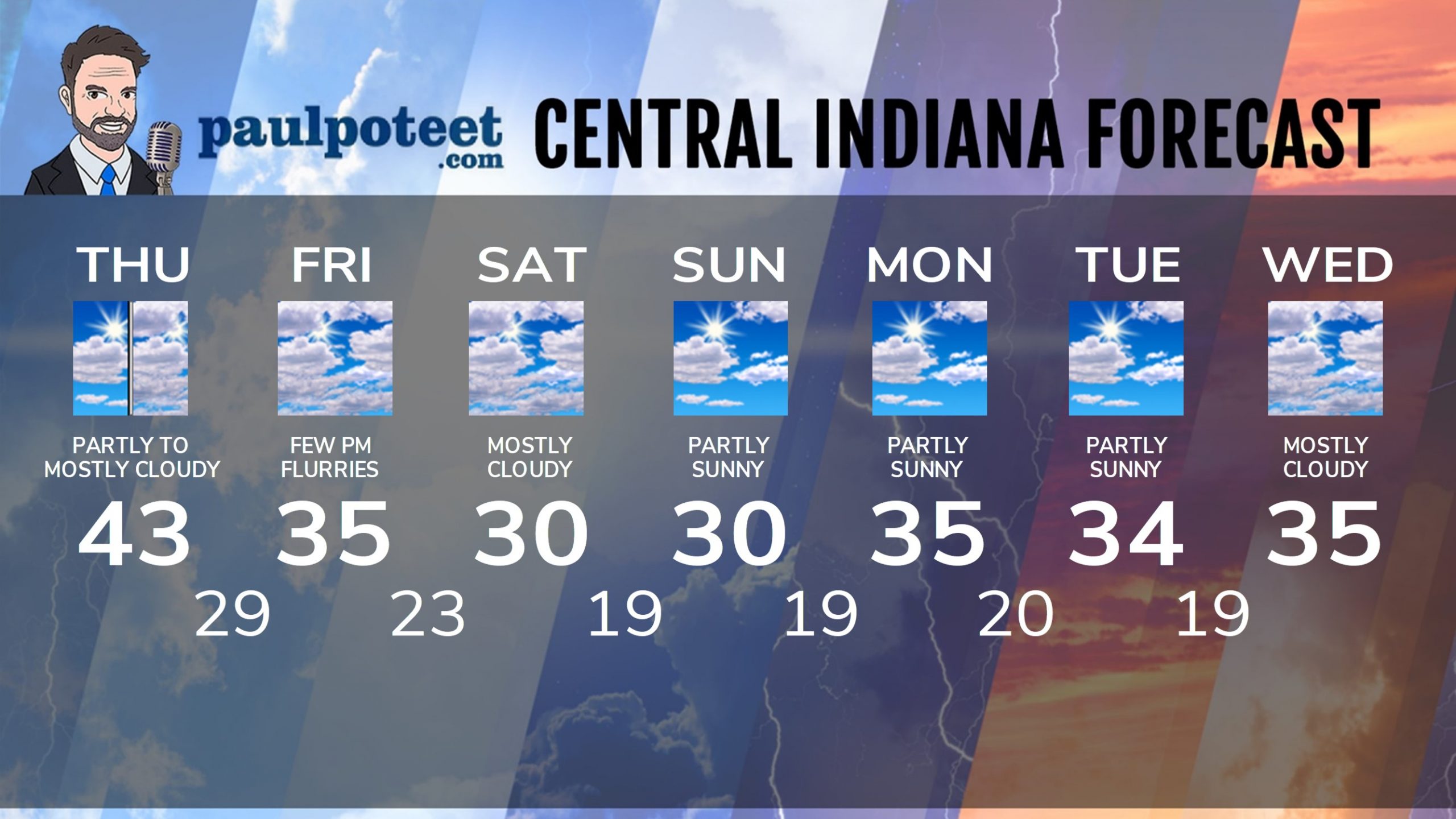
Today: Partly to mostly cloudy. High 43.
Tonight: Mostly cloudy. Few flurries possible. Low 29.
Friday: Mostly cloudy. A few flurries in the afternoon. High 35.
Friday Night: Mostly cloudy. A few flurries. Low 23.
Saturday: Mostly cloudy. High 30.
Saturday Night: Partly cloudy. Low 19.
Sunday: Partly sunny. High 30.
Sunday Night: Partly cloudy. Low 19.
Monday: Partly sunny. High 35.
Monday Night: Partly cloudy. Low 20.
Tuesday: Partly sunny. High 34.
Tuesday Night: Partly cloudy. Low 19.
Wednesday: Mostly cloudy. High 35.
Never miss me! Subscribe for free. My Huge Radar has real-time weather tracking, current temperatures, and severe weather watches and warnings. Get detailed Indiana conditions by clicking here. Click here to see my central Indiana 7-Day Forecast. Follow these links to get my forecasts for Lafayette, Muncie, Hendricks County, and Hamilton County. Need a second opinion? Click here for central Indiana National Weather Service forecasts. (Some charts via WeatherBELL.)


