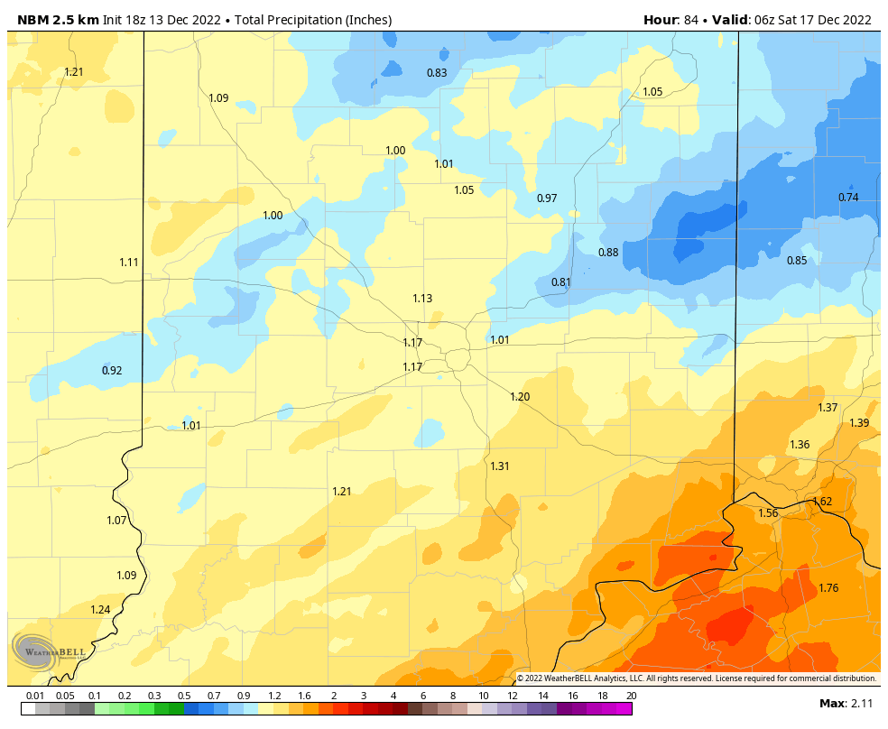
The biggest rainfall of month arrives today, in two waves. Rain starts and finishes the day, with a precipitation pause possible in the midday and early afternoon. Final totals should be at least an inch in most central Indiana locations.
Ho ho ho! The American medium range model is hinting at snow the Thursday before Christmas, and yep it would stick…with possible highs only in the teens by Christmas. STAY TUNED.
Never miss me! Subscribe for free. My Huge Radar has real-time weather tracking, current temperatures, and severe weather watches and warnings. Get detailed Indiana conditions by clicking here. Click here to see my central Indiana 7-Day Forecast. Follow these links to get my forecasts for Lafayette, Muncie, Hendricks County, and Hamilton County. Need a second opinion? Click here for central Indiana National Weather Service forecasts. (Some charts via WeatherBELL.)
INDY SEVEN DAY FORECAST
Today: Morning rain. Showers possible in the midday and early afternoon. Rain returns in the later afternoon. Wind gusting to 30 mph. High 50.
Wednesday Night: Rain. Wind gusting to 30 mph. Low 40.
Thursday: Partly sunny. High 44.
Thursday Night: Mostly cloudy. Low 29.
Friday: Mostly cloudy. A few flurries or snow showers. High 35.
Friday Night: Mostly cloudy. A few flurries or snow showers. Low 24.
Saturday: Mostly cloudy. A few flurries or snow showers. High 30.
Saturday Night: Mostly, then partly cloudy. Low 21.
Sunday: Partly sunny. High 31.
Sunday Night: Partly cloudy. Low 21.
Monday: Partly sunny morning. Flurries or snow showers possible. High 33.
Monday Night: Partly cloudy. Low 20.
Tuesday: Partly sunny. High 30.

Never miss me! Subscribe for free. My Huge Radar has real-time weather tracking, current temperatures, and severe weather watches and warnings. Get detailed Indiana conditions by clicking here. Click here to see my central Indiana 7-Day Forecast. Follow these links to get my forecasts for Lafayette, Muncie, Hendricks County, and Hamilton County. Need a second opinion? Click here for central Indiana National Weather Service forecasts. (Some charts via WeatherBELL.)


