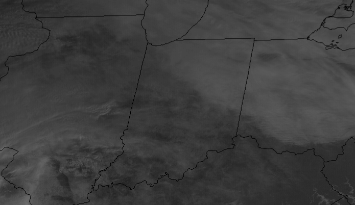
What to my wondering eyes should appear,
But a satellite shot with Indiana in the clear!
Well: SOME of Indiana. Clouds have been stubborn yet again up around Muncie.
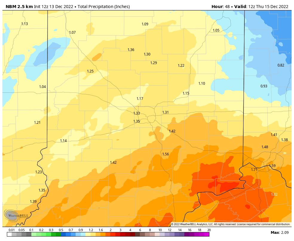
It’ll be wet when you wake up Wednesday. There will be two rounds of steady rain tomorrow. One in the morning, and one in the late afternoon and evening.
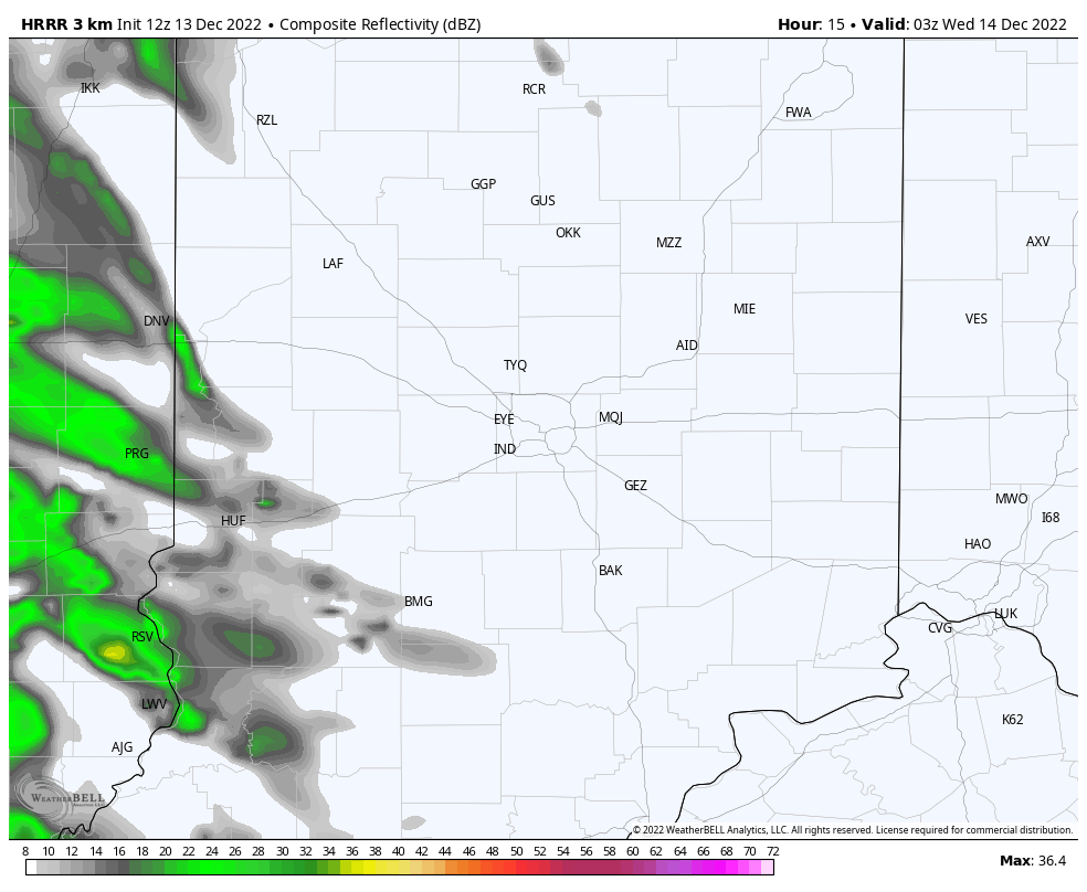
That (hopefully) will yield over an inch of rainfall.
Never miss me! Subscribe for free. My Huge Radar has real-time weather tracking, current temperatures, and severe weather watches and warnings. Get detailed Indiana conditions by clicking here. Click here to see my central Indiana 7-Day Forecast. Follow these links to get my forecasts for Lafayette, Muncie, Hendricks County, and Hamilton County. Need a second opinion? Click here for central Indiana National Weather Service forecasts. (Some charts via WeatherBELL.)
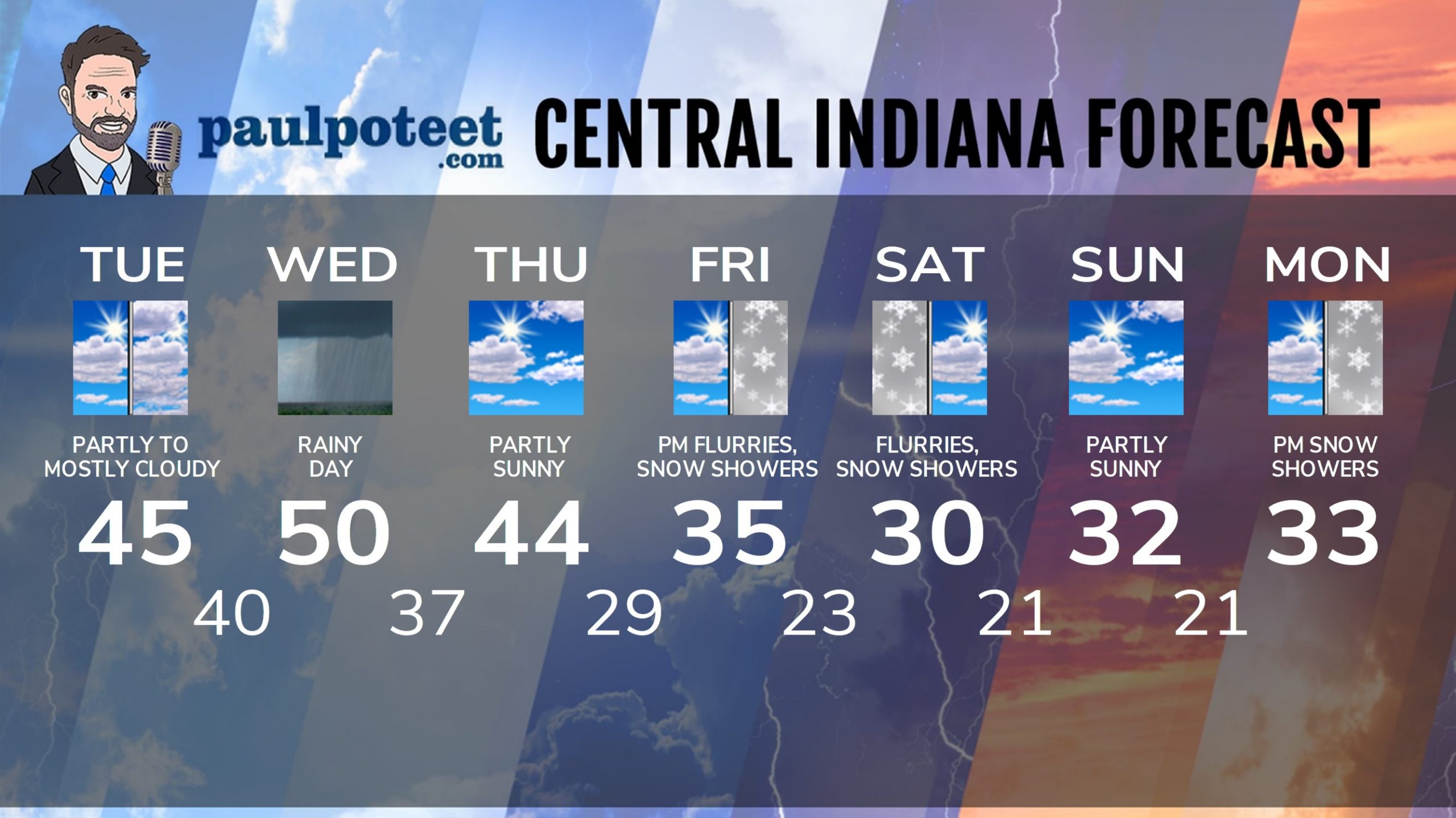
INDY SEVEN DAY FORECAST
Today: Partly, then mostly cloudy. High 45.
Tonight: Showers after midnight. Low 40.
Wednesday: Morning rain. Showers possible in the afternoon. Wind gusting to 30 mph. High 50.
Wednesday Night: Showers. Wind gusting to 25 mph. Low 37.
Thursday: Partly sunny. High 44.
Thursday Night: Mostly cloudy. Low 29.
Friday: Mostly cloudy. Scattered afternoon snow showers. High 35.
Friday Night: Mostly cloudy, with a few snow showers. Little or no accumulation. Low 23.
Saturday: Mostly cloudy. Few flurries or snow showers. Little or no accumulation. High 30.
Saturday Night: Mostly, then partly cloudy. Low 21.
Sunday: Partly sunny. High 32.
Sunday Night: Partly cloudy. Low 21.
Monday: Partly sunny morning. Snow shower chances by later afternoon. High 33.
Never miss me! Subscribe for free. My Huge Radar has real-time weather tracking, current temperatures, and severe weather watches and warnings. Get detailed Indiana conditions by clicking here. Click here to see my central Indiana 7-Day Forecast. Follow these links to get my forecasts for Lafayette, Muncie, Hendricks County, and Hamilton County. Need a second opinion? Click here for central Indiana National Weather Service forecasts. (Some charts via WeatherBELL.)


