The day begins with many central Indiana spots sporting single digit wind chills. The wind, however, will be much lighter today. It’s a one-day breather before things get gusty again Friday afternoon through Saturday morning.
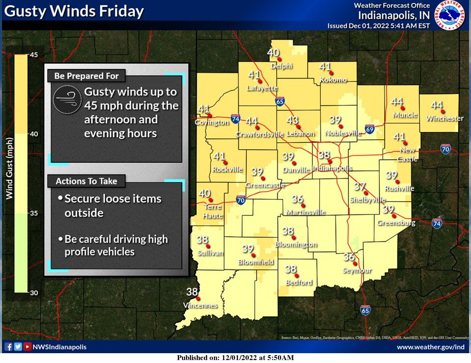
The reason will be another cold front slamming the state.
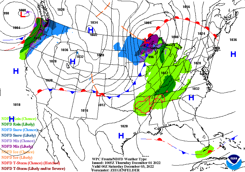
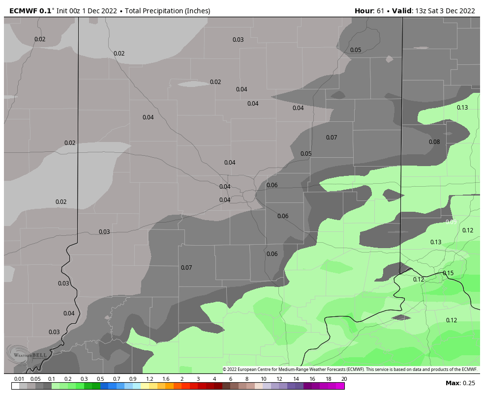
Friday night rain amounts will be light.
There’s a little more precipitation possibility with our next system Monday afternoon into Tuesday morning. Might see a little snow by the end of next week!
Never miss me! Subscribe for free. My Huge Radar has real-time weather tracking, current temperatures, and severe weather watches and warnings. Get detailed Indiana conditions by clicking here. Click here to see my central Indiana 7-Day Forecast. Follow these links to get my forecasts for Lafayette, Muncie, Hendricks County, and Hamilton County. Need a second opinion? Click here for central Indiana National Weather Service forecasts. (Some charts via WeatherBELL.)
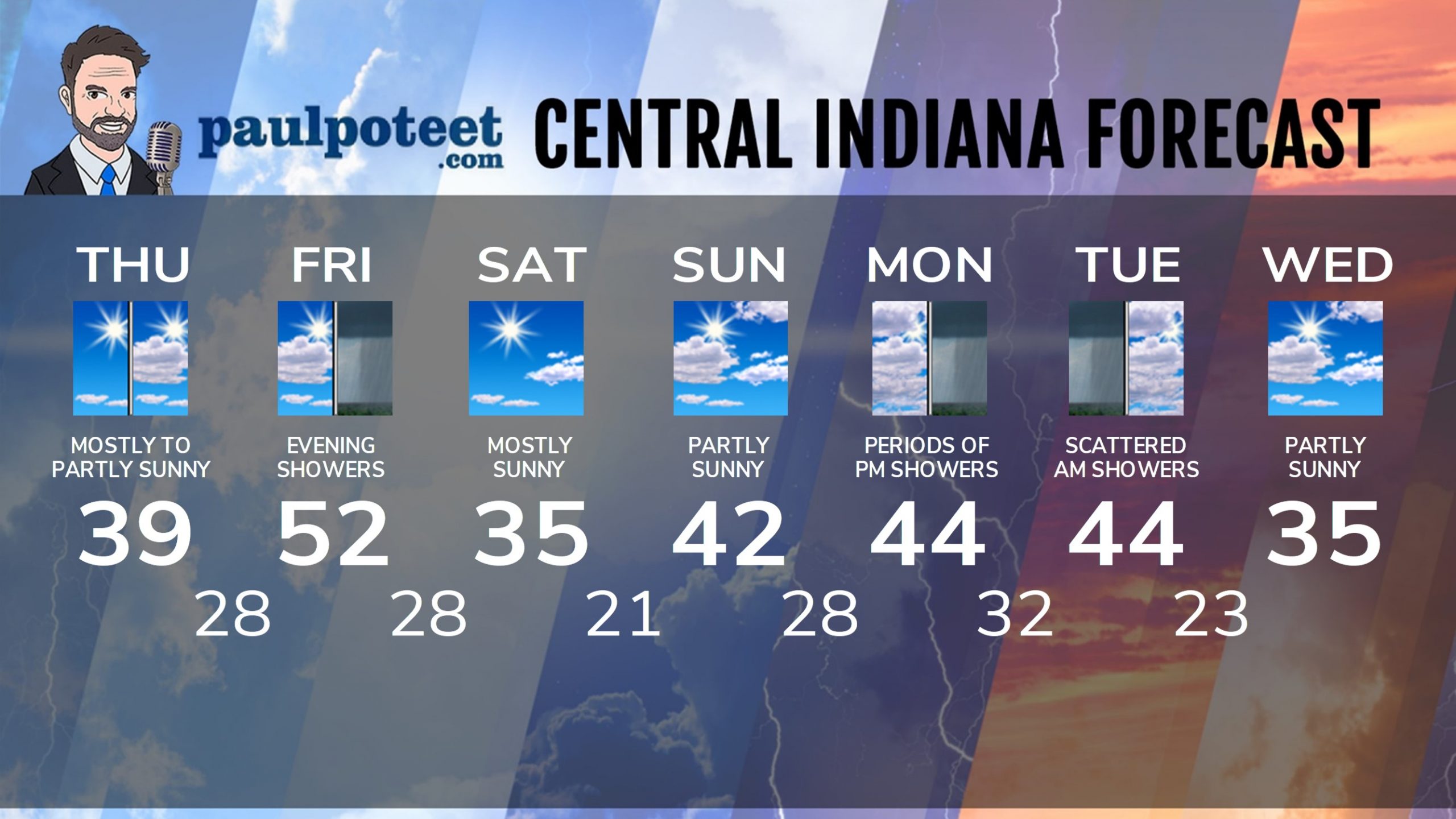
INDY SEVEN DAY FORECAST
Today: Sunny start. Becoming partly sunny. Not as breezy. High 39.
Tonight; Mostly clear evening. Partly cloudy overnight. Low 28.
Friday: Partly to mostly cloudy. Wind gusts around 40 mph by mid to late afternoon. High 52.
Friday Night: Scattered showers. Wind gusting to 45 mph. Low 28.
Saturday: Mostly sunny. Wind gusting to 30 mph in the morning, diminishing in the afternoon. High 35.
Saturday Night: Clear. Low 21.
Sunday: Partly sunny. High 42.
Sunday Night: Partly cloudy. Low 28.
Monday: Periods of showers, mainly in the afternoon. High 44.
Monday Night: Periods of showers. Low 33.
Tuesday: Mostly cloudy. Scattered morning showers. High 44.
Tuesday Night: Partly cloudy. Low 23.
Wednesday: Partly sunny. High 35.
Never miss me! Subscribe for free. My Huge Radar has real-time weather tracking, current temperatures, and severe weather watches and warnings. Get detailed Indiana conditions by clicking here. Click here to see my central Indiana 7-Day Forecast. Follow these links to get my forecasts for Lafayette, Muncie, Hendricks County, and Hamilton County. Need a second opinion? Click here for central Indiana National Weather Service forecasts. (Some charts via WeatherBELL.)


