(Via @NWSIndianapolis.) 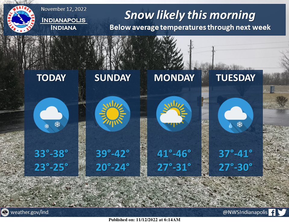 Snow is likely this morning with accumulations of half an inch in most spots. Locally higher amounts of 1-2″ are possible and may lead to slick spots on roadways. Dry conditions return briefly before a system brings another chance for snow or rain/snow mix on Tuesday. #INwx https://t.co/oNzatmwa9s
My Huge Radar has real-time weather tracking, current temperatures, and severe weather watches and warnings. Get detailed Indiana conditions by clicking here. Follow these links to get my forecasts for Lafayette, Muncie, Hendricks County, and Hamilton County. Need a second opinion? Click here for central Indiana National Weather Service forecasts.
Never miss me! Subscribe for free. My Huge Radar has real-time weather tracking, current temperatures, and severe weather watches and warnings. Get detailed Indiana conditions by clicking here. Click here to see my central Indiana 7-Day Forecast. Follow these links to get my forecasts for Lafayette, Muncie, Hendricks County, and Hamilton County. Need a second opinion? Click here for central Indiana National Weather Service forecasts. (Some charts via WeatherBELL.)


