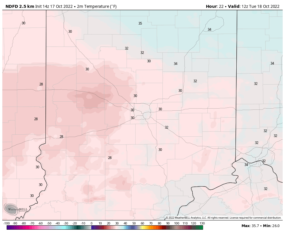
The coldest night of the young Fall season is ahead, as temperatures come down the near and below freezing Tuesday morning.
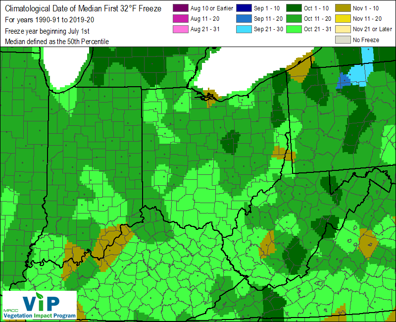
We are right in the sweet spot for the first freeze in much of central Indiana…maybe a week early right around Indy.
Never miss me! Subscribe for free. My Huge Radar has real-time weather tracking, current temperatures, and severe weather watches and warnings. Get detailed Indiana conditions by clicking here. Click here to see my central Indiana 7-Day Forecast. Follow these links to get my forecasts for Lafayette, Muncie, Hendricks County, and Hamilton County. Need a second opinion? Click here for central Indiana National Weather Service forecasts. (Some charts via WeatherBELL.)
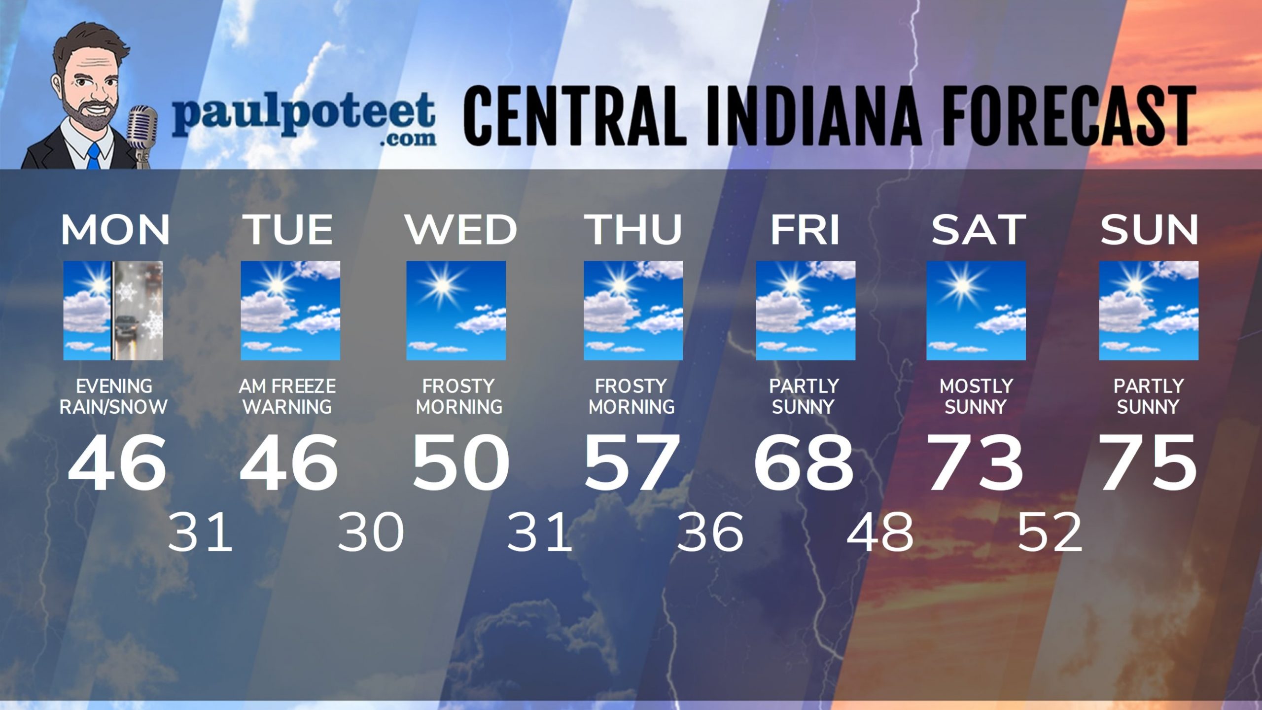
INDY SEVEN DAY FORECAST
Today: Partly to mostly cloudy. Gusts to 35 mph. High 46.
Tonight: Clouds, with a few rain and/or snow showers. A dusting is possible. Wind gusting to 30 mph. Partly cloudy with widespread frost toward daybreak. FREEZE WARNING starts at 10pm. Low 31.
Tuesday: FREEZE WARNING until 10am. Partly sunny. Wind gusting to 30 mph. High 46.
Tuesday Night: Partly cloudy. Widespread frost toward daybreak. Low 30.
Wednesday: Mostly sunny. High 50.
Wednesday Night: Mostly clear. Widespread frost toward daybreak. Low 31.
Thursday: Partly sunny. High 57.
Thursday Night: Partly cloudy. Patchy frost toward daybreak. Low 36.
Friday: Partly sunny. High 68.
Friday Night: Mostly clear. Low 48.
Saturday: Mostly sunny. High 73.
Saturday Night: Mostly clear. Low 52.
Sunday: Partly sunny. High 75.
Never miss me! Subscribe for free. My Huge Radar has real-time weather tracking, current temperatures, and severe weather watches and warnings. Get detailed Indiana conditions by clicking here. Click here to see my central Indiana 7-Day Forecast. Follow these links to get my forecasts for Lafayette, Muncie, Hendricks County, and Hamilton County. Need a second opinion? Click here for central Indiana National Weather Service forecasts. (Some charts via WeatherBELL.)


