Last of the red-hot (by October standards) days! At least, until next week. Mid to upper 70s today, with an upper air disturbance sparking sprinkles or a passing shower in the early to mid morning. The afternoon is brighter, with a bit of a breeze. A cold front comes marching in tonight.
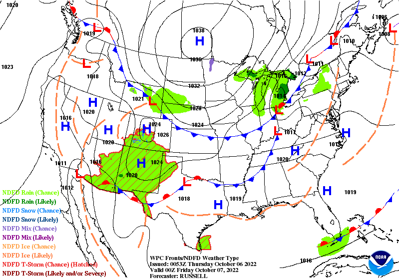
It will usher in cooler temps and winds gusting to 30 mph tonight, and 25 mph tomorrow. Might be some showers late tonight and overnight.
Look at this map:
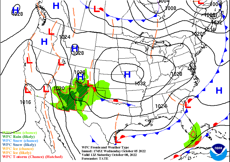
When I see that in October I feel the frost in my bones. That “H” means high pressure, which means a mostly clear sky, and a light wind, which will contribute to patchy frost both mornings this weekend.
Never miss me! Subscribe for free. My Huge Radar has real-time weather tracking, current temperatures, and severe weather watches and warnings. Get detailed Indiana conditions by clicking here. Click here to see my central Indiana 7-Day Forecast. Follow these links to get my forecasts for Lafayette, Muncie, Hendricks County, and Hamilton County. Need a second opinion? Click here for central Indiana National Weather Service forecasts. (Some charts via WeatherBELL.)
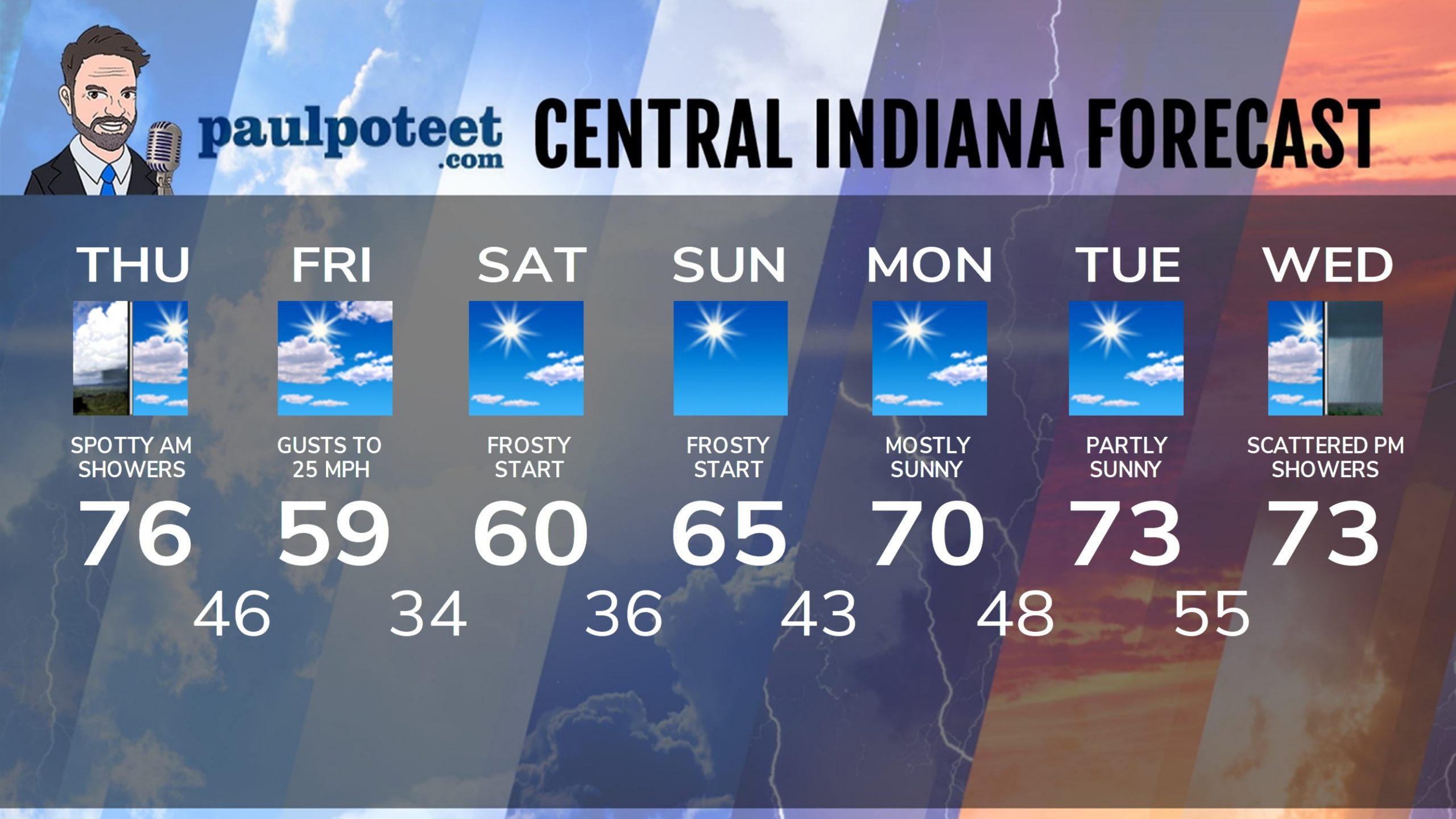
INDY SEVEN DAY FORECAST
Today: Mostly cloudy morning, with a few passing sprinkles or light showers possible. Partly sunny afternoon, with winds gusting to 20 mph. High 76.
Tonight: Clouds increase again. Spotty showers late night. Wind gusts to 30 mph. Low 46.
Friday: Partly sunny. Much cooler breezes, gusting to 25 mph. High 59.
Friday Night: Mostly clear. Patchy frost toward daybreak. Low 34.
Saturday: Mostly sunny. High 60.
Saturday Night: Clear. Patchy frost toward daybreak. Low 36.
Sunday: Sunny. High 65.
Sunday Night: Mostly clear. Low 43.
Columbus Day: Mostly sunny. High 70.
Monday Night: Partly cloudy. Low 48.
Tuesday: Mostly to partly sunny. High 73.
Tuesday Night: Partly cloudy. Low 55.
Wednesday: Mostly cloudy. Spotty afternoon showers. High 73.
Never miss me! Subscribe for free. My Huge Radar has real-time weather tracking, current temperatures, and severe weather watches and warnings. Get detailed Indiana conditions by clicking here. Click here to see my central Indiana 7-Day Forecast. Follow these links to get my forecasts for Lafayette, Muncie, Hendricks County, and Hamilton County. Need a second opinion? Click here for central Indiana National Weather Service forecasts. (Some charts via WeatherBELL.)


