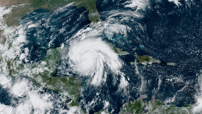
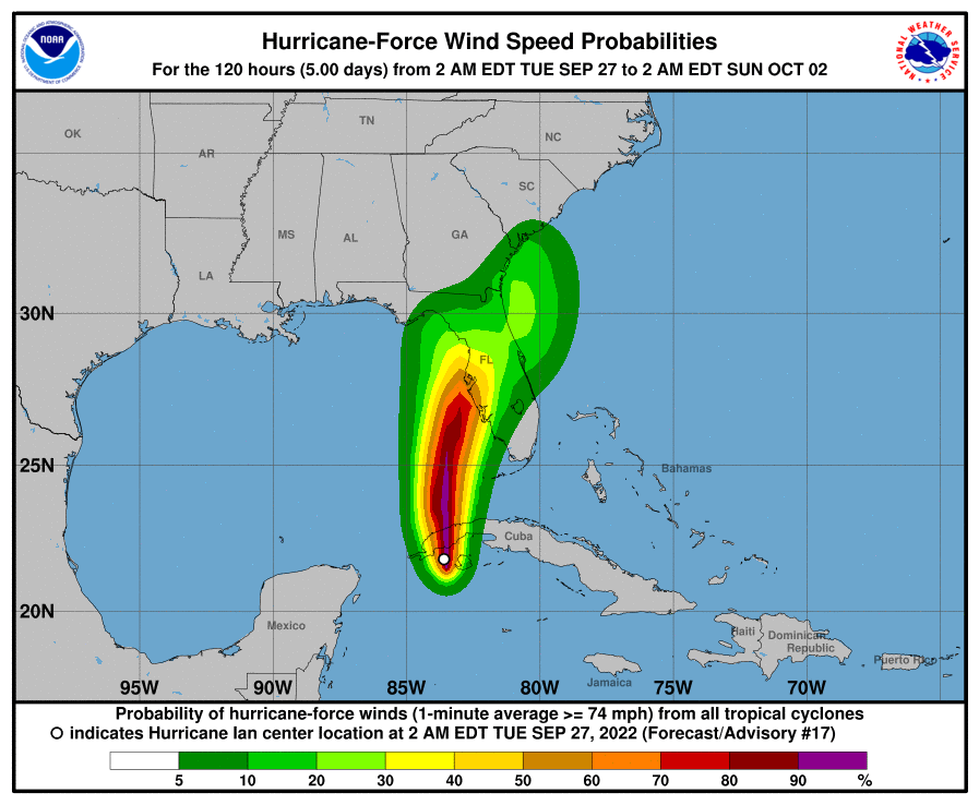
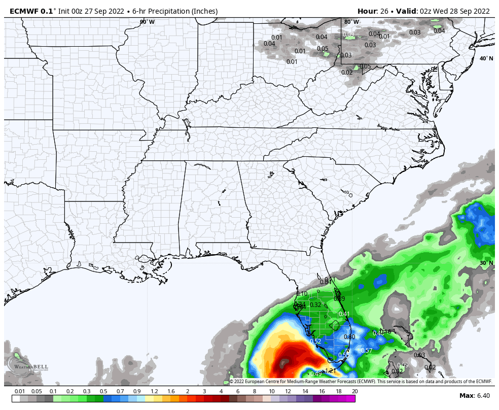
Hurricane Ian’s impact on the Sunshine State starts today, with the Storm Prediction Center standing by to issue a Tornado Watch for the southern part of the state, and the Keys. The Gulf Coast side of FLA is under the gun through at least Thursday.
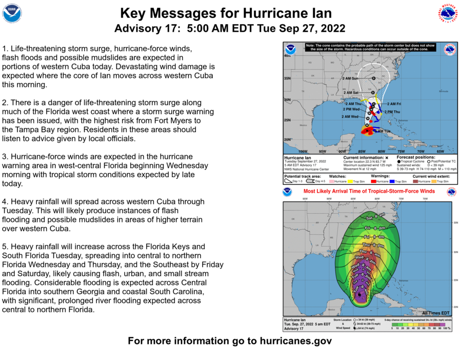
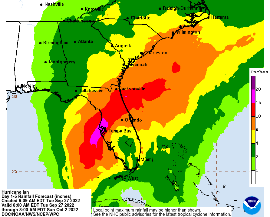
As much as 20 inches of rainfall is possible.
Still no significant impact on Indiana weather…a few showers Saturday night into Sunday morning are possible in the southern/eastern half of the state.
Never miss me! Subscribe for free. My Huge Radar has real-time weather tracking, current temperatures, and severe weather watches and warnings. Get detailed Indiana conditions by clicking here. Click here to see my central Indiana 7-Day Forecast. Follow these links to get my forecasts for Lafayette, Muncie, Hendricks County, and Hamilton County. Need a second opinion? Click here for central Indiana National Weather Service forecasts. (Some charts via WeatherBELL.)
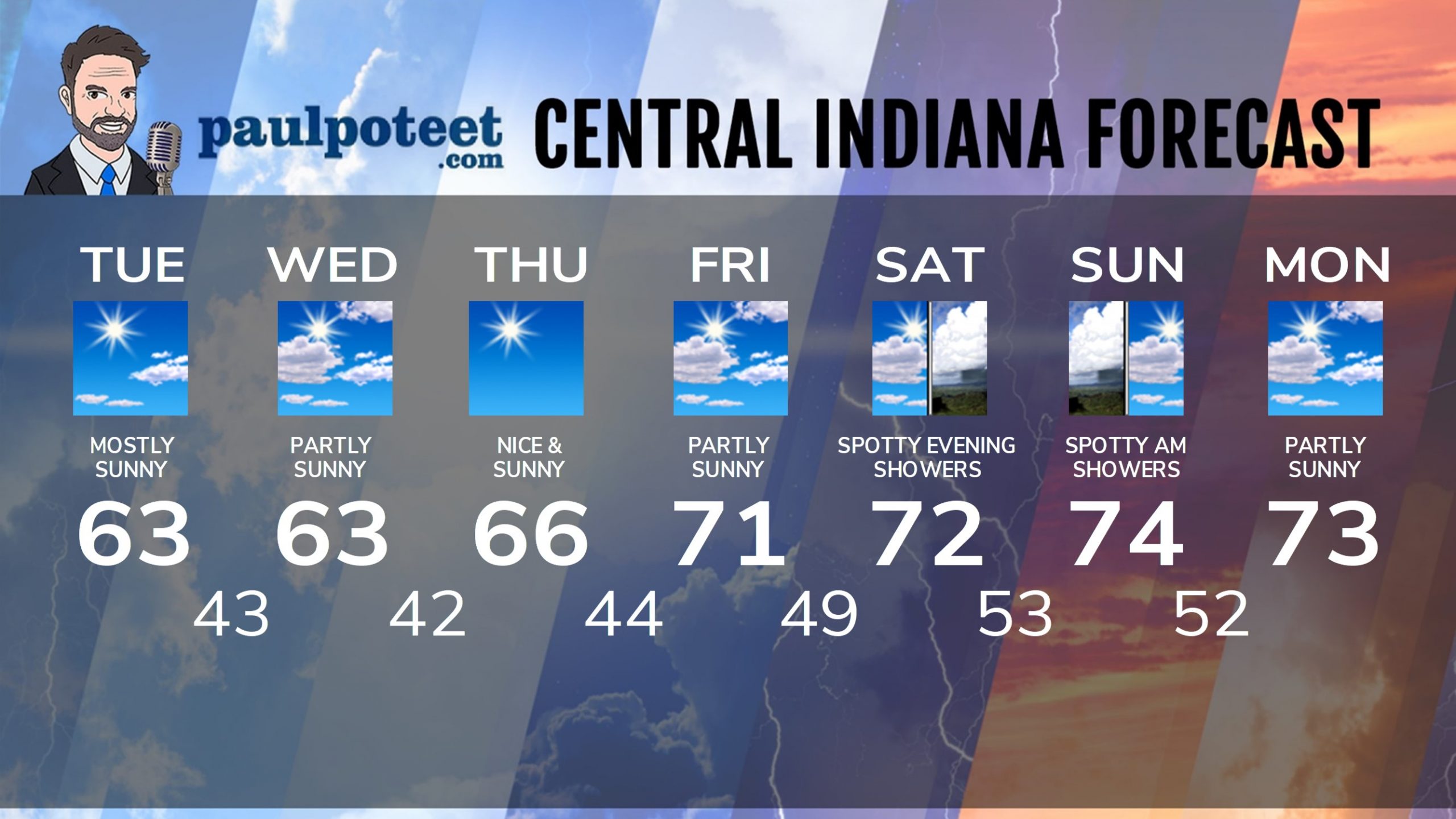
INDY SEVEN DAY FORECAST
Today: Mostly sunny and breezy. Wind gusting to 30 mph. High 63.
Tonight: Mostly clear. Low 43.
Wednesday: Partly sunny. High 63.
Wednesday Night: Mostly clear. Low 42.
Thursday: Sunny. High 66.
Thursday Night: Clear. Low 44.
Friday: Mostly sunny. High 71.
Friday Night: Partly cloudy. Low 49.
Saturday: Partly sunny. High 72.
Saturday Night: Spotty showers possible. Low 53.
Sunday: Spotty morning showers. Partly sunny. High 74.
Sunday Night: Partly cloudy. Low 52.
Monday: Partly sunny. High 73.
Never miss me! Subscribe for free. My Huge Radar has real-time weather tracking, current temperatures, and severe weather watches and warnings. Get detailed Indiana conditions by clicking here. Click here to see my central Indiana 7-Day Forecast. Follow these links to get my forecasts for Lafayette, Muncie, Hendricks County, and Hamilton County. Need a second opinion? Click here for central Indiana National Weather Service forecasts. (Some charts via WeatherBELL.)


