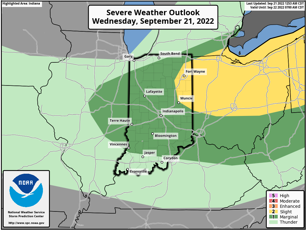
Summer gonna end with a bang! A cold front slices through the heat and humidity late this afternoon and evening. Expect a band of showers and storms to move southeasterly through central Indiana from about 4pm to midnight.
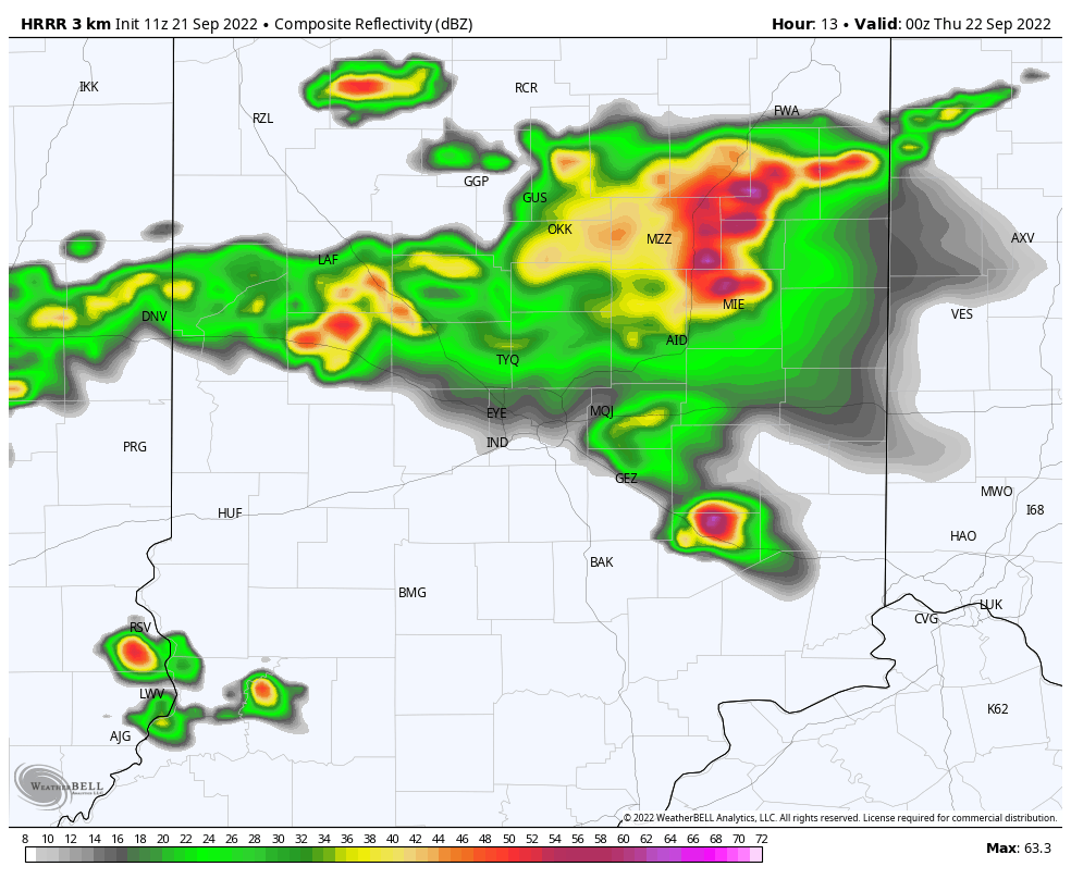
The storms have a marginal (level one of five) risk of being severe for most, but it is a level two risk around…and just north/east of the Muncie area.
Following the front: a dramatic drop in humidity. This chart models the dropping dew point at 1am, as the drier air pushes in from the north. It’ll be all over the state tomorrow. Fall arrives at 9:03 tonight. You’ll feel it tomorrow!
Never miss me! Subscribe for free. My Huge Radar has real-time weather tracking, current temperatures, and severe weather watches and warnings. Get detailed Indiana conditions by clicking here. Click here to see my central Indiana 7-Day Forecast. Follow these links to get my forecasts for Lafayette, Muncie, Hendricks County, and Hamilton County. Need a second opinion? Click here for central Indiana National Weather Service forecasts. (Some charts via WeatherBELL.)
INDY SEVEN DAY FORECAST
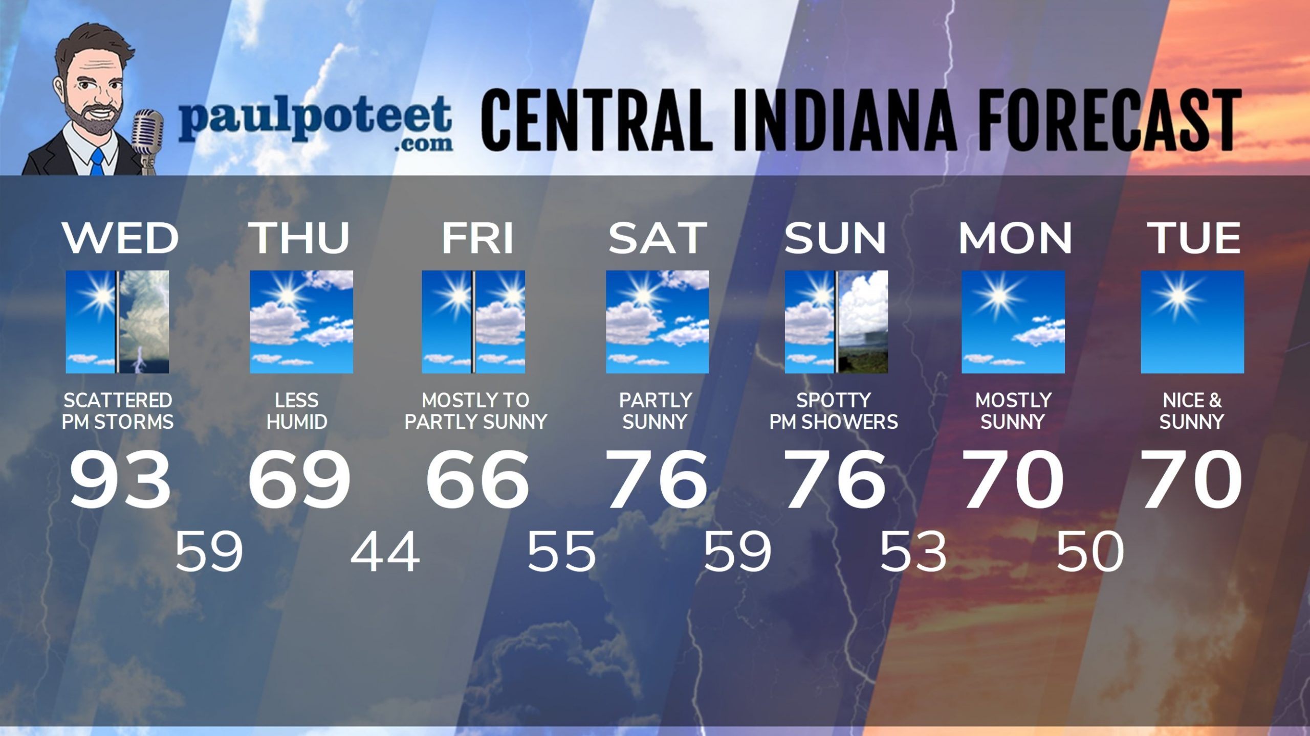
Today: Humid. Mostly sunny morning, with a few stray showers and storms in the afternoon. A few could be severe. High 93.
Tonight: Evening shower/storm chance, then partly cloudy. Low 59.
Thursday: Partly sunny, and less humid. High 69.
Thursday Night: Mostly clear. Low 44.
Friday: Mostly sunny morning. Partly sunny afternoon. High 66.
Friday Night: Mostly cloudy. Low 55.
Saturday: Partly sunny. High 76.
Saturday Night: Partly cloudy. Low 59.
Sunday: Partly sunny, with a few spotty showers, mainly in the afternoon, High 76.
Sunday Night: Partly cloudy. Low 53.
Monday: Mostly sunny. High 70.
Monday Night: Mostly clear. Low 50.
Tuesday: Sunny. High 70.
Never miss me! Subscribe for free. My Huge Radar has real-time weather tracking, current temperatures, and severe weather watches and warnings. Get detailed Indiana conditions by clicking here. Click here to see my central Indiana 7-Day Forecast. Follow these links to get my forecasts for Lafayette, Muncie, Hendricks County, and Hamilton County. Need a second opinion? Click here for central Indiana National Weather Service forecasts. (Some charts via WeatherBELL.)


