(Via @NWSIndianapolis.) 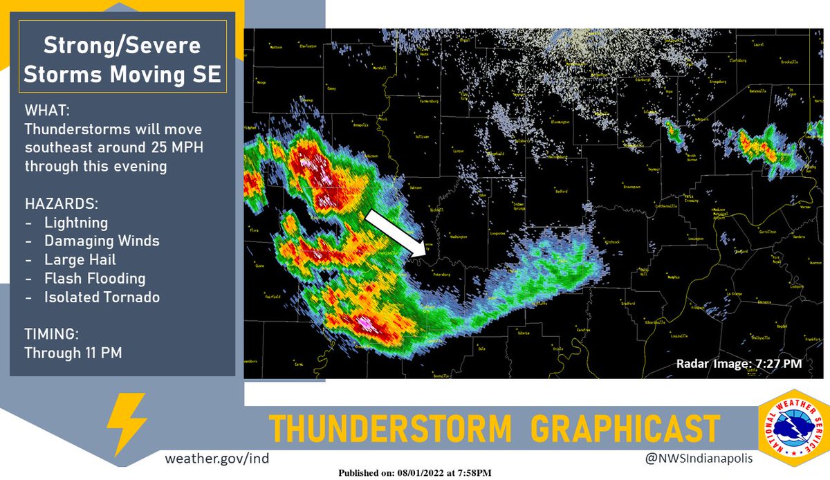 Strong to severe storms will move SE around 25 MPH across the southwest 1/2 of Knox county the next few hours. Torrential rainfall, flooding, large hail, damaging winds, frequent cloud to ground lightning. Isolated tornado possible. #INwx #nwsind https://t.co/chVshex6Vr
My Huge Radar has real-time weather tracking, current temperatures, and severe weather watches and warnings. Get detailed Indiana conditions by clicking here. Follow these links to get my forecasts for Lafayette, Muncie, Hendricks County, and Hamilton County. Need a second opinion? Click here for central Indiana National Weather Service forecasts.
Never miss me! Subscribe for free. My Huge Radar has real-time weather tracking, current temperatures, and severe weather watches and warnings. Get detailed Indiana conditions by clicking here. Click here to see my central Indiana 7-Day Forecast. Follow these links to get my forecasts for Lafayette, Muncie, Hendricks County, and Hamilton County. Need a second opinion? Click here for central Indiana National Weather Service forecasts. (Some charts via WeatherBELL.)


