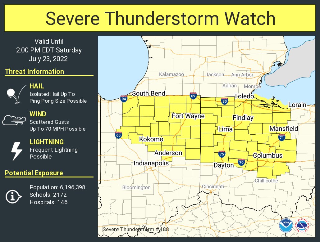
Thunderstorms have congealed into an mesoscale convection system this morning across northern Indiana. Two measured severe wind gusts to 67 and 73 mph have been reported with this activity, along with associated damage. This cluster will continue moving east-southeastward across parts of northern/central Indiana and western Ohio over the next couple of hours. Warnings any time on My Huge Radar.
Never miss me! Subscribe for free. My Huge Radar has real-time weather tracking, current temperatures, and severe weather watches and warnings. Get detailed Indiana conditions by clicking here. Click here to see my central Indiana 7-Day Forecast. Follow these links to get my forecasts for Lafayette, Muncie, Hendricks County, and Hamilton County. Need a second opinion? Click here for central Indiana National Weather Service forecasts. (Some charts via WeatherBELL.)


