Here is the final map of Sunday rainfall, compiled by the National Weather Service.

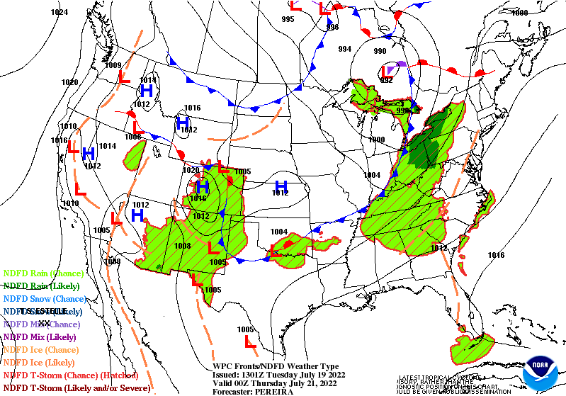
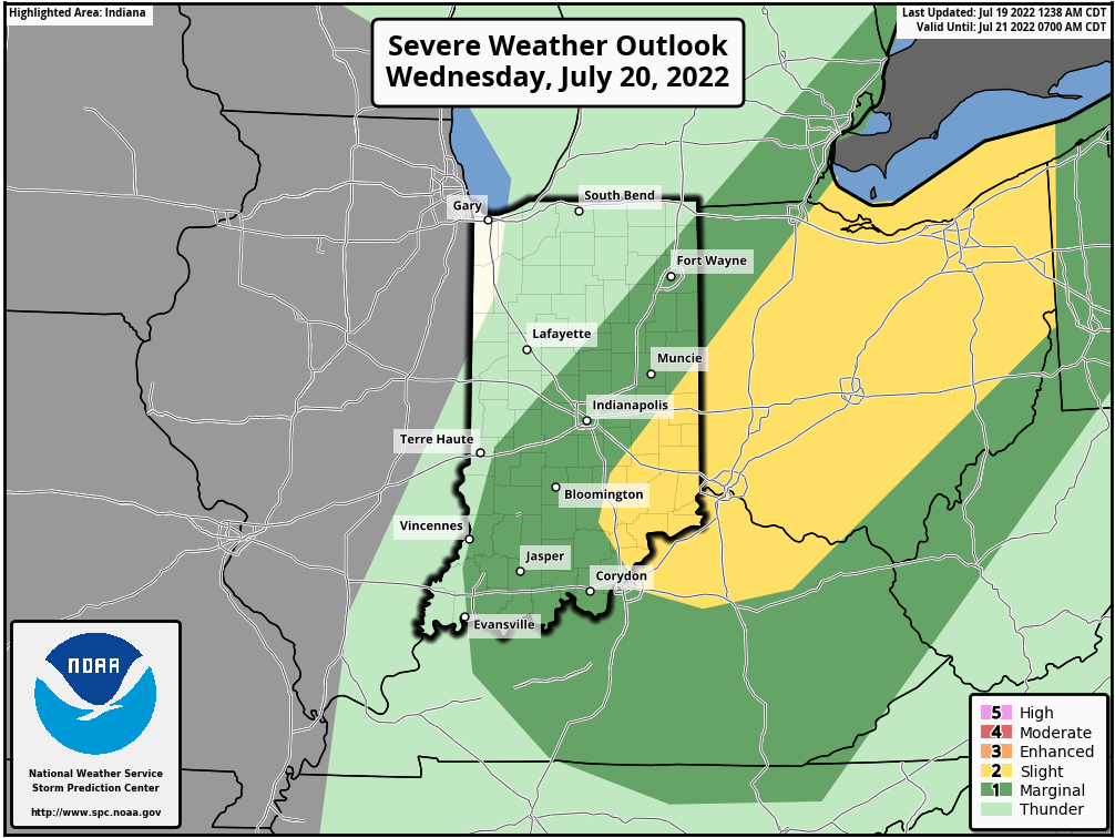
Could be some more precipitation Wednesday afternoon, with a few spotty showers and storms around in the afternoon. A cold front will move thorough and drop the temperature and humidity ever-so-slightly Thursday. There is a level 1 or 2 (out of 5) risk of severe weather from said storms in parts of the state.
Never miss me! Subscribe for free. My Huge Radar has real-time weather tracking, current temperatures, and severe weather watches and warnings. Get detailed Indiana conditions by clicking here. Click here to see my central Indiana 7-Day Forecast. Follow these links to get my forecasts for Lafayette, Muncie, Hendricks County, and Hamilton County. Need a second opinion? Click here for central Indiana National Weather Service forecasts. (Some charts via WeatherBELL.)
INDY SEVEN DAY FORECAST
Today: Patches of dense morning fog. Mostly sunny. High 90.
Tonight: Mostly clear. Low 72.
Wednesday: Mostly sunny morning. Partly sunny afternoon. Spotty shower or storm possible in the afternoon. High 96.
Wednesday Night: Partly cloudy to mostly clear. Low 70.
Thursday: Sunny. High 92.
Thursday Night: Clear. Low 72.
Friday: Mostly sunny. High 94.
Friday Night: Partly cloudy. Low 74.
Saturday: Partly sunny. High 96.
Saturday Night; Partly cloudy. Low 78.
Sunday: Partly sunny. Scattered shower or storm. High 93.
Sunday Night: Partly cloudy. Scattered showers and storms. Low 69.
Monday: Partly sunny. Scattered showers and storms. High 88.

Never miss me! Subscribe for free. My Huge Radar has real-time weather tracking, current temperatures, and severe weather watches and warnings. Get detailed Indiana conditions by clicking here. Click here to see my central Indiana 7-Day Forecast. Follow these links to get my forecasts for Lafayette, Muncie, Hendricks County, and Hamilton County. Need a second opinion? Click here for central Indiana National Weather Service forecasts. (Some charts via WeatherBELL.)


