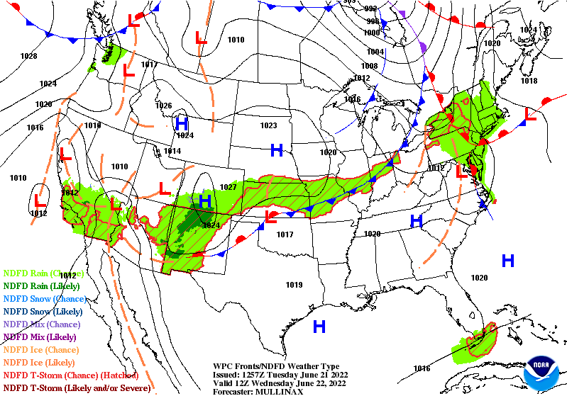
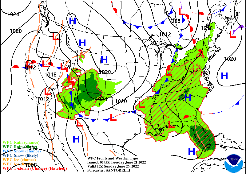
Gunning for the hottest temp in 9 years today, but unlike last week–no Heat Advisory. The reason is that dew points (and therefore humidity) won’t be as high. They will peak in the upper 60s to around 70 tonight and tomorrow. That peak is ahead of a cold front arriving later Wednesday. A few storms are possible with that, mainly south and southeast of Indy. Then the humidity dips again Thursday and Friday. It will get juicy again Saturday, ahead of another front Sunday, which looks to bring better storm chances.
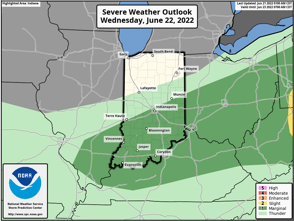
Here are the Wednesday and Sunday fronts. If any storm gets going Wednesday it has a marginal (level one of five) risk of going severe, with respect to large hail and damaging straight-line winds.
Never miss me! Subscribe for free. My Huge Radar has real-time weather tracking, current temperatures, and severe weather watches and warnings. Get detailed Indiana conditions by clicking here. Click here to see my central Indiana 7-Day Forecast. Follow these links to get my forecasts for Lafayette, Muncie, Hendricks County, and Hamilton County. Need a second opinion? Click here for central Indiana National Weather Service forecasts. (Some charts via WeatherBELL.)
INDY SEVEN DAY FORECAST
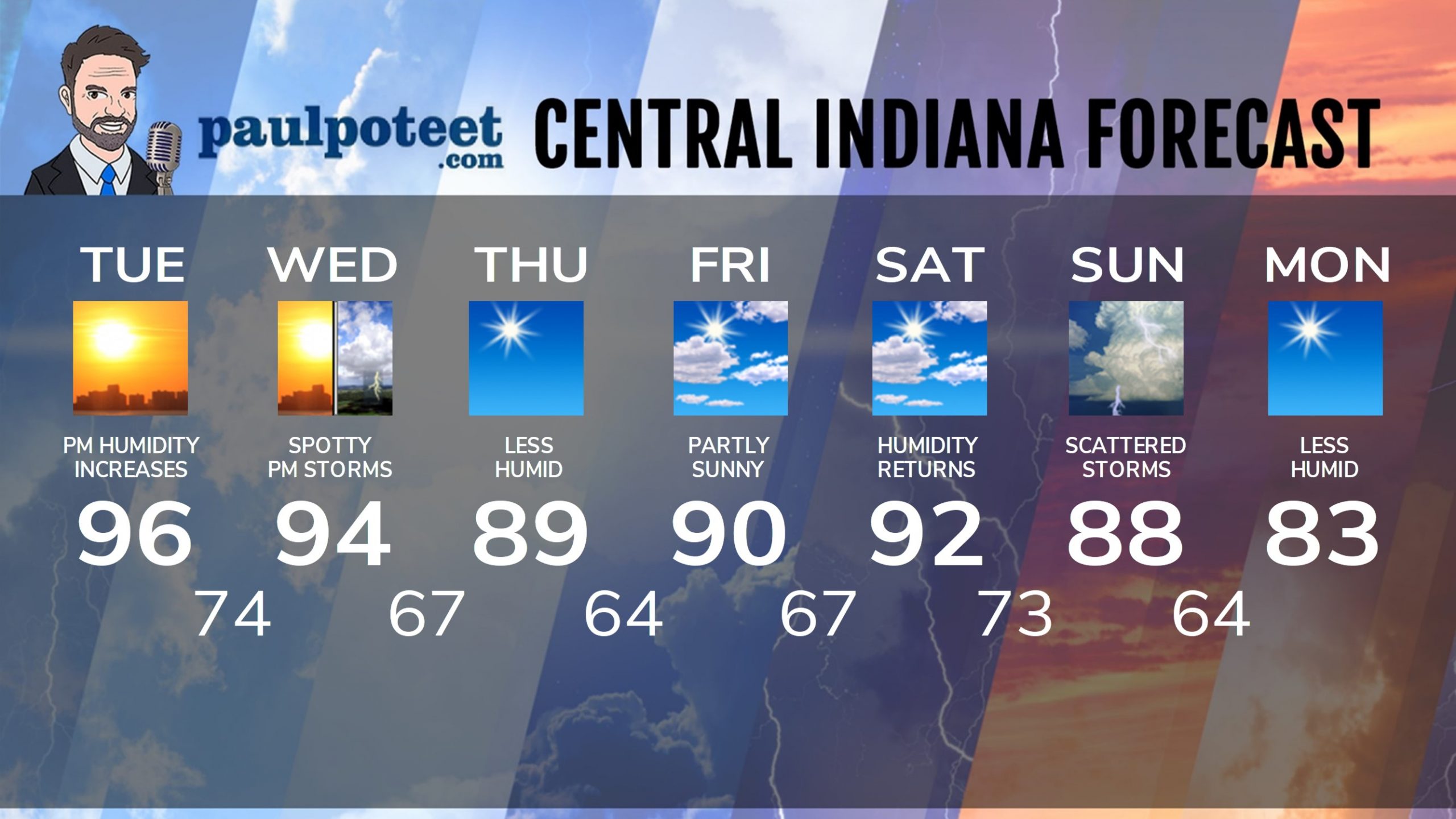
Today: Hot and sunny. Humidity increases in the afternoon. High 96.
Tonight: Mostly clear and muggy. Low 74.
Wednesday: Mostly to partly sunny, hot and humid. Spotty afternoon shower or storm. High 94.
Wednesday Night: Isolated evening shower or storm. Low 67.
Thursday: Sunny. Lower humidity again. High 89.
Thursday Night: Mostly clear. Low 64.
Friday: Partly sunny. High 90.
Friday Night: Partly cloudy. Low 67.
Saturday: Partly sunny. Humidity returns. High 92.
Saturday Night: Partly cloudy. Low 73.
Sunday: Partly sunny. Scattered showers and storms. High 88.
Sunday Night: Scattered evening showers and storms. Low 64.
Monday: Sunny and less humid again. High 83.
Never miss me! Subscribe for free. My Huge Radar has real-time weather tracking, current temperatures, and severe weather watches and warnings. Get detailed Indiana conditions by clicking here. Click here to see my central Indiana 7-Day Forecast. Follow these links to get my forecasts for Lafayette, Muncie, Hendricks County, and Hamilton County. Need a second opinion? Click here for central Indiana National Weather Service forecasts. (Some charts via WeatherBELL.)


