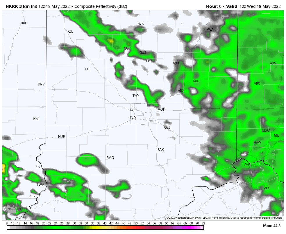
One round of mostly light early morning showers…another round of showers and some thunder this afternoon. Expect up to a third of an inch of precipitation.
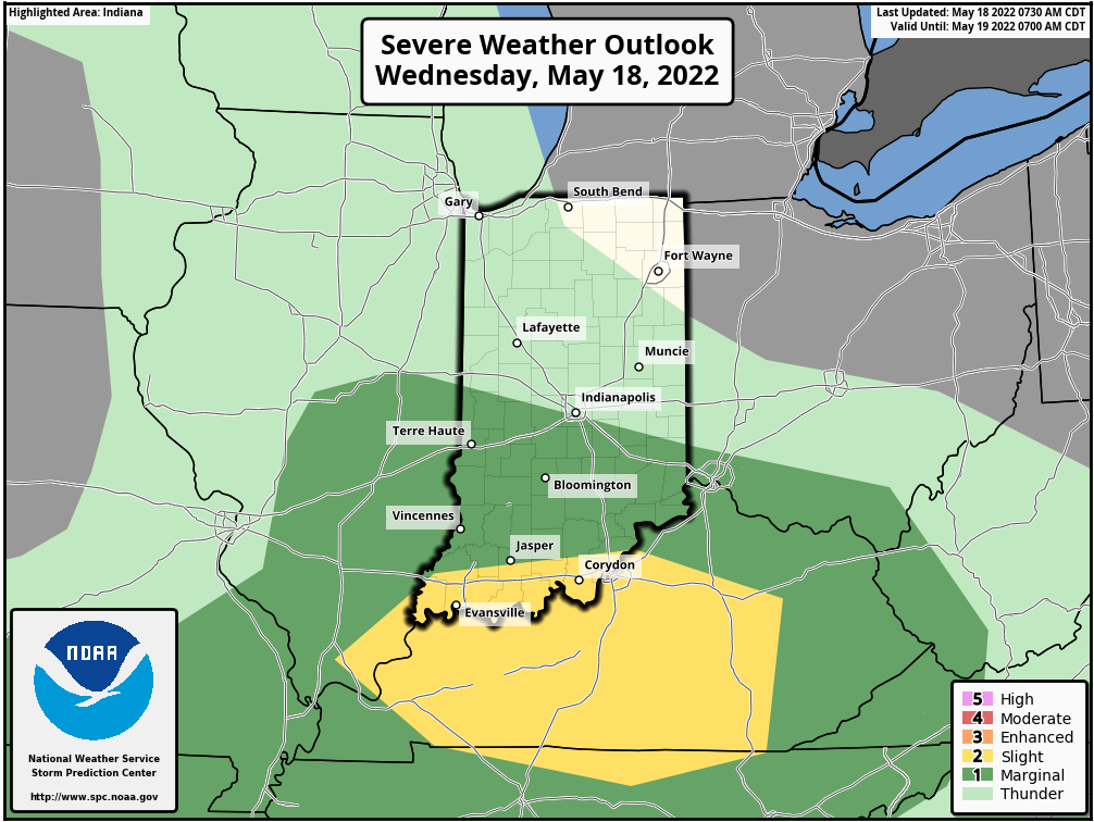
There’s a small (level one of five) risk of severe weather (large hail, damaging wind gusts) generally south of I-74.
Never miss me! Subscribe for free. My Huge Radar has real-time weather tracking, current temperatures, and severe weather watches and warnings. Get detailed Indiana conditions by clicking here. Click here to see my central Indiana 7-Day Forecast. Follow these links to get my forecasts for Lafayette, Muncie, Hendricks County, and Hamilton County. Need a second opinion? Click here for central Indiana National Weather Service forecasts. (Some charts via WeatherBELL.)
INDY SEVEN DAY FORECAST
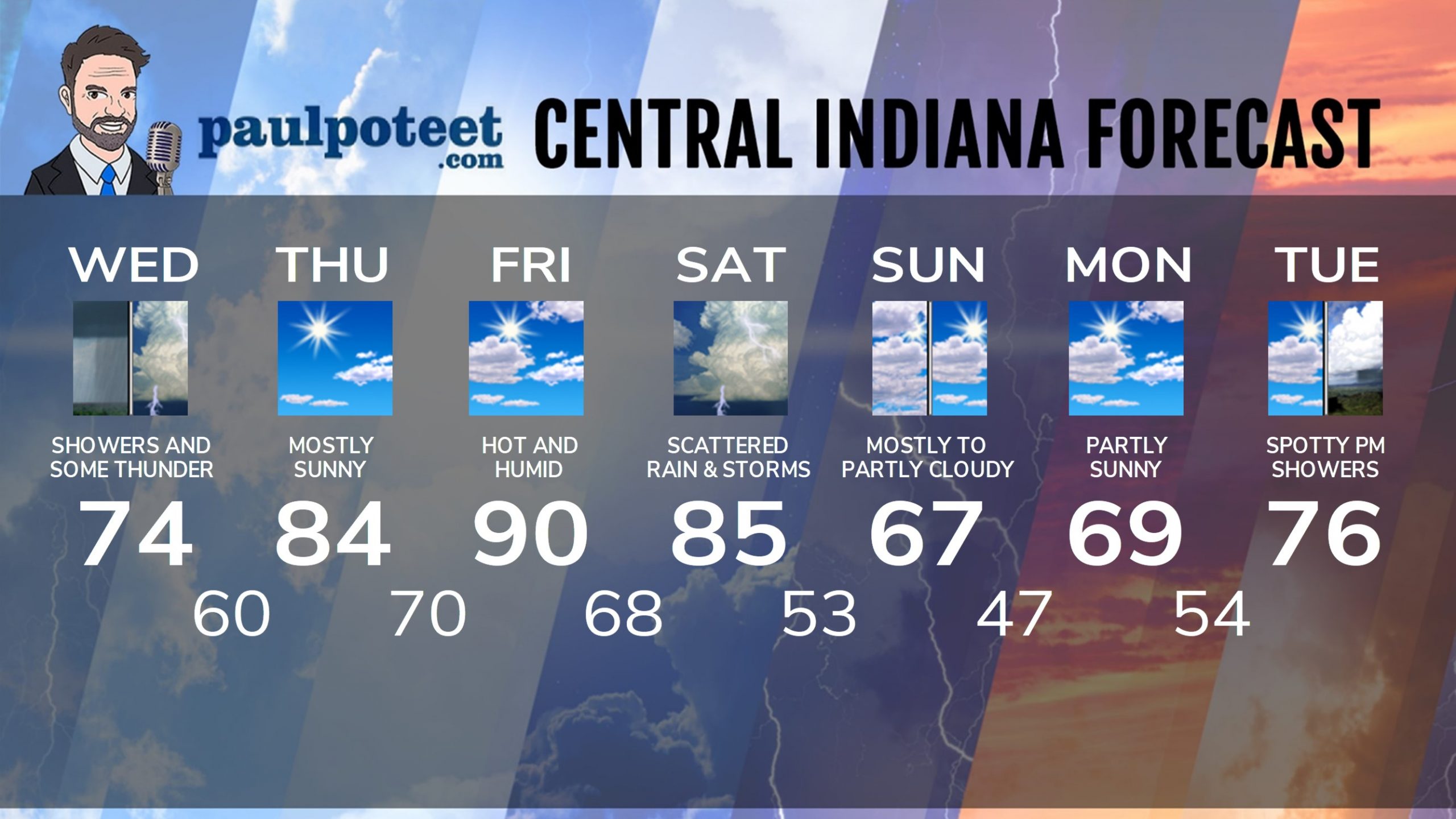
Today: Scattered showers in the morning. Scattered showers and storms in the afternoon. High 74.
Tonight: Any stray shower or storm ends early in the evening, then mostly cloudy. Low 60.
Thursday: Mostly sunny. Humidity increases. High 84.
Thursday Night: Partly cloudy. Muggy. Isolated shower or storm possible. Low 70.
Friday: Partly sunny, hot and humid. Isolated late afternoon storm possible. Wind gusting to 35 mph. High 90.
Friday Night: Scattered showers and storms, especially late. Storms could be severe. Low 68.
Saturday: Partly sunny, hot and humid, with scattered showers and storms. High 85.
Saturday Night: Scattered showers and storms. Low 53.
Sunday: Mostly, then partly cloudy. High 67.
Sunday Night: Partly cloudy. Low 47.
Monday: Partly sunny. High 69.
Monday Night: Partly cloudy. Low 54.
Tuesday: Partly sunny morning. Spotty showers in the afternoon. High 76.
Never miss me! Subscribe for free. My Huge Radar has real-time weather tracking, current temperatures, and severe weather watches and warnings. Get detailed Indiana conditions by clicking here. Click here to see my central Indiana 7-Day Forecast. Follow these links to get my forecasts for Lafayette, Muncie, Hendricks County, and Hamilton County. Need a second opinion? Click here for central Indiana National Weather Service forecasts. (Some charts via WeatherBELL.)


