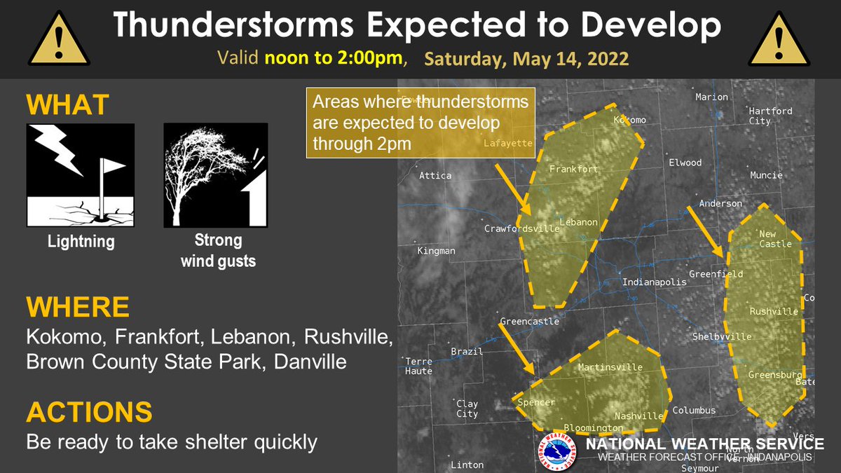
(Via @NWSIndianapolis.) 12:15pm update: Satellite shows cumulus clouds increasing, and this is the first step to thunderstorm development across central Indiana. This graphic highlights areas likely to see storms first. The storm threat will expand across the entire area through the afternoon. #inwx https://t.co/vsrSeh1x3F
My Huge Radar has real-time weather tracking, current temperatures, and severe weather watches and warnings. Get detailed Indiana conditions by clicking here. Follow these links to get my forecasts for Lafayette, Muncie, Hendricks County, and Hamilton County. Need a second opinion? Click here for central Indiana National Weather Service forecasts.
Never miss me! Subscribe for free. My Huge Radar has real-time weather tracking, current temperatures, and severe weather watches and warnings. Get detailed Indiana conditions by clicking here. Click here to see my central Indiana 7-Day Forecast. Follow these links to get my forecasts for Lafayette, Muncie, Hendricks County, and Hamilton County. Need a second opinion? Click here for central Indiana National Weather Service forecasts. (Some charts via WeatherBELL.)


Much better font, Mr. Poteet!!!