It will be our third consecutive dry day in central Indiana. Is that a problem with you? Didn’t think so. Today also marks the return of the 80s, and a little more cloudiness and humidity. One new thing: I am adding the chance of a passing shower or storm late tonight or very early Wednesday morning.
The Indy record high tomorrow is 89. My forecast is 88.
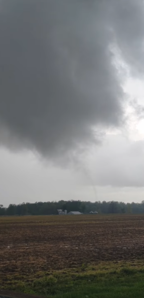
Did you know there was a landspout tornado in southern Indiana last Friday? The National Weather Service with the story here.
Never miss me! Subscribe for free. My Huge Radar has real-time weather tracking, current temperatures, and severe weather watches and warnings. Get detailed Indiana conditions by clicking here. Click here to see my central Indiana 7-Day Forecast. Follow these links to get my forecasts for Lafayette, Muncie, Hendricks County, and Hamilton County. Need a second opinion? Click here for central Indiana National Weather Service forecasts. (Some charts via WeatherBELL.)
INDY SEVEN DAY FORECAST
Today: Mostly to partly cloudy. Humidity increases. High 85.
Tonight: Partly cloudy, muggy, with the chance of a passing shower or storm. Low 66.
Wednesday: Partly sunny, hot and humid. Record high possible. High 88.
Wednesday Night: Mostly clear. Low 61.
Thursday: Sunny. Hot, but not as humid. Record high possible. High 86.
Thursday Night: Clear. Low 60.
Friday: Sunny. High 85.
Friday Night: Partly cloudy. Low 62.
Saturday: Partly sunny. Spotty showers and storms possible in the afternoon. High 83.
Saturday Night: Scattered showers and storms, mainly after midnight. Low 63.
Sunday: Partly sunny. Scattered showers and storms. High 77.
Sunday Night: Scattered storms end early, then partly cloudy. Low 57.
Monday: Partly sunny, with a spotty shower or storm possible. High 75.

Never miss me! Subscribe for free. My Huge Radar has real-time weather tracking, current temperatures, and severe weather watches and warnings. Get detailed Indiana conditions by clicking here. Click here to see my central Indiana 7-Day Forecast. Follow these links to get my forecasts for Lafayette, Muncie, Hendricks County, and Hamilton County. Need a second opinion? Click here for central Indiana National Weather Service forecasts. (Some charts via WeatherBELL.)


