Two rounds of rain (and some thunder) this morning. As of 9:30 Terre Haute’s had both rounds, and the rain total is 0.93 of an inch. The amounts are two-tenths of an inch or less so fair in Indy, Lafayette, Muncie, and Bloomington.
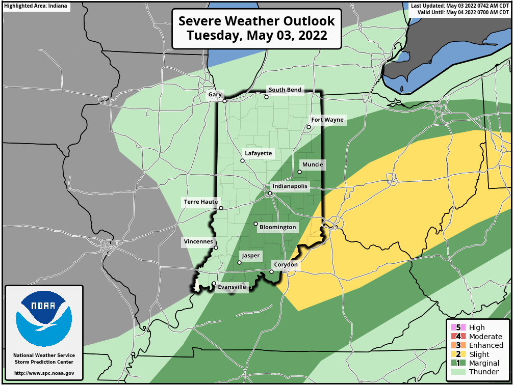
Another round of scattered showers and storms are likely this afternoon, mainly east and southeast of Indianapolis.
Never miss me! Subscribe for free. My Huge Radar has real-time weather tracking, current temperatures, and severe weather watches and warnings. Get detailed Indiana conditions by clicking here. Click here to see my central Indiana 7-Day Forecast. Follow these links to get my forecasts for Lafayette, Muncie, Hendricks County, and Hamilton County. Need a second opinion? Click here for central Indiana National Weather Service forecasts. (Some charts via WeatherBELL.)
INDY SEVEN DAY FORECAST
Today: Showers and some thunder in the morning. Scattered showers and storms in the afternoon. Severe storms and heavy rainfall possible. High 72.
Tonight: Spotty shower or storm in the early evening, then mostly cloudy. Low 50.
Wednesday: Mostly cloudy. High 65.
Wednesday Night: Mostly cloudy. Low 50.
Thursday: Mostly cloudy. High 69.
Thursday Night: Evening shower chance. Showers and storms overnight. Low 58.
Friday: Showers and storms. High 69.
Friday Night: Spotty showers. Low 54.
Saturday: Mostly cloudy. Scattered showers in the morning. High 68.
Saturday Night: Partly cloudy. Low 53.
Sunday: Partly sunny. High 75.
Sunday Night: Partly cloudy. Low 59.
Monday: Partly sunny. High 82.

Never miss me! Subscribe for free. My Huge Radar has real-time weather tracking, current temperatures, and severe weather watches and warnings. Get detailed Indiana conditions by clicking here. Click here to see my central Indiana 7-Day Forecast. Follow these links to get my forecasts for Lafayette, Muncie, Hendricks County, and Hamilton County. Need a second opinion? Click here for central Indiana National Weather Service forecasts. (Some charts via WeatherBELL.)


