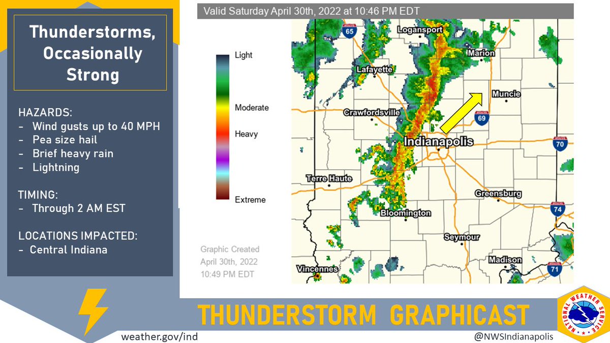
(Via @NWSIndianapolis.) Line of t-storms slowly traversing E thru central IN, with individual storm cells moving NE along the line at ~50 MPH. Strongest storm at 10:45 PM located near Kokomo & Tipton. Winds gusts up to 40 MPH, pea size hail, & brief heavy rain possible. #INwx #nwsind https://t.co/QBFSK8d4NH
My Huge Radar has real-time weather tracking, current temperatures, and severe weather watches and warnings. Get detailed Indiana conditions by clicking here. Follow these links to get my forecasts for Lafayette, Muncie, Hendricks County, and Hamilton County. Need a second opinion? Click here for central Indiana National Weather Service forecasts.
Never miss me! Subscribe for free. My Huge Radar has real-time weather tracking, current temperatures, and severe weather watches and warnings. Get detailed Indiana conditions by clicking here. Click here to see my central Indiana 7-Day Forecast. Follow these links to get my forecasts for Lafayette, Muncie, Hendricks County, and Hamilton County. Need a second opinion? Click here for central Indiana National Weather Service forecasts. (Some charts via WeatherBELL.)


